Before GPS and Geocaching Existed: Three Navigation Systems


Nowadays, we’re lucky to have an abundance of smartphones and GPS devices to help us navigate to different locations (and to our beloved geocaches). But did you know that personal navigation predates the invention of Global Positioning Systems (GPS)? Prior to Sputnik, TRANSIT, and GPS devices, there were three personal navigation maps that we still see glimpses of in today’s modern technology. Get ready to learn!
Cane Maps
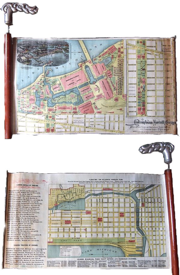
It started at the 1893 World’s Fair in Chicago… In celebration with the 400th anniversary of Christopher Columbus’s entry into the New World, the Columbian Novelty Company created “Cane Maps”. The cane map was a 10″ x 16″ sheet with maps printed on both sides. It rolled in and out of a wooden cane. The front side contained a map of the fairgrounds and the back side of the map was of Chicago, showing popular tourist attractions in the area. These maps were sold in gift shops at the fair and paved the way for future mapping and navigation techniques.
Plus Fours RouteFinder
Watch-you-wearing? Worn around the wrist, the Plus Fours Routefinder was a fashionable and efficient way to transit. These watch-like devices contained miniature scrolls with driving directions that rotated and updated as the motorist moved. The scrolls could be switched out and changed depending on what route was taken.

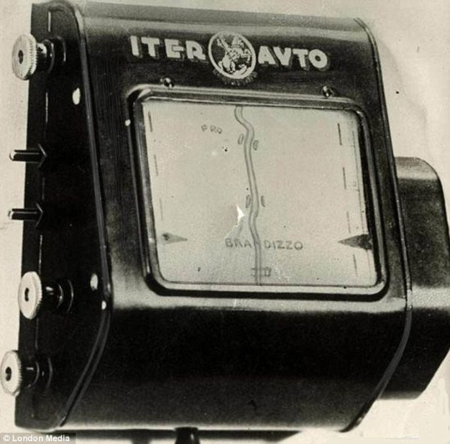
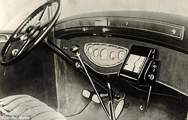
Inter-Auto or “Iter-Avto”
Zoom Zoom! In 1932, an Italian company releases the Inter-Auto, the world’s first personal navigation system for an automobile. This device also contained a scrolling map and additionally, connected to the car’s speedometer to maintain an accurate scrolling rate. Similar to a modern day Garmin or Tom Tom, this device showed a motorist’s position in real-time.
Navigation systems today have come a long way since Cane Maps and Inter-Autos. With the addition of the GPS, geocachers today have numerous devices to choose from. As technology advances, it will be fascinating to see the direction navigation systems will head in the coming years.
What is your preferred device for geocaching?
Not done reading yet? Check the ghosts lingering in your GPS in this Who’s Hiding in Your GPS Device? post from 2010.
Sources and Images: Before There was GPS: Personal Navigation in the 1920s and 1930s, Cane Maps, The antique route show: ‘First ever built-in sat nav’ from 1930 which used a map on a scroll to guide motorists
