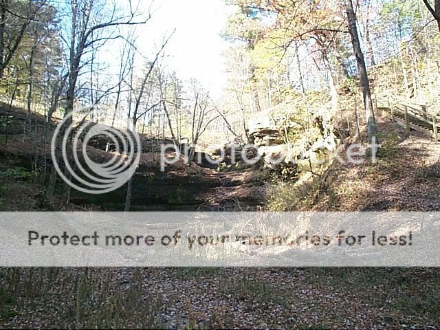
Black's Ravine, or more
commonly called The Devil's Punchbowl, is located just to the south
of Menomonie Wisconsin.
Where you are standing now, was part of a
shallow seabed 550 million years ago.
Black's Ravine (also
known as The Devil's Punchbowl) is formed out of the Eau Claire
Sandstone Formation that was part of these ancient sea deposits.
Evidence that this was once an aquatic environment can be found in
the form of fossils in the surrounding strata.
What you see today, The Devil's Punchbowl, is a
product of the immense erosional forces caused by the melting of
glaciers approximately 10 thousand years ago.
To receive credit for this EarthCache, you'll
need to take a couple of measurements (and do a little math).
Hopefully by doing so, you'll better understand what incredible
forces were at work that led to the formation of
Black's
Ravine.
1. At the parking
coordinates given, take an elevation reading from your
GPS.
2. Now proceed to the
final coordinates listed. Take an elevation reading
there.
Assuming that the erosional forces that created The Devil's
Punchbowl began 10 thousand years ago (and are still at work
today).
3. How much rock is being
lost per year?
E-mail this information to me when you log this
EarthCache.
Also, when logging this EarthCache, please upload a
picture of yourself/team, with your GPS clearly
visible.
Logs that don't meet these criteria
Will Be Deleted. No
Exceptions.
Please note.
Visitors to this area are asked to respect the Punchbowl's
fragile soils and plants, its streambed and sandstone slopes, its
natural sounds and silences. So please stay on the established
trails, the information required can be obtained from
these.
Also, even though this EarthCache is suited for the entire
family, and can be accessed year round. Because of spring water
that is constantly seeping into this area, this area may be icy in
the wintertime. Please use caution when visiting this special area
during the colder months.