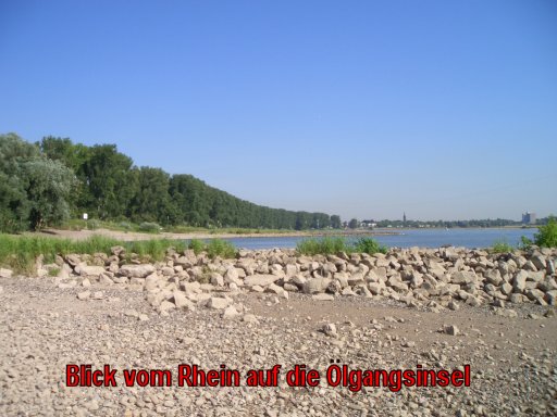
Im Jahre 2004 wurde die „Ölgangsinsel“ von der
Deutschen Umwelthilfe als Monatsprojekt prämiert. Man wollte so
Anstoß geben für eine natürliche Flussentwicklung des Rheins. Das
ganze geschah im Rahmen des Projektes „Lebendiger Rhein
– Fluss der tausend Inseln“. Es geht also um
Renaturierung. In diesem Zusammenhang ist es hier speziell Ziel,
Uferabschnitten einen natürlichen Verlauf zu geben. Das ist für die
Pflanzen – und Tierwelt sehr wichtig, da durch die
„Begradigung“ des Rheins viele alte Inseln verschwunden
sind und eine Neubildung durch die intensive Schifffahrt mit dem
damit einhergehenden Wellenschlag so gut wie verhindert wird.
Pflanzen und Tiere verlieren so ihren Lebensraum und sind vom
Aussterben bedroht. Eine Tieferlegung der Hochflutrinne soll ein
Durchströmen des Rheinwassers in den Altarmen möglich machen und
damit Voraussetzungen für die Erhaltung der Arten sein. Dieses
Projekt wird besonders vom BUND (Bund für Umwelt und Naturschutz
Deutschland) Neuss mit der NABU (Naturschutzbund Deutschland)
unterstützt.Ich möchte mit diesem Cache auf ein Stück Natur
aufmerksam machen, das viele wegen der Abgeschiedenheit nicht
kennen und das so bekannter werden soll. Nach dem Auffinden des
Caches kann man das eigentliche Naturschutzgebiet gut zu Fuß oder
mit dem Rad durchstreifen.
Der Cache befindet sich an einer Stelle, die vom Weg aus
erreicht werden kann .Er liegt am Rande des Naturschutzgebietes,
also außerhalb desselben. Man muß keineswegs „ins
Unterholz“ und damit schädigend für die Natur sein. Der Cache
ist "natürlich" versteckt. Bitte versteckt den Cache – der
eine NORMALE GRÖSSE hat, wieder möglichst unsichtbar, so dass er
nicht sofort geortet werden kann.
Bei
starkem Hochwasser wird der Cache nur noch mit Taucherausrüstung zu
erreichen
sein.

In 2004 the "oil way island" was awarded by the
German environmental help as a month project. One wanted to give
thus impulse for a natural river development of the Rhine. The
whole one „the living Rhine – river of thousand
islands“ happened within the scope of the project. It is
about renaturing. Here in this connection it is especially an aim
to give a natural course to bank segments. This
is very important
for
the plants and the animal world because by the
"Begradigung" of the Rhine many old islands have disappeared and a
formation is virtually prevented by the intensive navigation with
the lapping of the waves walking along with it. Plants and animals
lose thus her living space and are threatened by the extinction.
Flowing through the Rhine water in the old arms should make a deep
lapping of the high flood channel possible and be with it
conditions for the preservation of the kinds. This project is
supported particularly by the BUND (alliance for environment and
nature conservation Germany) Neuss with the NABU (nature
conservation alliance of Germany). I would like to draw the
attention with this Cache to a piece of nature which many do not
know because of the seclusion and which should become so more
known. On discovering the Cache one can rove through the real
nature reserve well on foot or with the
bicycle.
The Cache is at a place which can be reached from
the way. It lies on the edge of the nature reserve, so beyond the
same. One must not creep „in the underground“ and with
it damage the nature. The Cache is hidden "in a natural manner".
Please, hide the Cache – which has a NORMAL SIZE, again very
invisibly, so that it cannotbe located
immediately.
In times of strong high water the
Cache shall be reached only with diver's
equipment.
Logbar auch unter:
http://www.opencaching.de/viewcache.php?wp=OC5F89