Hverfjall, also sometimes written Hverfell, is a tuff ring volcano in the Mývatn region. As this region has many interesting geological features, but no Earthcache before this one, we decided it was about time to start with one - maybe encouraging the creation of others. Because of its prominence and its unique geology, we chose Hverfjell crater for this.
Hverfjall seen from the Ring Road south of Reykjalíð
Hverfjall means "hot spring mountain" in Icelandic. With its big, nearly perfectly round crater, it looks like a prototypical volcano. It was generated about 2500 years ago by a single giant water vapour explosion, and is a part of the Krafla fissure system. The eruption generating Hverfjall was caused when molten basalt came into contact with groundwater, vapourizing it in a giant explosion which shredded the surrounding molten rock to pieces and threw them into the air. (The air-fall material produced by a volcano is generally known as tephra, which means "ash" in Greek. Tephra grains with a diameter of less than 2 mm are called "volcanic ash", though having nothing to do with ash after a fire. Fine ash particles can remain in the earth's atmosphere for years and can affect the climate.) At the perimeter of the water vapour column during Hverfjall's eruption, rock particles (with a total volume of 250 million cubic metres) fell down to earth, the bigger boulders closer to the centre, the smaller ones scattered around further, generating the crater ring. Had the explosion occurred at higher gas pressure, the tephra would have been pelted further away, leaving only the volcanic pipe at the site of the eruption.

View across the crater towards Mývatn
Hverfjall has a total height of about 420 m above zero, and the crater ring has a diameter of about 1000 m, and a depth of about 140 m. The south side of the crater rim is lower, possibly due to a landslide during the eruption.
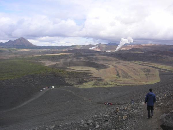
View from Hverfjall towards North-Northeast
There are two labelled paths to ascend the crater rim of Hverfjall, one from the Northwest, and one from the South. Leaving the paths, including offroad driving, is forbidden in order to avoid damage to the sensitive tuff ash formations. The path from the Northwest (shown in the picture above) starts at the parking site (off the Ring Road), for which the coordinates are given. Climbing up to and hiking around the crater rim is also highly recommended for the great views on Mývatn (picture below).

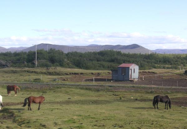
View from Hverfjall across Mývatn towards Vindbelgjarfjall
In order to claim this Earthcache, please:
1) Email us (via geocaching.com) answers to the following questions, answers in German are also welcome, and we try our very best for answers in Icelandic. Please don't post answers in the log!:
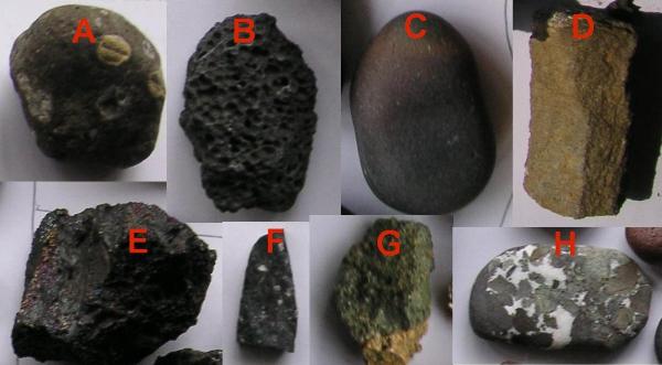
a) Have a closer look at the rocks and pebbles on Hverfjall. Which of the Icelandic rocks shown below is from Hverfjall? How would you describe the appearance of the Hverfjall rocks, and how might this shape be explained?
b) While the rock on the crater rim seems barren at first glance, a variety of plants grow here. Describe the plants you can see on Hverfjall (don't harm them in the process). It would be great if you can find out their names as well.
c) If you look North, you probably will see (and possibly hear) some steam rise up. Describe what is done there in our days.
d) There are presently only two more volcanos of this type known worldwide. Name at least one of them.
e) The volcanic activities in the Mývatn region and the existence of Iceland result from its place at the border of two big tectonic plates. What are their names?
2) Log your discovery (optional: including an uploaded picture of you on Hverfjall).

We hope you enjoy our Earthcache!
The Datenkaros (here seen discussing plate tectonics)