Before this area was settled by pioneers, Native Americans
resided here for many centuries along the banks of what is now
known as the Kankakee River. The Potawatomi Indians who called this
place home actually called the River the "Theatiki", which only
through a series of mispronunciations and misspellings became known
by the settlers as the "Kankakee" River.
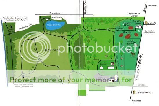
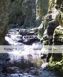
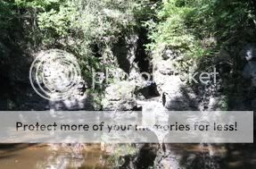
The Bourbonnais Geologic area, locally known as the Indian
Caves, is located within the Perry Farm Park along the Kankakee
River. The geological area includes the Bourbonnais Creek and
ravine and covers approximately 30 acres of land. This area
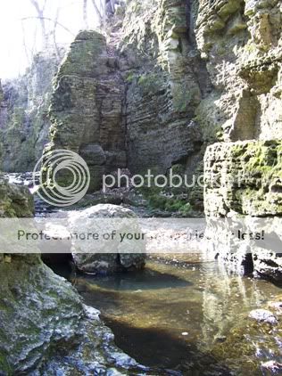
features a dolomite cliff and cave community, rare in the State of
Illinois. On September 16, 1996, Governor Jim Edgar authorized the
dedication of the Bourbonnais Geologic Area as an Illinois Nature
Preserve in an attempt to protect it against vandalism and other
destructive activities. It is open year round and its public use is
limited to walking, exploring, and observing nature. Please
remember to take care when exploring the cliff and creek areas and
to take care of this rare natural resource.
The Indian Caves at this site are small, narrow caves that are
readily accessible for exploration only to the most daring
adventurers. The deepest of the caves is only about 20 feet deep,
and requires entry through a very narrow crevice in the rock.
Access to the caves can most easily be obtained by venturing back
to the trail from the posted coordinates, walking North across the
bridge spanning the creek, and following the dirt trail up and over
the cliffs to the East. From there it will be evident how to get
down into the ravine and ultimately to the caves. You can also
follow the trail to the ENE of the posted coordinates, but the
trail is not quite as defined and the climb may be a bit
steeper.
Once you arrive at the posted coordinates, take note of the
color of the dolomite limestone, the shape of the formations, and
the size and shape of the caves. This information will prove useful
when answering the questions that follow.
To receive credit for logging this EarthCache, please respond
correctly to each of the following questions via the Geocaching.com
email system (no answers in logs, please):
1. At the posted coordinates, please estimate (in feet) the
height of the dolomite limestone cliffs from the water level up to
the top of the cliff.
2. The cliffs that you see are composed of "Dolomite"
limestone which differs from traditional limestone in both color
and texture. Based on your observations of the cliffs and rocks
before you, is this example of Dolomite limestone lighter or darker
in color than traditional limestone based on your
experience?
3. Based on your physical examination of the cliffs and rocks
before you, is this example of Dolomite limestone softer or harder
than traditional limestone based on your experience?
4. Based on your observations of the site and on the current
water flow through the ravine, into the creek, and ultimately to
the Kankakee River, what factors do you think contributed to the
formation of these caves and ravines. In addition, do you believe
that it was simply natural factors that contributed to their
formation, or do you think man had a hand in it as
well?
5. Finally, take a photo of you, your team, or just your GPSr
with the cave(s) in the background to confirm your visit to the
site.
INDIAN CAVES IN THE FALL
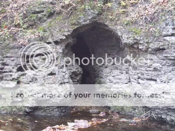
INDIAN CAVES IN THE FALL
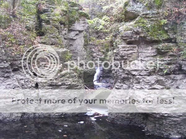
INDIAN CAVE CREEK
INDIAN CAVE RAVINE
THE SHORE ALONG THE INDIAN CAVES
PROUD TO BE CHOSEN AS THE JUNE 2010 GONIL CACHE OF THE
MONTH

