This feature is another reason why this region is called
'Lakes and Craters Country'...
The given coordinates will lead you to a spot that provides you
with a panoramic view of two of Camperdown's most scenic, volcanic
features - Lake Bullen Merri and Lake Gnotuk.
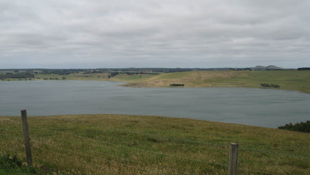
Lake Bullen Merri (looking
left)

Lake Gnotuk (looking
right)
Both these features are part of an unusual volcanic landform
known as a 'Maar'. A maar is a circular, flat-floored volcanic
crater surrounded by a low rim of rock fragments blown out of the
crater during volcanic eruptions thousands of years ago. Lava flows
can still be seen underneath the rim on the northern side of Lake
Gnotuk, which is the lake on the right as you're facing the
information boards.
The lakes are both filled with water running directly off the
crater slopes, and from the water table leaking into the craters.
Interestingly, each lake is vastly different in salinity to the
other.
As you look out to the north, you will notice a number of lakes.
Only a few years ago, these lakes were full of water; due to the
effects of the prolonged drought, they are nearly all empty. Lakes
Bullen Merri and Gnotuk aren't quite that way yet, but long-term
research shows that the level of both lakes has dropped
considerably since settlement in the region.
To log a find on this earthcache, you must email answers to the
following questions from the information provided at GZ:
1. Referring to the lava flow still visible on the
nothern side of Lake Gnotuk: where is this lava flow believed to
have originated?
2. How many maars make up each lake, and what shape are they
in?
3. What causes the lakes to become saline?
4. What is an indicator of the previous water levels around
the northwestern rim of Lake Bullen Merri?
Lastly, when you log your find, please upload a photo of
yourself brandishing your GPSr at GZ.
Feel free to log as a find when you send your email. Logs not
meeting the above criteria will be
deleted.