Amherst's Mill Pond on the Yellowstone Trail 3.0 Multi-cache
Amherst's Mill Pond on the Yellowstone Trail 3.0
-
Difficulty:
-

-
Terrain:
-
Size:  (small)
Please note Use of geocaching.com services is subject to the terms and conditions
in our disclaimer.
The mill in Amherst, until recently used the power from the mill
pond dam to grind feed. The feed mill was still in operation when I
first visted in September 2005, and still had a working dam and
power generation facility between the dam and the feed mill. The
feed mill closed in 2007, and when I visited in July of 2009
bulldozers were removing the mill, a sad sight indeed.
At the coordinates above, you will find the mill pond dam. There is
now a sidewalk across the top of the dam, where rail tracks once
ran up to the side of the mill.
From the dam, you get a great view of the mill pond. If you turn
around, and look downstream, you will see an old bridge, still used
for traffic today, that once carried Yellowstone Trail traffic. The
bridge, at least to my non-engineer's eyes looks like it is in
decay. But walk over to the road bridge, you will see on each side
of the bridge, in the middle of the bridge a stainless steel plaque
left by the builders proud of their work. For fun, walk on the
pedestrian bridge just downstream from the bridge for the road, and
guess how soon until the bridge falls down.
When I was here in 2005, on the side of the dam, you could see the
electric meter on the wall of the feed mill, running backwards as
it added electricity to the grid from the power plant here. That
too, is gone now.
You will find the final cache downstream from the dam in a nice
community park.
Coordinates for the final cache are:
44.26.ABC
89.17.DEF
A = 9
B = 3
C = Number of gates on the dam.
D = 0
E = According to the billboard on top of the dam, how many days do
you need to let a boat dry between use to prevent spread of
invasive species?
F = 5
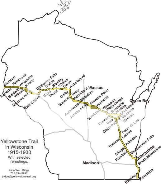
This is one of several caches I have placed along the route of the
historic Yellowstone Trail. The trail is a historic motor route
that went across Wisconsin from 1918 to 1930. The Wisconsin portion
of the Yellowstone Trail is 406 miles long, starting at the state
line south of Kenosha and going north, and then west to
Hudson.
Additional Hints
(Decrypt)
Jvyybj