
The Vicinity:
This site is located in an environmentally sensitive glacial outwash plain where the Kewaunee River enters into Lake Michigan. Several hundred acres surrounding the site are within a large public land area, which includes prime aquatic and terrestrial habitats.
The River Itself:
The Kewaunee River is a large, low gradient stream which begins near Frog Station in northwest Kewaunee County and meanders for approximately twenty-five miles. Its major tributaries include Casco, School, Scarboro and Little Scarboro Creeks. The lower river has extensive wetlands, which serve as home to 28 species of fish and numerous animal and birdlife species.
The Watershed and Erosion:
The main stem of the river and its tributaries (watershed) drain 120 square miles of surface area, 79 percent of which is agricultural. Erosion from agricultural runoff within this watershed not only delivers sandy and silty soil particles and their attached healthy nutrients into the river, but also carries with it, fertilizers, herbicides, chemicals and other potential toxins, threatening plant and animal life downstream. By minimizing cropland erosion, stream bank pasturing, wastewater discharge and runoff of animal waste, pollution levels within the river can be lowered. Reductions in forested and wetland vegetation surrounding the area have resulted in a watershed that lacks adequate opportunities for infiltration and retention of precipitation and snow melt. The result is flashy runoff which overwhelms existing stream channels and aquatic habitat by stripping valuable sediments and nutrients from the terrestrial environment. This flash erosion also generates turbidity and diminishes light transmission, resulting in degraded water quality and poorer habitat which can kill sensitive and intolerant fish and aquatic invertebrates.
Pollution, Sedimentation and Dredging:
Over 1900 tons of potentially toxic sediment is delivered and deposited into Kewaunee Harbor each and every year, threatening plant and wildlife existence in the area. In 1988, the Army Corps of Engineers dredged 41,089 cubic meters of sediment from the harbor and an additional 5,220 cubic meters was dredged in 1989. Sediment sampling in 1988 revealed levels of phosphorus, oil and grease, PCB’s, lead, chemical oxygen (organic pollutants) and other unspecified metals. The WDNR (Wisconsin Department of Natural Resources) considered these river bottom samplings moderately polluted and the state of Wisconsin placed the river on the EPA’s (Environmental Protection Agency) 303(D) list of impaired surface waters.
Entry to the Location:
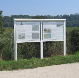
Access to the cache site is an 8 to 10 foot wide trail, with a level and hard packed surface, ideal for hiking, biking and horseback riding. This spur trail interconnects with 95 miles of trails in Kewaunee County and 275 miles of trail in Door County. Park at N44 28.705 W87 31.385 and walk east, crossing River Road/County Road E. Ignore the no trespassing sign located to the left side of the dirt road/trail as you enter. This no trespassing sign is meant for properties beyond the gate. Do not pass this gate. Entry onto the actual trail is to the left just before you reach the gate at N44 28.692 W87 31.357.
Arsenic Information sign
N44 28.544 W87 31.052
Bonus Site #1: Accidental Arsenic Spill
The Wisconsin Department of Natural Resources was informed that a small area within this plain was completely devoid of plant life, and in a larger surrounding area, plant life was severely distressed for an unknown reason. The WDNR and the former property owner joined forces in an investigation to determine the cause, degree and extent of this problem. Together they collected soil and water samples from the area and found high concentrations of arsenic. These high concentrations were thought to have come from a train derailment and subsequent spill of Sodium arsenate some years prior. During that time period, sodium arsenate was a commonly sprayed insecticide used on Door County fruit trees. The results of the initial investigation found that approximately 15 acres contained elevated levels of arsenic, with the highest levels being within the dead and stressed area of vegetation.
A Temporary Fix:
A cover “or Cap” was installed over the area to limit contact by humans, birds and animals. The cap was constructed from large sheets of Styrofoam placed on the land surface and covered with a geotextile fabric. This fabric was then used to support a layer of wood chips and a dense vegetative mat. This cap was “not” intended as a long-term solution and will quickly degrade, exposing the arsenic contaminated soil once again. This was an interim measure put into place until a more feasible and permanent solution could be implemented at this site.
Bonus Site #2: Wetlands Walk
Located at N44 27.996 W87 30.118 is a 1,500 ft. boardwalk path leading into the middle of this wetland. This is also a good place to find parking if you don’t mind a longer walk to the cache. This area is well known to be a birders' paradise, where a wide variety of waterfowl congregate. The walkway meanders through the wetland habitat, with benches along the way, ending in an observation deck with a breathtaking panoramic view.
Logging Requirements:
Email your answers to the questions, to me, using the link in my profile only. If your answers are not recieved by me, your log will be deleted. Photos are accepted and appreciated as long as the answers are not pictured. You do not have to wait for confirmation from me before logging this cache as completed. Most of all……learn……and enjoy the view.
Since task #1 can not be performed in the winter I have added another task for you to choose from. You can now perform either #1 or #2. (added 7-29-10)
#1. At the posted coordinates, calculate the flow rate of the river in "Feet Per Second". This can be done by:
• Measuring the width of the bridge.
• Drop a stick/leaf from the upstream side of the bridge into the river.
• Take a time measurement of how long it takes this stick/leaf to reach the other side of the bridge.
• Once "Distance" and "Time" have been determined, you can calculate the "Feet Per Second" of flow rate for the River.
#2. In your estimation, what is the overall width and length of the bridge and what 2 colors are on the signs posted at each corner of the bridge.
#3. Using your GPSr, or a compass, in what direction is the river flowing?

