Warsaw Triad: Spelunking Warsaw Caves EarthCache
Warsaw Triad: Spelunking Warsaw Caves
-
Difficulty:
-

-
Terrain:
-

Size:  (other)
Please note Use of geocaching.com services is subject to the terms and conditions
in our disclaimer.
Welcome to Warsaw Caves Conservation Area.
This area is well-known for “Fissure Caves” and Spelunking. This Earthcache will take you on a wonderful tour of the area highlighting beautiful geological wonders from our Glacier period. As such, due to the ecological sensitivity and the geological significance, The Ontario Ministry of Natural Resources has deemed the entire Warsaw Caves Conservation Area to be an Area of Natural & Scientific Interest (ANSI).
WARNING: As part of offering this Earthcache: Be advised, the Caves trail is CLOSED from December 1st until April 15th annually due to hazardous conditions in the area.
How were the Warsaw Caves formed ?
The Warsaw area is characterized by limestone bedrock formed in the Paleozoic era seas that covered the entire region over 350 million years ago. This bedrock was shaped through a series of Pleistocene epoch glaciations, including the Wisconsin ice age which ended 10,000 years ago. At the height of this ice age 20,000 years ago much of Ontario was covered in sheets of ice two to three kilometres thick. When these glaciers began to retreat 12,000 years ago, meltwaters created prehistoric Lake Algonquin (the present-day upper Great Lakes and Lake Simcoe) and Lake Iroquois (present-day Lake Ontario).
The flow of glacial meltwater from Lake Algonquin to Lake Iroquois formed the Kirkfield Spillway, which included the Indian and Otonabee Rivers. The ancient rivers were very different from the shallow, placid Indian River of today, being more like the modern-day Niagara River.
The caves were created by the chemical erosion of the limestone bedrock. Limestone has a distinctive crystal structure and it will fracture and crack in a specific pattern. As the ancient river flowed over the bedrock it made its way into and through these cracks. High carbon dioxide levels made the river water slightly acidic and it dissolved the limestone over thousands of years, widening the natural cracks and fissures in the rock. In time the river was flowing both over and through the bedrock, in its surface bed and in underground channels. This type of landscape is known as karst topography.

As the glaciers retreated, the weight of ice carried by the bedrock lessened and it rose up in a process known as isostatic rebound. The shifting of the bedrock and continued erosion caused the collapse of underground river channels, leaving behind a series of caves and the broken limestone landscape we see now. The site is geologically stable today and the rebound of the bedrock means there is no longer water flowing through the caves, although there are still many underground river channels flowing through the area.
What is Spelunking, you ask? It is the ability to explore natural caves. Warsaw caves offers this true wonder and is available for all to enjoy.
Before you go: Be aware that this location has an entrance fee during peak operating seasons. Additional fees apply for vehicle entries. Guided tours of the caves are available on weekends in the summer (Fees apply). Please be respectful of others and the environment. The caves, the uneven terrain, and other natural features of the park can be hazardous. Visitors use the site at their own risk and must exercise caution.
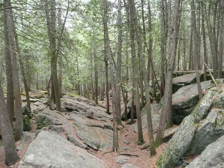
Any cachers who seek this EC will enjoy an area where you may explore up to 7 caves on one trail. The conservation area is home to a wide array of geology, wildlife and is a family oriented with additional recreational activities offered onsite.
For additional information on location updates, operating times, fees, and summer and winter trail conditions: visit: www.warsawcaves.com
Above all, enjoy the geology and have fun out there. Happy Caching!
TO LOG THIS EARTHCACHE:
You must bring your GPSr and a handheld thermometer that can record outdoor temperatures. Feel free to bring a headlamp and appropriate hiking shoes and even knee pads. Explore the Caves Trail and if interested, GO Spelunking!
In order to log this EarthCache you must complete the following:
1 – Include with your log, a photo that clearly demonstrates that you visited this Earthcache. You do not have to be in the photo as per policies. However, including a picture of the area, although optional, is the best way to display your visit.
2 – Take the temperature in the listed parking lot. Next, take the temperature while on the caves trails. Finally, take a temperature while standing in or next (within 1m) to any of the caves. Are they different and if so, Why? Email us your findings.
3 – Due to the erosional course over time, how large is the dimension of the entrance to cave site #1 in meters? Email us your findings.
4 – At the trailhead, how many 1cubic meter sized rocks are present on the first 10m of the caves trail entrance? Email us your findings.


Additional Hints
(No hints available.)