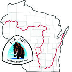
This is an EarthCache along the Ice Age Trail. There were five (5) known ice ages on earth. Ice core data of the last 400,000 years shows that short interglacial (10,000 – 30,000 years) periods are generally warm climate similar to what we are currently experiencing. The interglacial periods alternate with much longer (70,000 – 90,000 years) glacial periods that are substantially colder than present.
The most recent glacial period is known as the Wisconsin because the effects are most prominent in the state. It is believed to have started approximately 110,000 years ago and ended approximately 12,000 years ago. The glacial period prior to the Wisconsin period is commonly known as the Illinoian. It is believed to have started approximately 200,000 years ago and ended approximately 130,000 years ago.
The solid line on the map shows the approximate extent of glaciations during the last (Wisconsin) ice age.
The dotted line shows the approximate extent of earlier (Illinoian) glaciations. [Source: Iceagenow.com]
This ColdCache site is located in an area that was glaciated during the Illinoian period, but not during the Wisconsin glaciation period. You will find some till, but much of the glacial deposits have been eroded away. There are several sandstone outcrops along the trail between the Frenchtown Road parking area and the bench overlook. The Johnstown Moraine (a terminal moraine from the Wisconsin period) can be seen on the eastern horizon. The edge of the Wisconsin period can also be found approximately 3 miles to the north. The hills of the Driftless area are just beyond the Sugar River Valley to the west.
 IATCC is the cache designation to highlight a series of EarthCaches along the Ice Age National Scenic Trail grouped into a special category called "ColdCache."
The Ice Age Trail is one of eleven National Scenic Trails designated by the National Park Service. This unique trail is entirely within the state of Wisconsin and follows along the terminal moraine of the most recent glacier which retreated about 10,000 years ago.
This project is supported by the Ice Age Trail Alliance (IATA). The goal is to bring more visitors to the trail and promote public awareness, appreciation, and understanding of Wisconsin’s glacial landscape.
The IATA has created an awards program to encourage visits to the trail and ColdCache sites. This awards program is separate from, and in addition to, any other Geo- or EarthCache awards program.
A current list of approved ColdCache sites can be found on the “IATCC Bookmark List”. More information on the Ice Age Trail Atlas, the Companion Guide, the ColdCache Project and Awards Program can be found on the “ColdCache Webpage”
Resources:
Geology of the Ice Age National Scenic Trail; by David M. Mickelson, Louis J. Mahler Jr., and Susan L. Simpson
Wikipedia
1. Look straight out from the bench; what direction are you facing?
- Is the driftless area to your right or left?
- Is the Johnstown Moraine to your right or left?
The Geocache Notification Form has been submitted to Brad Bates of the Wisconsin DNR. Geocaches placed on Wisconsin Department of Natural Resource managed lands require permission by means of a notification form. Please print out a paper copy of the notification form, fill in all required information, then submit it to the land manager. The DNR Notification form and land manager information can be obtained at: www.wi-geocaching.com/hiding