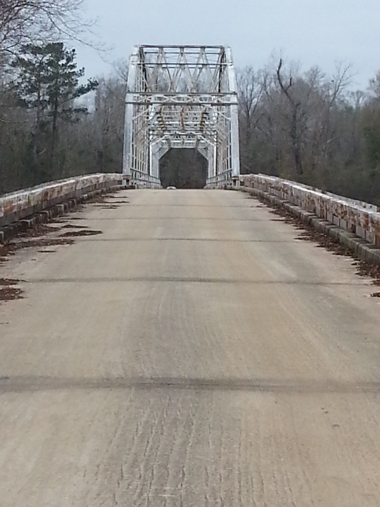
Skip to content

Merrill Bridge Traditional Geocache

This cache has been archived.

MacGyver69&CuteBoots: Sounds like it is covered.

More
Hidden : 1/9/2013
Difficulty:
1.5 out of 5
Terrain:
1.5 out of 5

Size: Size:   micro (micro)

Join now to view geocache location details. It's free!

Watch

How Geocaching Works

Please note Use of geocaching.com services is subject to the terms and conditions in our disclaimer.

Geocache Description:

You can experience this neat bridge up close and personal! Bridge can be approached from either side, but is closed to vehicle traffic. However, you can walk over it to get both caches.


THE BRIDGE:
Two-span Parker through truss built in 1915 or 1928 (conflicting data) and has a span of 176' and total length is 848'. It is designated as an official Mississippi landmark by the Mississippi Department of Archives and History.

THE RIVER:
This bridge is just south of where the Leaf and Chickasawhay rivers merge to form the Pascagoula river. If you look up river from the west side of the bridge, you should be able to see this point. It is about 80 miles long and is the only river in the United States that flows unobstructed into the Gulf of Mexico and is the only river totally in the Cfa (Humid Subtropical) Köppen Climate Zone.

Sources:
Bridgehunter.com
UglyBridges.com
Wikipedia.com


FTF Congrats to: waller88, mwaller88, and nosaints2526!

Placed by a proud member of:

Additional Hints (Decrypt)

"AB GEHPXF"

Decryption Key

A|B|C|D|E|F|G|H|I|J|K|L|M
-------------------------
N|O|P|Q|R|S|T|U|V|W|X|Y|Z

(letter above equals below, and vice versa)