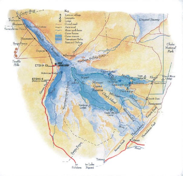
Lying in the midst of the Kalahari desert - the largest continuous stretch of sand in the world – the Okavango Delta is the greatest of Africa´s wetland wildernesses, and among its last.
Here we have a magical, 18 000 square kilometre wonderland of waterways, floodplains, islands and forests, which between them give home to a multitude of animal and bird species.
There is much speculation about when and how the Delta was formed, but certainly its development spanned millions and millions of years and was closely interwoven with the creation of the Kalahari desert, and of a succession of massive water systems that created the region.
It all started 135 million years ago when Gondwanaland, a colossal landmass which once combined today´s southern hemisphere continents, began to fragment.
India and Madagascar, Australia and Antarctica, and finally South America slowly split off and moved across the oceans, until by 100 million years ago the present configuration of landmasses had formed.
This separation led to the lifting of the southern edges of the African continent in a period of intermittent tectonic instability that created giant drainage basins. Prominent landforms were eroded, and the resulting debris was collected by rivers and winds and deposited in low-lying areas like the Kalahari basin.
The highest region in this basin is the Benguela plateau in Angola where, four or five million years ago, the collected rainfalls began to form the Cubango River.
The infant Cubango River – or Okavango, as it is known further downstreams – was joined first by the Cuito and Chobe rivers, also coming from sources in the Angolan highlands, and then by the upper Zambezi coming from northwestern Zambia.
Passing through the exposed sands of the Kalahari, 400 km from its source, it joined the Orange River and flowed westward into the Atlantic ocean.
About three million years ago geological instability diverted the great river´'s flow to the east.

Still finding its way through the endless Kalahari sands, it now joined up with the Limpopo River and ended up in the Indian Ocean.
Still later, a warping of the earth's crust dammed the giant river back, and thus the Lake Makgadikgadi was formed in what is now northeastern Botswana. This lake just began to find alternative routes to send its waters to the sea, when further movements of the earth's crust tilted the subcontinent again.
The extension of the great East African Rift System that goes down for 6400 kilometres, combined with the sinking of a section of the earth´s crust between the newly formed fault lines created a trough that interrupted the flow of the Okavango River.
When this trough slowly was filled up with the sediments brought down by the river and with wind-blown material it finally formed a wide, gently sloping fan.
The river continued to flow into this fan depositing more and more sediments, so channels became blocked and altered their course, and evaporation sapped what little momentum the river had left.
So without sustenance Lake Makgadikgadi gradually dried up and ended up as one of the largest salt flats in the world, but the inland delta persisted, vegetation taking root.
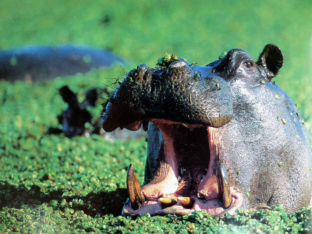
Into the resulting confusion of meandering, papyrus lined channels, forested islands and lagoons – the Delta as we know it today – all kinds of animals and bird species were drawn from the surrounding Kalahari thirstlands to the wealth offered here.
However, the Okavango is not, strictly speaking, a delta at all, but rather an alluvial fan.
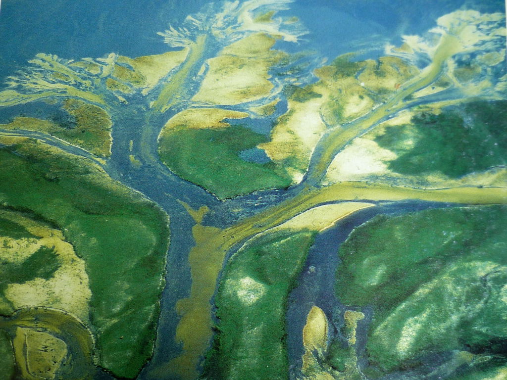
Instead of discharging into another body of water, as an authentic delta does, the Okavango's channels disappear in the thirsty sands of the Kalahari desert.
The fan that forms the Delta consists of two rather distinct parts – the permanently and the seasonally flooded areas.
The permanent or perennial Delta retains water all year round and gives life to an abundance of reeds, grasses, shrubs and trees, while the seasonal Delta, apart from its main channels, is a grassland area for most of the year, until the annual floodwaters originating from the summer rains in the Angolan highlands send up to 11 billion cubic metres of water through the area each winter and transfer it briefly into a lush wetland wilderness.
The Delta region's rainfall is much less than that of its distant catchment area, but the rains, that should fall between November and April add a further 5 billion cubic metres of water to the wetland water system.
Although these figures may sound generous, they are rather deceptive: an astonishing amount of the moisture is lost to the atmosphere by evaporation or simply disappears into the burning desert sands.
In a dry year all the water is lost this way, and even in good years not more than 2 percent of the inflow eventually can leave the Delta System at its base, flowing into the Thanalakane River. The Delta has its tides that can be compared to the tides of the sea, only the rhythm is much slower: Vegetation and animals have to cope with the difference in water level between the coming and going of the annual flood, and between years when this flood is high and when it is low.
Although the Delta is set within the semi-arid Kalahari, the local climate differs somewhat from from that of the surrounding area, in much the same way as mini-climates occur over rainforests.
There are marked seasonal differences: temperatures range from 18°C to 32°C in summer, and from 5°C to 25°C in winter.


Visitors come from all over the world to experience this unique gem of African wilderness – usually starting from Maun you can explore the wonders of the Delta on game drives, by Mokoro (the traditional boat), or most preferably riding a horse or an elephant, thus almost blending with nature and almost being a part of the wildlife itself.
Hunting was very restricted for long and now is banished completely, so the animals are quite relaxed, for they have only to fear four-legged predators.
The camps are all operated eco-friendly, and it is not allowed to build permanent structures in the Delta.
When you are flown into your camp from Maun, you will notice the change in the landscape near the given coordinates.
To log this Earthcache, please send a MAIL to nannibella, answering the following questions
IN YOUR OWN WORDS:
1) What is the difference between the Okavango Delta and a “normal” Delta?
2) Which are the four components that compose (+ and -) the fluctuating water level of the Delta? (See Hint)
3) Where did the waters of the Okavango end up 4-5 million years ago?
4) Where did they flow to 3 million years ago?
5) What did finally interrupt the flow of the Okavango to the sea?
6) Estimate "tidal range" or the difference of the water level (in meter!) in a seasonally flooded area between "dry" season and "high" season. The guides at your camp might give you some advice.
7) If you are not exhausted by now, a picture of your Okavango experience will be welcome and much appreciated.
Have fun!