Rakke is the name of the large peninsula between Solplassen Camping and Fuglevik.
"Rakkebåene", with a number shallows and reefs, is known as one of the most dangerous waterways for boat traffic along the Norwegian coast. In all there were 13 skips wrecked here.
In 1935 the Range on Østre Rakke was inaugurated, with both King Haakon and Crown Prince Olav present. Her Norwegian soldiers received training in using the existing most modern antiaircraft cannons.
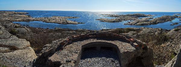
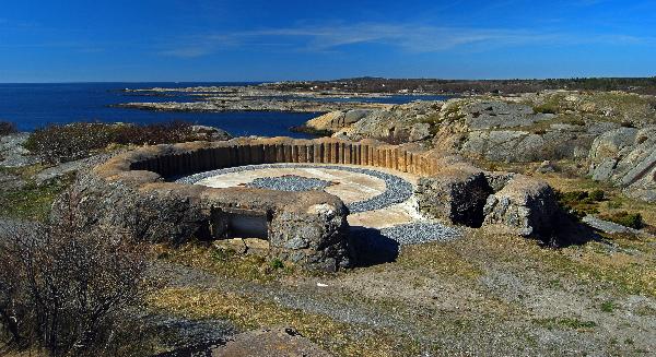
When the Germans possessed Norway in 1940, they found out that Rakke was an ideal place for a coastal fortress, both because of the strategic location and proximity to the camp in Stavern. In 1941 the Germans put in enormous time and effort on construction work, spread over an area of 2-300 acres, and a command center was set up on the highest point. On the force's map from 1955, there are 91 firing positions, gun platforms, bunkers, tilfluktsrom, tunnels, barracks, etc marked throughout. In addition, a network of roads, paths and steps. Most of this was built during the war, and was more or less intact until 2007. From 1943 Rakke was also adopted as the school and practice facility for the German coastal artillery.
After the war the firing activities coninued. The area was blocked off by a fence. While shooting was taking place, a guard boat would be patrolling the "LKØ2" outside Rakke to prevent boats from being in at risk. In 2002, the military's operations in Stavern closed down, and thus also on the Rakke range. After the shooting school was closed down, there was little activity there.
The availability of Rakke is now highly improved, and so even people with reduced movement's ability have the chance to experience memories of the war and come out in a coastal landscape that is one of the most dramatic in Larvik.
From November 2008 Larvik Council took over responsibility for the fort and the surrounding area. This means that the entire Rakke area is freely available to the public and there is no military activity here anymore!
Unfortunately, this means that most of the trenches were filled in and all bunkers etc. were sealed off. This can make it hard to see and understand the size of the complex that was here.
On 8.12.2008 was also Rakke became part of the coastal trail.