How long ago did this occur?
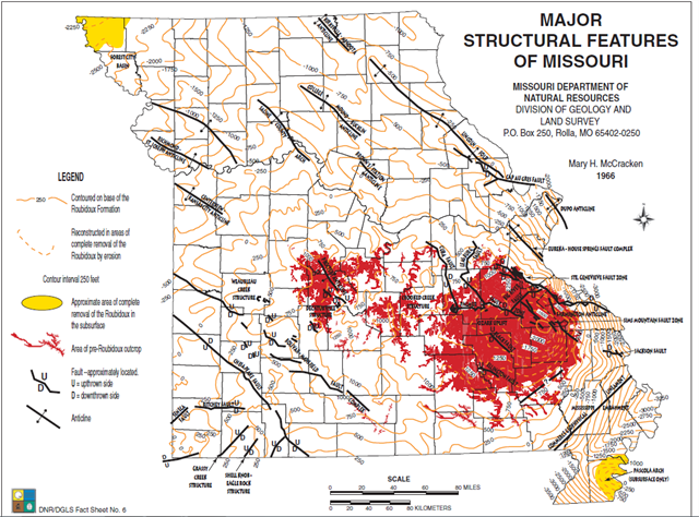
“The Bolivar-Mansfield Tectonic Zone (BMTZ) is an early Proterozoic basement structure that trends northwest through the Midcontinent region. This structure was reactivated several times during Precambrian and Paleozoic time.” (Cox )
- Early Proterozoic =541 – 2500 million years ago
- Precambrian = 541 – 4600 million years ago
- Paleozoic = 252.2 – 541 million years ago
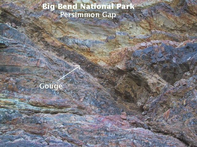
Seeing as how we can physically see the fault in this area we are going to observe and evaluate this area.
“This part of the fault is a compressional fault with a massive up thrown block clearly visible” – Missouri Registered geologist.
This fault is obvious on the East side of Hwy 13 with its higher upthrown side clearly visable.
Different types of Faults
A close look at faults helps geologists to understand how the tectonic plates have moved relative to one another.

Normal faulting – where the crust is being pulled apart, normal faulting occurs, in which the overlying (hanging-wall) block moves down with respect to the lower (foot wall) block.
Reverse faulting – where the crust is being compressed, reverse faulting occurs, in which the hanging-wall block moves up and over the footwall block – reverse slip on a gently inclined plane is referred to as thrust faulting.
Dip-slip movement—Slip of one fault block, relative to the other block, by movement parallel to the dip of the fault. On any inclined surface, such as a fault in the Houston area, it is possible to draw an imaginary horizontal line, termed the strike of the fault, and to draw a second line perpendicular to the strike, termed the dip line. The angle by which the dip line deviates from horizontal is the dip of the fault; it corresponds to the inclination of the fault in nonscientific terms. If movement of one fault block relative to the other block occurs parallel to the dip line, it is termed dip-slip movement.
Downthrown side—The side of a fault that appears to have moved downward relative to the other side.
Upthrown side—The side of a fault that appears to have moved upward relative to the other side.
(USGS)
Nature’s crusher
Fault gouge is crushed and ground-up rock produced by friction between the two sides when a fault moves. (USGS)
Source: Web
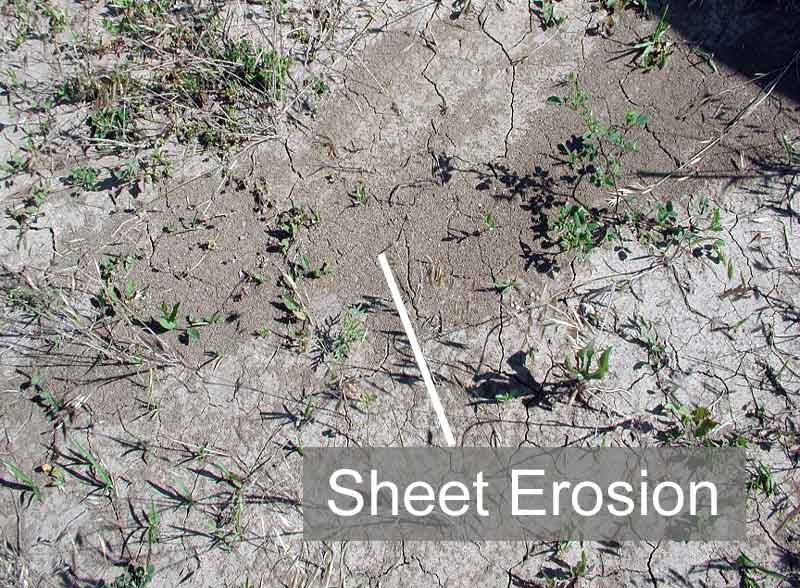
Primary types of erosion
There are four primary types of erosion that occur as a direct result of rainfall: splash erosion, sheet erosion, rill erosion, and gully erosion. Splash erosion is generally seen as the first and least severe stage in the soil erosion process, which is followed by sheet erosion, then rill erosion and finally gully erosion (the most severe of the four).
Splash erosion, the impact of a falling raindrop creates a small crater in the soil, ejecting soil particles. The distance these soil particles travel can be as much as two feet (0.6 m) vertically and five feet (1.5 m) horizontally on level ground. Once the rate of rainfall is faster than the rate of infiltration into the soil, surface runoff occurs and carries the loosened soil particles down the slope.

Sheet erosion is the transport of loosened soil particles by overland flow.
Rill erosion refers to the development of small, ephemeral concentrated flow paths which function as both sediment source and sediment delivery systems for erosion on hill slopes. Generally, where water erosion rates on disturbed upland areas are greatest, rills are active. Flow depths in rills are typically of the order of a few centimeters or less (around an inch) and slopes may be quite steep. This means that rills exhibit hydraulic physics very different from water flowing through the deeper, wider channels of streams and rivers

Gully erosion occurs when runoff water accumulates and rapidly flows in narrow channels during or immediately after heavy rains or melting snow, removing soil to a considerable depth.

Source: Wiki
**Logging requirements**
DO NOT POST ANSWERS IN YOUR LOG.
Send the following answers to me via email.
- What kind of erosion is occurring in the fault gouge?
- What color is the fault gouge?
- What are three primary colors of rocks here?
- What is the angle of this upthrown side? (There is an app for that, or if you must you can estimate)
- Elevation at GZ which is the upthrown side?
- Elevation at the downthrown side? (waypoint "Down")
| I have earned GSA's highest level: |
 |
The above information was compiled from the following sources: