This EarthCache provides a visitor an opportunity to discover an ancient rock formation in Pictured Rocks National Lakeshore that was deposited approximately one billion years ago. This site is found at the mouth of the Hurricane River and can be accessed near the parking lot leading to the Hurricane River campground at Pictured Rocks National Lakeshore.
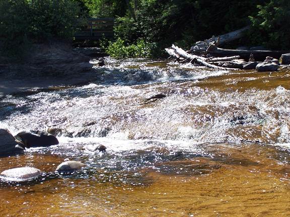
Photo by Y. Kuiphoff
Coordinates: N 46 39.947, W 86 10.062
Background
What is so special about this formation and what does it tell us about its depositional environment? The Jacobsville Formation is a feldspar-rich quartz sandstone that formed in a moist and humid fluvial/lacustrine environment approximately one billion years ago during the late Precambrian. It is the oldest exposed rock in Pictured Rocks National Lakeshore and sits unconformably below the Munising and Au Train Formations . This unconformity marks a gap of approximately 500 million years of geologic history. Its red color and light mottled streaks and spots make it easily recognizable. The red color is caused by the mineral hematite (ferric iron oxide). The white streaks or spots are thought to be the result of organic material in the rock at the time of formation that subsequently did not oxidize and thereby take on the red color.
The Jacobsville is not as well exposed in the park as the Munising and Au Train formations, with only the top few feet rising above the lake level. The mouth of the Hurricane River and other parts in the Au Sable Point vicinity afford visitors the opportunity to put their hand on a billion years of geologic history! For a view of more spectacular cliffs one can visit the western side of Grand Island. There, like other places in Michigan’s Upper Peninsula, the Jacobsville was quarried for building stone in the late 1800’s.
Logging your visit

Photo by Y. Kuiphoff
The bush in this picture is growing on glacial deposit on top of an outcrop of exposed Jacobsville sandstone.
Q1 – Using your hand (thumb to pinky extended) how many hands tall is the Jacobsville sandstone outcrop compared to the glacial deposit on top of it?
Q2 – Which direction is the downward tilt of this formation?
Links to the Big Ideas of Earth Science (http://www.earthscienceliteracy.org/)
Big Idea #2 Earth is 4.6 Billion years old.
2.1 Earth’s Rocks and other materials provide a record of its history.
Big Idea # 5 Earth is a water planet
5.6 Water shapes landscapes.
Misconceptions
All rocks in the park are the same age.
Rocks are boring and don’t tell us anything.
The owner of this cache is a participant in the Michigan Teaching Excellence Program (MITEP) through Michigan Technological University, which teams with science teachers to improve science teaching and learning. This work was supported by the National Science Foundation award #0831948.
References:
Blewett, William L., Geology and Landscape of Michigan’s Pictured Rocks National Lakeshore and Vicinity. 2012 Wayne State University Press, Detroit, MI
http://en.wikipedia.org/wiki/Jacobsville_Sandstone
http://www.nps.gov/piro/naturescience/upload/RR%2097-1%20cambrian%20sandstone.pdf