DEVILS MOUNTAIN SERIES #6
This geocache was part of an archived series. I archived the rest of them but the waypoints below give you the highlights. The trek to the lookout site is a nice moderate hike to the top of Devils Mountain, 2 Miles each way with 1000 feet of elevation gain. Please be aware that you cross private land on a DNR road easement during the first quarter mile of the hike. The rest of the walk to the top is on DNR forest land. Motorized vehicles are not allowed.
Access is off Arnick road in South Mount Vernon. Don't come in from highway 9. That access is private.
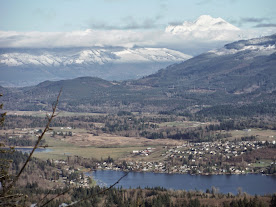
The top of Devils Mountain is the site of an old lookout but now houses large transmission towers. Devils Lake, deep in the woods, is private and even has some houses around it. The rest of the roads up there are nice to explore (also on a mountain bike) with some good views of glacier peak and Big Lake
There is a spectacular view of the tulip fields along this hike. See the waypoint. Hiking the route up here in April is highly recommended.
Devils Mountain is an interesting geologic area. This is the location of the Devils Mountain Fault, the most Northern Puget Sound Fault. It is an active fault and could cause another earthquake. It runs from Darrington west through the heart of Devils Mountain and then continues west to Whidbey Island and eventually Victoria, BC.
Up here at 1727 feet elevation was the location of the old lookout. It was standing from 1936 to 1970