ALL LAND IS FOREST SERVICE LAND AND NOT PRIVATE PROPERTY. ACCESS TO CACHE IS ON FOREST SERVICE PROPERTY.
IMPORTANT NOTE AS OF JUNE 13, 2019!! We have changed the Terrain Difficulty as this now requires a more significant and steep walk to even the Trailhead Access, so a steep up-hill walk up the road from the only available parking as directed by staff down by the resort office. PLEASE DO NOT DRIVE UP THE ROAD TO THE CABIN AREAS AS NONE ARE DESERTED NOW, SO NO PARKING AVAILABLE FARTHER UP FS ROAD 7172. CHECK IN AT THE OFFICE FOR A PARKING PERMIT AND SUGGESTED PARKING AREA, DEPENDING ON AVAILABILITY AND THE SEASON. YOU MAY WIND UP IN THE GENERAL AREA WE HAVE LISTED, BUT PLEASE CHECK WITH MANAGEMENT STAFF FOR DIRECTIONS.
This beautiful area is located in the rain shadow of Mount Rainier, on US Forest Service land in the Mount Baker-Snoqualmie National Forest. The original use for this land was as Bennett’s Horse Outfitters in 1925, and many of the current cabins have been on site since the 1920’s and 1930’s. The historic name for the more current usage is Alta Silva Resort at Deep Creek, and has been operated as several enterprises over the years. At one time, this area was home to the College of Puget Sound Ski Team. There are a number of privately owned cabins on the forest service land that hold a long-standing lease. These cabins pre-date the nearby modern ski area by 40 years. At this time, the Forest Service and a private company operate a partnership in recreation.
Elk are frequently found making their way down to the White River to feed and drink. You are likely to see or hear other animals and birds in the area also. We saw elk as we were leaving the area after placing this cache. Please note that we had NO CELL PHONE COVERAGE (AT&T) without using a hot spot connection, so do not rely on using only your cell phone to find this cache. Also note that the Resort has several scavenger hunt items placed that should not be disturbed or confused with this cache.
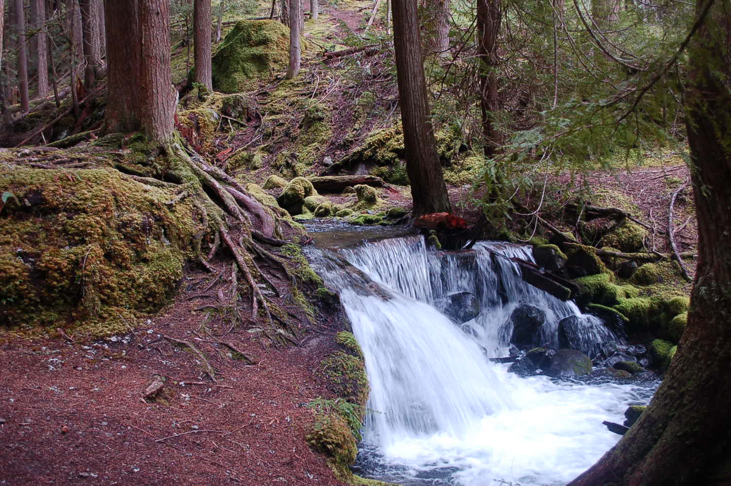
CACHE: This small lock & lock camouflaged container is placed with permission of Alta Crystal Resort management on a trail on forest service land leading out from the Resort. Turn off Hwy. 410 on to FS 7172, and drive into parking near the office/store, going in to visit with Greg or other management at the resort to request a short-time parking space while you seek the cache. They will refer you to the appropriate location, so do not automatically head to the coordinates we listed as they may not be available when you arrive, depending on the time of year and occupancy of the resort. After you receive permission to park and the location, start walking up the road which becomes dirt, and continue up hill and look for a wooden sign marked "TRAIL" on your left. Follow this trail down to the edge of the creek and to the bridge. We have indicated the Trail Coordinates as a waypoint (N47 00.416 W121 31.379). Remember that you will have a longer and more strenuous hike to the cache site, thus, the increased terrain rating. Also remember that ALL land is Forest Service land, and open to the public. This trail is NOT wheelchair accessible at any point, and has a small elevation gain and somewhat uneven trail pack (roots and rocks), but is frequented by guests at the resort as well as other visitors. Cache site is just over the bridge (N47 00.433 W121 31.355) and up the trail for a short distance at Deep Creek Falls, and the remnants of an old water wheel used to produce a small amount of power. A water chute is the only remaining evidence at these falls. Please re-hide cache as well or better than you find it.
2016 was the 100th anniversary of the National Park Service, and to celebrate, Visit Rainier and WSGA hosted the Visit Rainier Centennial GeoTour - 100 caches placed in and around Mount Rainier National Park. The geocaches highlighted the rich history, scenic wonders, quaint communities, and hidden gems of the Rainier region. Participants received geocoin and pathtag prizes for finding all the caches.

