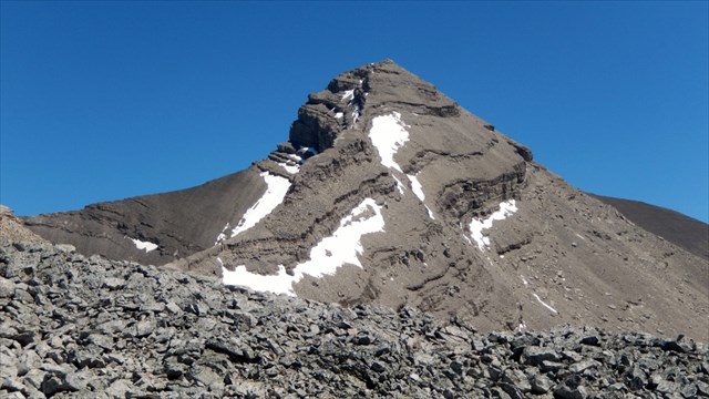
The Intimidating West Ridge of Mount Bogart:
There are two scramble routes to the summit of Mount Bogart:
1) A Moderate Scramble via the Ribbon Creek Trail and the South Slopes: This route will require a round trip of 28 kilometers and an elevation gain of 1,700 meters. Park at the Ribbon Creek parking lot and proceed along the Ribbon Creek trail for 11 kilometers. At least part of this can be biked. Scramble up into a large alpine bowl to the SW of Mount Bogart. Ascend up the south scree slopes to the summit. There are some cliff bands that offer moderate scrambling. For more information, refer to Alan Kane's "Scrambles in the Canadian Rockies"
2) (RECOMMENDED) A Moderate-Difficult Scramble via Sparrowhawk Tarns and the West Ridge: I think this is the first time I have ever said this but the Nugara route up this mountain is, in fact, the best route in my opinion. Expect a round trip of 17 kilometers and an elevation gain of 1,500 meters. This route is more desirable than Kane's route due to the approach being 11 kilometers shorter and the gain 200 m fewer. Begin your hike by reaching the Sparrowhawk Tarns. Refer to this page for more information on reaching the tarns. Scramble up a very steep and VERY loose ramp to a col. Proceed to the outlier and carefully scramble down cliff bands (moderate scrambling) to the col below the outlier. The daunting west ridge appears. Attack a buttress head on or traverse it on the right on loose but easy terrain. Follow slabs up higher and negotiate a small cliff band where you feel comfortable (2 m, moderate scrambling). From there, proceed up loose scree to the summit. Refer to Andrew Nugara's "More Scrambles in the Canadian Rockies" for more route information.
Regardless of the route, Mount Bogart has a lot of loose scree. Be prepared for this - a helmet is highly recommended. I discovered first hand that snow and cold temperatures add to the difficulty immensely - a layer of verglas (ice on rock) will make the ascent very difficult. Take this into consideration. Routefinding skills are a must regardless of conditions. Also remember that this is in the backcountry - I would recommend bringing a personal beacon such as a SPOT device.
Once atop the summit, you will be treated to phenomenal views on a clear day. Several 11,000ers will be visible. After finding the cache, please rehide it well.
Good luck, and stay safe!
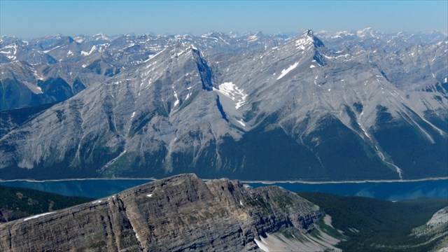
The View West from the Summit - Spray Lakes in the foreground:
 The View South from the Summit - Ribbon Lake in the foreground:
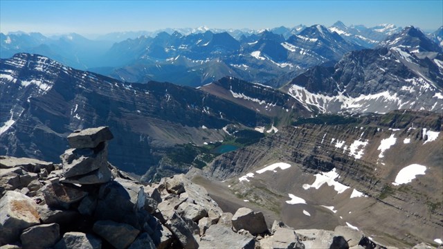 Photo Credits: Matthew Hobbs