GEOCACHE “DE DUVELSKUUL”
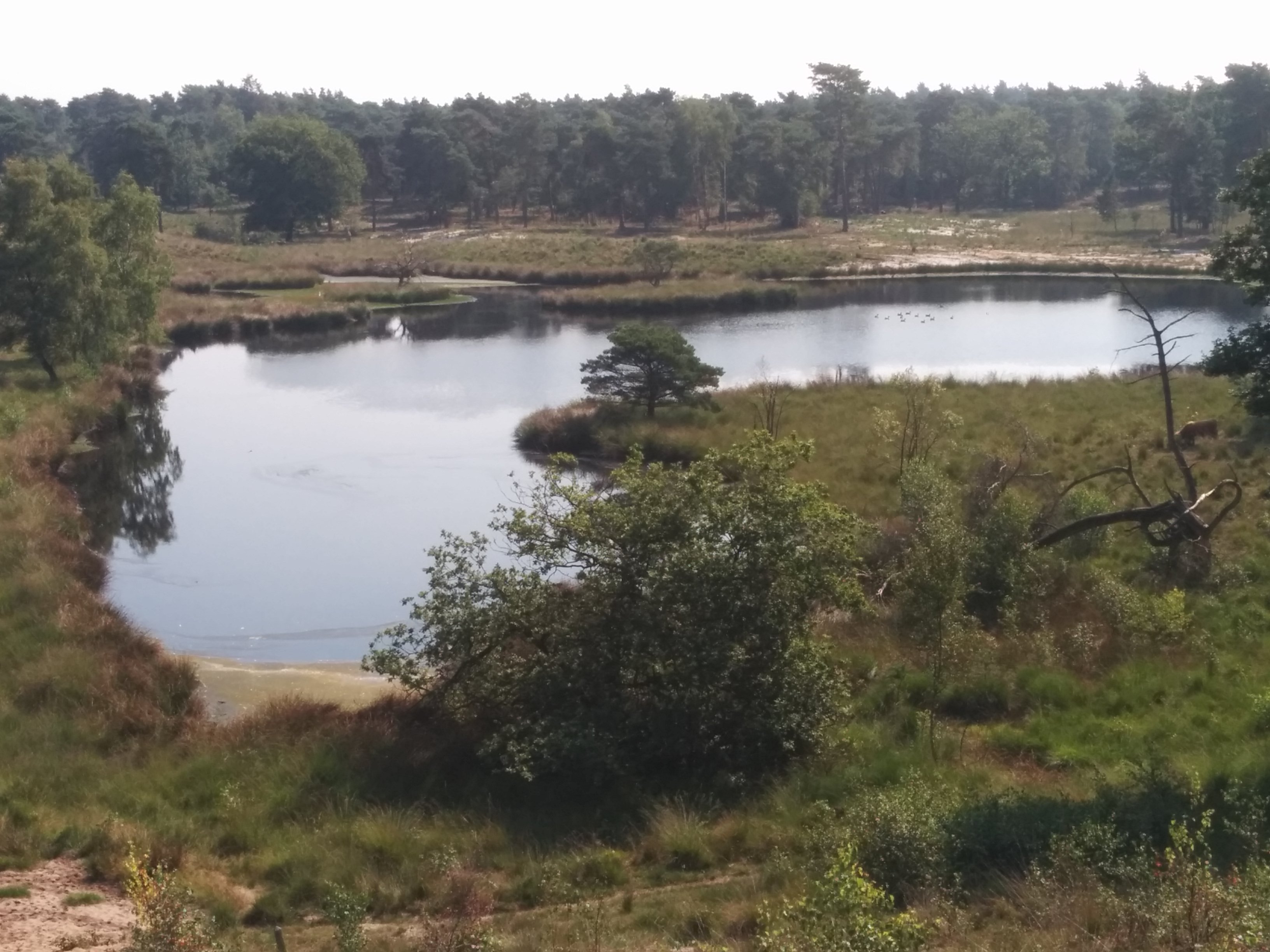
“De Duvelskuul” zoals deze mooie plek in de volksmond in Afferden wordt genoemd, is een groep vennen in de uitgestoven kommen van de rivierduinen van de Maas. Vroeger werd in dit moerasgebied turf gestoken waarbij je soms kon wegzakken in het veen wat een enkele reis naar de duivel en de hel zou betekenen. Vandaar de naam; de kuil van de duivel. Het is tegenwoordig een fraai heideterrein in het 800 hectare grote Bergerbos.
De geschiedenis van het gebied is nauw verbonden met die van het landgoed Bleijenbeek dat voor het eerst in 1400 wordt vermeld. Het landgoed, dat bestond uit een kasteel, bos, landbouwgrond en een heidegebied met vennen, was eeuwenlang in het bezit van de familie Schenck van Nijdeggen. In 1996 kocht Staatsbosbeheer een deel van het landgoed. Sinds enige tijd is er een golfbaan aangelegd die de naam Bleijenbeek draagt.
Het Bergerbos is een onderdeel van het 5323 hectare grote Nationaal Park “De Maasduinen”. Dit park dankt zijn naam aan de opvallende stuifzandruggen die paraboolduinen worden genoemd. Deze paraboolduinen zijn ontstaan tegen het einde van de laatste ijstijd. Grote delen van Noord- en Midden-Limburg waren toen bedekt met een laag dekzand. Door de wind werd dit zand opgeblazen tot zandruggen en hoefijzervormige duinen. Staatsbosbeheer heeft in het Bergerbos - de Afferdense bossen en de Duvelskuul - zo'n 30 hectare bos gekapt om de 3 heide-eilandjes met elkaar te verbinden: "Het Quin" ("De Kwen") in het noorden, "De Cokse Hei" in het midden en "De Duvelskuul" in het zuiden van de Afferdense bossen. Aan hei en open zand zijn diverse plant- en diersoorten gebonden. Vogels als nachtzwaluw en boomleeuwerik, amfibieën als hagedis, knoflookpad, heikikker en rugstreeppad, insecten als blauwvleugelsprinkhaan, diverse heidevlinders en -libellen doen er hun voordeel mee. De deelpopulaties ervan kunnen zich dan door het hele gebied verspreiden. Uiteindelijk zal een nieuwe ecologische verbindingsstrook ontstaan, bestaande uit een bosheidelandschap. Er is nog 10 à 25 procent bos over. Tegenwoordig maakt het onderdeel uit van een 110 hectare groot heidegebied waarin runderen en geiten meehelpen dit gebied open te houden.
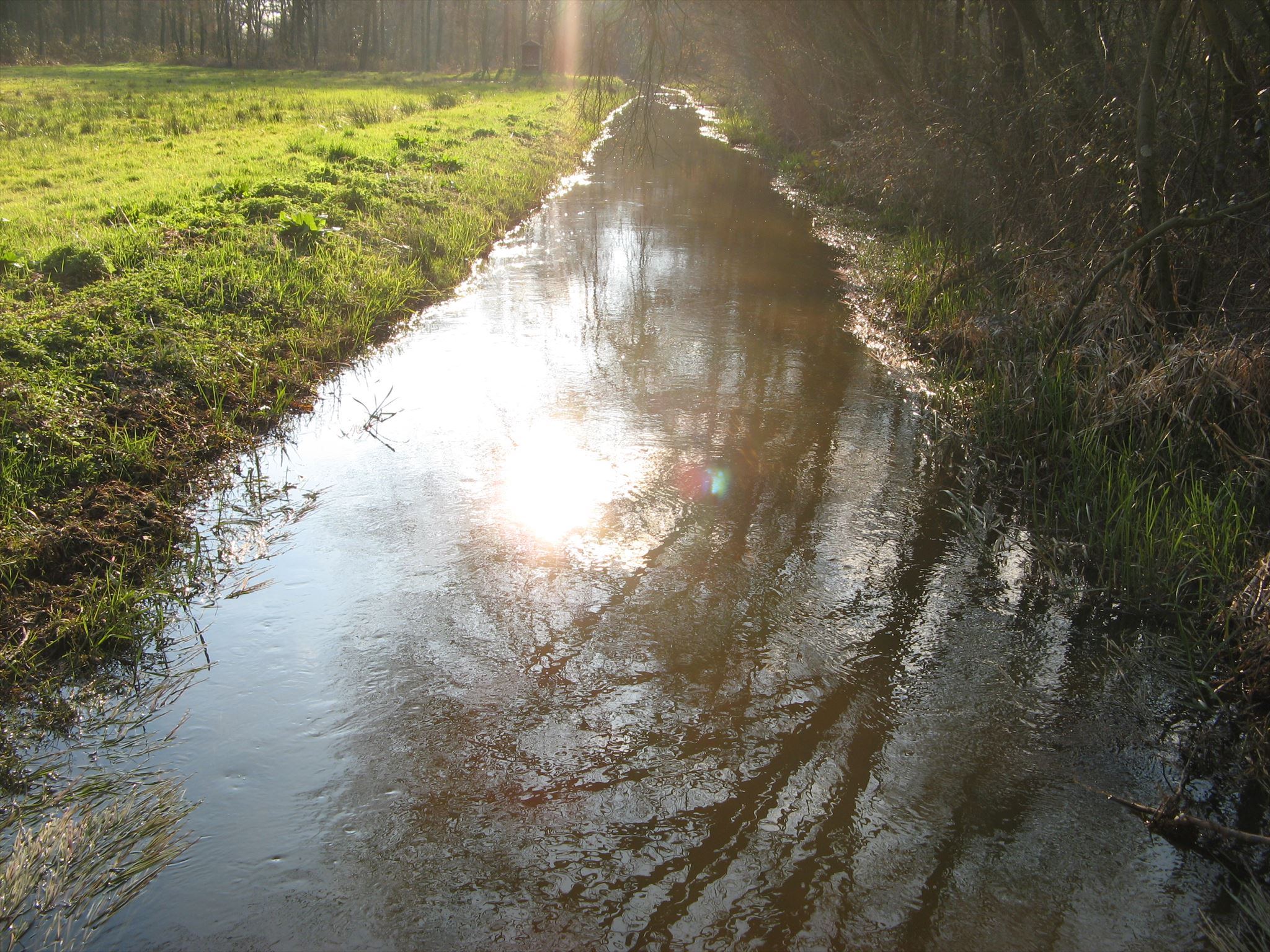
Deze 5.5 km lange tocht gaat hoofdzakelijk over bospaden met soms los zand of modder en kan eigenlijk alleen maar te voet uitgevoerd worden en is niet toegankelijk per rolstoel. De route loopt ook voor een stuk parallel aan de Eckeltse beek. Onderweg wordt een gebied ingegaan met loslopende geiten en runderen. Deze kunnen onvoorspelbaar reageren als je te dicht in de buurt komt. Houd hier rekening mee! Verder is er geen toegang met loslopende honden en na zonsondergang.
Deze cache is mede mogelijk gemaakt door Golfbaan Bleijenbeek.
- Parkeer uw cachemobiel bij de volgende coördinaten: N51° 38.066' E6° 02.052'
- Ga vervolgens naar WP1: N51° 38.053' E6° 02.217'. Onderweg wordt U in een aantal talen uitgezwaaid. Tel daar 3 bij op.
A = In hoeveel talen + 3
- Loop vervolgens naar WP2: N51° 37.974' E6° 02.244'. Ga vlak vóór het beekje rechtsaf en blijf het pad naast het beekje volgen tot WP3: N51° 37.865' E6° 01.901'.
- Volg vanaf dit punt het pad naar links en ga naar WP4: N51° 37.853' E6° 01.627'. Ga niet over privé terrein om WP4 te bereiken. Aangekomen bij WP4 moet U op zoek naar een groene brievenbus.
B = Neem het huisnummer op deze brievenbus, vermenigvuldig die met 2 en tel er dan 1 bij op.
- Ga dan naar WP5: N51° 37.722' E6° 01.709' en zoek het knooppunt nummer van het fietsroutenetwerk. Tel daar 3 bij op en deel de som door 4.
C = (Knooppunt Nummer + 3 ) / 4
- Loop vervolgens via de paden naar WP6: N51° 37.726' E6° 02.314' en zoek dan het juiste pad om het hoog(s)tepunt van deze tocht te bereiken WP7: N51° 37.715' E6° 02.499'. Rust lekker uit en geniet van het uitzicht. Tel ook even het aantal planken waaruit de rugleuning van deze rustplaats is opgebouwd.
D = Aantal planken in Rugleuning.
- Ga dan via WP8: N51° 37.684' E6° 02.854' naar WP9: N51° 37.778' E6° 03.005' en tel hierbij het aantal zwarte tie-wraps aan een van de palen.
E = Aantal Tie-Wraps.
- Vervolg het pad naar WP10: N51° 37.830' E6° 02.569' en neem de stapeltelling van dit wandelknooppunt. F = Stapeltelling knooppunt.
- Vervolg de weg naar WP11: N51° 37.920' E6° 02.523' en zoek het bord met de maximum snelheid. Vermenigvuldig deze snelheid met 4 en stapeltel de uitkomst.
G = Snelheid maal 4 en dan stapeltellen.
U kunt de cache nu vinden op:
N51° 3(B).(A)(F-G)(G-D)' E6° 0(E).(A-G)(B-D-E)(C)'
Volg na GZ het pad om weer richting het startpunt te lopen.
Als je alle 3 de caches (De Kwen, De Duvelskuul & De Cokse Hei) hebt bezocht, dan mag je onderstaande banner aan je profiel toevoegen.
Bannercode:
<p><a href="http://coord.info/GC6JJPP"><img src="https://s3.amazonaws.com/gs-geo-images/6dd1ccae-b1a2-40e5-b0ac-86279550e05b.jpg"></a></p>
GEOCACHE “DE DUVELSKUUL”
“De Duvelskuul”, as called by the local inhabitans, exists of a group of fens in the basin of a river dune of the Meuse river. The meaning of “Duvelskuul” is “pit of the devil” and refers to the former swamp area where you should meet the devil when sink in the soft soil. Nowadays it is a part of the forest called "Bergerbos" covering approximately 800 ha.
The history of this area is closely connected to country estate “Bleijenbeek” mentioned for the first time in the year 1400. This country estate that exists of a castle, forest, farming land and heathland with fens was in possession for centuries by the family “Schenck van Nijdeggen”. In 1996, Staatsbosbeheer (a Dutch organization founded in 1899 to control and conserve Dutch nature reserves) bought a part of the country estate to recover the heathland. Since several years there is also a golf course called Bleijenbeek.
The "Bergerbos is part of the national park "Maasduinen", founded in 1996 and covering approximately 5300 ha. The landscape consists of forests and heathlands on a sandy plateau along the river Meuse close to the German border. The present characteristics of the park are strongly influenced by an intense interplay of wind, water and humans through the course of time, resulting in a unique pattern of drifting sand ridges or parabolic dunes which date from the last glaciation. Besides heathlands and forests, there are several fens in the park.
Staatsbosbeheer has cut down about 30 ha. trees to connect 3 islands of heathlands. These islands are called "Het Quin" ("De Kwen") in the north, "De Cokse Hei" in the middle and "De Duvelskuul" in the south of the Afferden forest. The natural rejuvenation of this forest lead to new flora and fauna like some reptiles and amphibians species. Among the flora we find several oak species, birch, pine, alder and beech. In these days this place is a part of a 110 ha. sized heathland area in which Galloways and goats are helping to keep this area open.
This geocache trail is about 5.5 km and uses small sandy forest trails with sometimes mud and can only be done by foot. The trail also partly follow a small brook, called the “Eckeltse beek”. The area is not accessible for wheelchairs. Along the way you enter an area with Galloways and goats. These animals can response unpredictable if you come too close. So keep this in mind. Furthermore there is no access to this area for unattached dogs and after sunset.
This geocache has been made partly possible by Golfcourse Bleijenbeek.
- Park your cache vehicle on: N51° 38.066' E6° 02.052'
- Then go to WP1: N51° 38.053' E6° 02.217'. On your way to WP1 you will see “Goodbye” in a certain number of languages. Add up 3 to this number of languages.
A = Number of languages + 3
- Arrived at WP1, go to WP2: N51° 37.974' E6° 02.244'. Go to the right just before you’ll cross the small brook and keep on the trail that runs parallel to the brook until you reach WP3: N51° 37.865' E6° 01.901'.
- From this point on follow the forest trail to the left and walk to WP4: N51° 37.853' E6° 01.627'. Do NOT walk on private property to reach for WP4. Arrived at WP4 you have to find a green letterbox.
B = Take the House number on this letterbox, multiply by 2 and then add 1 to this number.
- Then go to WP5: N51° 37.722' E6° 01.709' and find the bicycle intersection point (‘Knooppunt’). Add up 3 to this number and divide the answer by 4.
C = (Intersection point Number + 3 ) / 4
- Walk along the trails to WP6: N51° 37.726' E6° 02.314' and then look for the right trail to reach for the highest point of this walk, WP7: N51° 37.715' E6° 02.499'. Take a rest on the bench and enjoy the view. Meanwhile please count the number of bars of the back of the bench.
D = Number of bars in back of the Bench.
- Now go via WP8: N51° 37.684' E6° 02.854' towards WP9: N51° 37.778' E6° 03.005'. At WP9 count the number of black tie-wraps on one of the poles.
E = Number of black Tie-Wraps.
- Continue the trail to WP10: N51° 37.830' E6° 02.569' and take the digit sum of this hiking intersection point.
F = Digit sum of hiking intersection point.
- Go further to WP11: N51° 37.920' E6° 02.523' and look for the sign with the maximum allowed speed. Multiply this max. speed by 4 and take the sum of digits of the answer.
G = Maximum allowed speed multiply by 4 and then take the sum of digits.
Now you can find the stash on:
N51° 3(B).(A)(F-G)(G-D)' E6° 0(E).(A-G)(B-D-E)(C)'
Continue the trail at GZ to return to the starting point.
If you have visited all 3 geocaches (De Kwen, De Duvelskuul & De Cokse Hei) you may add the banner below to your profile.
Bannercode:
<p><a href="http://coord.info/GC6JJPP"><img src="https://s3.amazonaws.com/gs-geo-images/6dd1ccae-b1a2-40e5-b0ac-86279550e05b.jpg"></a></p>