
 This climb is not for the feint hearted. Be sure to take enough water and food with you as the trail is almost entirely in direct sunlight. Winter ice and snow would make the trail almost impassable. That being said, my 8 year old daughter made the trip easily on an autumn morning.
This location takes you to the mouth of a hanging valley with small potholes and close to a free standing arch. The free-standing arch is a little way up the canyon on the west side. Watch for it, as it is easily missed. We passed by it the first time we walked up the canyon. 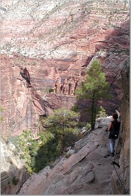 There are no gps coordinates for the arch since it is in a deep narrow canyon.
Hanging Valley (at the coordinates)
At one time, the main and tributary valleys were at the same elevation. The perennial Virgin River flows in the main valley while an ephemeral stream flows down the tributary valley called Hidden Valley that you have climbed up to. This difference in water flow results in extremely different rates of erosion between the main valley and the tributary forming the hanging valley.
Because the Virgin River flows year round, it erodes down through the underlying rock relatively quickly. However, the ephemeral stream does not flow as often, so it does not erode down through the same rock as quickly. Over millions of years, the difference in erosional rates creates a the main river valley at a much lower elevation than the small tributary.
Potholes (at the coordinates)
The potholes at the coordinates are relatively small and much larger ones can be found throughout the park, but they often require climbing gear to safely explore. I found the potholes here still filled with water at the end of summer, looking like dirty pools at the bottom of what would be a waterfall.
These potholes likely formed as water fell over a slight elevation change in the stream channel forming a small waterfall.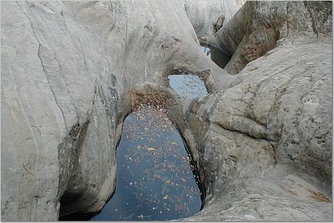 Through the years, the erosional force of the water and rocks falling over the waterfall was directly down. This etched out more and more material directly beneath the waterfall forming the pothole.
Free-standing Arch (up the valley on the west side hidden behind some trees. There is a sheer cliff opposite the arch)
Since the rock of this arch does not connect to any other rock face, other than at its base, it is called a free-standing arch. (Other types of arches can be found in the park.) The formation of free-standing arches are complex and not completely understood. In this case it is thought that expansion joints helped form this arch. Expansion joints are cracks that form in the rock as the pressure from being buried is released. These joints typically parallel and form at relatively regular intervals throughout a rock formation.
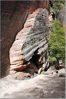
 Erosion preferentially occurs along these cracks and enlarges them. To form the arch, erosion takes advantage of some form of internal weakness in the middle of the rock and erodes out the center of the arch.
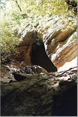
If you watch along the western wall as you walk back out, you can see what could potentially be another arch forming. (can be used for the logging requirement)
Logging requirements:
Send me a note with :
- The text "GCZ5YX Zion Side Canyon Erosion Features" on the first line
- The number of people in your group.
- Send me a note with the features of the forming arch that suggest it may become a free standing arch. !
- From the mouth of the canyon look around Zion Canyon and count how many other hanging valleys your see. Send the number to me in an e-mail.
- Optional--Please post a picture of yourself or other member of your party inside or by the arch.