Hunt Lake
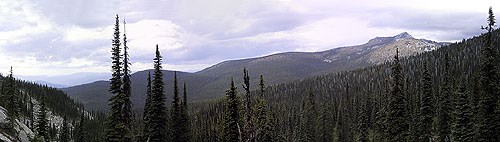
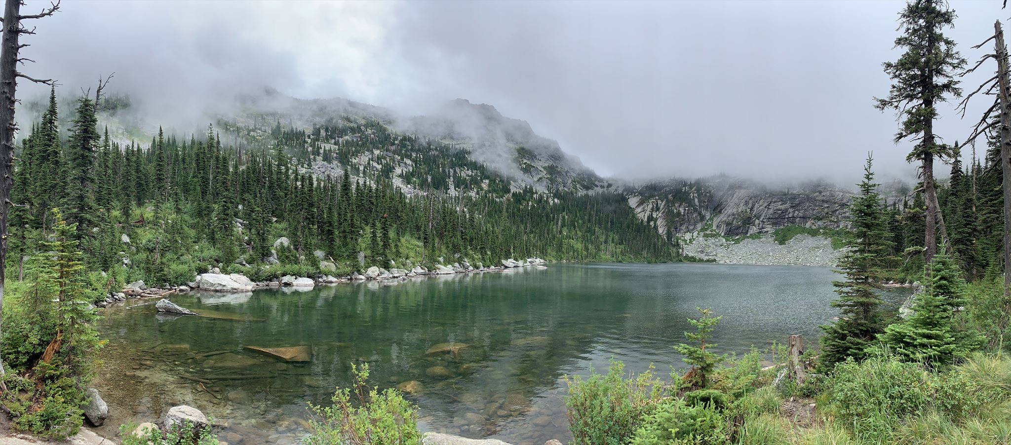
 At a glance, one would consider the hike in to Hunt Lake to be a relatively easy one: three-quarters of a mile in distance, 635 feet of net elevation gain. However, don't allow yourself to be misled by these numbers. This trail is unlike any you have seen in this region of the continent. You will do more hopping than hiking, more scrambling than walking, as the you wind your way up a massive talus field marked by painted arrows and dots placed every 50-100 feet. Only a few short stretches along the way get down to smooth, packed dirt. Yet while difficult (especially on ankles and exposed shins), this hike is quite memorable for its beauty and unique experience. Along the way you are treated to spectacular views down the Hunt Creek drainage from towering Mount Roothaan to the north to the Priest Lake basin to the west. Your journey will be punctuated at regular intervals by the shrill bleats of American pikas and marmots (aka "whistling pigs"), seen scurrying everywhere across the rocks. All along the way, the summit of Gunsight Peak rises ahead of you, beckoning you toward the alpine bowl beneath it in which lies Hunt Lake.
To get to the trailhead (located at N 48° 35.072', W 116° 43.050'), follow the East Shore Road along the eastern side of Priest Lake to the Hunt Creek Road #24 at N 48° 33.979', W 116° 49.683'. Turn right, climb up to a fork at N 48° 34.807', W 116° 47.120' and go right (left leads up toward Mount Roothaan). A short distance later, at N 48° 34.871', W 116° 46.543', you reach another fork at a sign about a reforested burn; this time, stay left. At N 48° 34.950', W 116° 45.69' is another fork; go left onto Road #243 and make the final rough climb up to the trailhead. This final road does not appear on USGS topo maps and was previously numbered as Road #241.
The container is a .30 caliber ammo can. It is located along a fishermen's trail on the western side of Hunt Lake. When you reach the northern tip of the lake on the main trail, pick up this narrow track leading you counter-clockwise around the lake and follow it for about 0.1 mile to the cache site.
Enjoy your journey!