Die Brücken des
Weißenbach - 3
The Weißenbach Bridges -
3
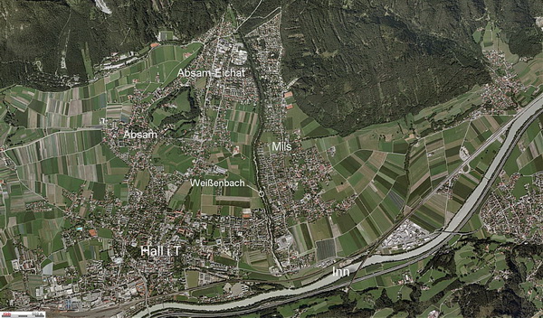
Der Weißenbach entspringt oberhalb der
Herrenhäuser im Halltal und fließt durch das Halltal.
Er bildet die Gemeindegrenze zwischen Hall i.T., Mils und
Absam.
Er ist ca. 8,3km lang - die Quelle liegt auf 1.580m.
Der Bach überwindet einen Höhenunterschied von ca. 1000m bei einem
Gefälle von 8-9%.
Er mündet in der Nähe der Westbahnstrecke in den
Inn.
Das ist der 3. Cache einer 7-teiligen Serie am
Unterlauf des Weißenbach.
Die Serie führt von der Mündung des Weißenbach in den Inn bis zum
Eingang des Halltales.
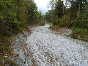
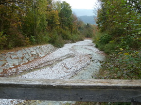
Dieser wenig bekannte Fußsteg im Weißenbachgraben führt dich von
Mils nach Hall/Schönegg.
Um die gesamte Serie zu machen benötigst du 3 h reine Gehzeit (2 h
aufwärts; 1 h abwärts).
Beachte die Hinweise in den Deckeln der Caches - sie führen dich zu
einem Bonuscache, den du am Rückweg suchen kannst!
The Weißenbach rises above the
Herrenhäuser in the Halltal and flows trough the Halltal.
It marks the borderline between Hall i.T. and the villages of Mils
and Absam.
It is about 8.3km (5.2mi) long - the spring is located at
1.580m.
The brook overcomes an altitude
difference of 1.000m and has a gradient of
8-9%.
It merges near
the Austrian Railways route with the Inn River.
This is the 3rd cache of a series
of 7 Caches at the lower reaches of the Weißenbach.
This not very well known small pedestrian bridge leads you from
Mils to Hall/Schönegg.
The series leads from the merging
of the Weißenbach with the Inn river up to the entry of the
Halltal.
It takes about 3 hrs walking time for the whole series (2 hrs up; 1
hr down).
Don't forget to collect the hints
in the lids of the caches - they will lead you to a bonuscache,
which you can search on your way back!
© Land
Tirol

Hinweise/Hints:
Der Cache wird oft gemuggelt. Bitte achte daher auf deine
Tarnung und lege die Dose exakt so zurück, wie du sie vorgefunden
hast.
Wenn du auf der Tour "Die Brücken des Weißenbach" bist, solltest du
vom Final des Cache "Die Brücken des Weißenbach - 2" kommend, über
WP1 und bei WP2 Richtung Westen abbiegend leicht hierher finden.
Bitte beachte, dass du mit dem Cachemobil nach dem WP2 keinen
Parkplatz findest! Zum nächsten Cache der Serie solltest du die
Brücke auf die Westseite überqueren und die Stage 1 des nächsten
Multi "Die Brücken des Weißenbach - 4" suchen.
This cache has been muggled very
often. Please pay attention to your camouflage and hide the
container exactly as you have found it!
If you are on the tour "The Weißenbach Bridges" it should be easy
to find this cache coming from the cache "Die Brücken des
Weißenbach - 2" across WP1 and turning left at WP2. There is no
place to park your car beyond WP2!
If you want to continue to the next cache of the series you should
cross the bridge to the west bank and search the stage 1 of the
next multi "Die Brücken des Weißenbach - 4".
Cache #4
von: