Dauer: ab Station 1 (Bergstation Feuerkogel) ca. 1,5 - 2h
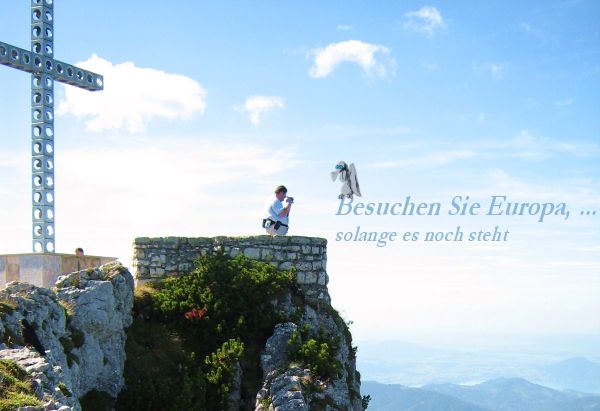
Mein Multi führt euch zum Europakreuz am Gipfel des Alberfeldkogels. Ein einzigartiges Gipfelkreuz, das 2006 von der HTL Wels gebaut wurde. Es ist aus einzelnen Würfeln zusammengebaut. Jeder symbolisiert einen EU-Mitgliedstaat und hat die gleiche Form und Größe. In den Würfeln sitzen Steine aus dem jeweiligen EU-Mitgliedsland, welche auf die Eigenheiten des Landes hinweisen sollen.
Eine maßstabsgetreue Version dieses Gipfelkreuzes ist seit dem Jahr 2007 auch im Bergmuseum von Reinhold Messners bei Bozen in Südtirol ausgestellt. Und ein weiteres in Scharten bei Mit der KirSche ums Kreuz 
Der Wanderweg vom Feuerkogel zum Europakreuz ist familientauglich, man sollte aber schon feste Schuhe tragen.
!! Zur Ermittlung der Werte bei diesem Cache: !!
Wenn ihr als Lösung einen oder mehrere Buchstaben erhältst, so ermittelt anhand der internat. KFZ-Zeichen das dazugehörige europäische Land. Die Buchstabenanzahl dieses Ländernamens ist der gesuchte Wert.
Beispiel: Buchstabe=D --> Land=Deutschland --> Wert=11
Es handelt sich um eher "bekannte" Länder, zur Sicherheit kann eine kleine Liste mit den europäischen KFZ-Abkürzungen aber nicht schaden  .
.
Parkplatz
N 47° 48.803 / E 13° 45.540
Um zur Station 1 bzw. wieder runter ins Tal zu gelangen, gibt es folgende Möglichkeiten:
a) für Gemütliche: mit der Seilbahn (www.feuerkogel.net)
b) für Sportliche: Wanderweg auf den Feuerkogel (1100 Hm); startet auch bei der Talstation der Seilbahn
c) für Moun10Biker: am 17.08.2007 wird die neue Downhillstrecke Bergstation-Talstation eröffnet
Station 1
N 47° 48.943 / E 13° 43.332
Ein oranges Licht, direkt daneben ein gelbes Schild: 3. Zeile, 1. Buchstabe (=A)
Station 2
N 47° 48.966 / E 13° 43.340
Eine Metalltafel "erinert" an ein tragisches Ereignis. Nimm den 1. Buchstaben vom Vornamen. (=B)
Station 3
N 47° 48.946 / E 13° 43.063
Jetzt bist Du vor einem legendären Fahrzeug. Suche dessen Baujahr und nimm den 2. Buchstaben eines der Wörter darüber. (=C)
Falls diese Station jahreszeitbedingt nicht betretbar ist, gehe zum Hütterl 20 Meter westlich. Nimm den 1. Buchstaben seiner Beschriftung
Station 4
N 47° 48.737 / E 13° 42.583
Du brauchst diesem Schild nicht weiter folgen, aber die Buchstaben 5 & 6 vom linken, unteren Wort sind dennoch sehr hilfreich für Deine Fundambitionen. (=D)
Station 5
N 47° 48.933 / E 13° 42. [A + B + C + D + 9] [3]
Findet den Micro, kombiniert und ihr habt die Lösung. Wieviele Buchstaben hat der Ländername? (=E)
Station 6
N 47° 49.027 / E 13° 42.318
Die zur Lösung von Frage F benötigte Buchseite gibt es seit 2019 nicht mehr. Das Ziel war Vilnius, die Hauptstadt von Litauen (Lietuva).
Wohin sind es genau 1108 km, wie sie eine Krähe fliegen würde? Davon der Abstand in Würfeleinheiten vom Zentrum des Kreuzes (also Zentrum nicht mitzählen) spendiert dir F
Jetzt peile noch nach etwas, und finde heraus "wer" da so angeblich in einer Höhe von 2647 m rumkraxelt. Deren 1. Buchstabe ist gaaanz wichtig! (=G)
CACHE
Y= (A + B + C - E)*10 + 2
Z= (D + E + F + G)*10 + 11
ACHTUNG, der Zugang zum Cache startet bei FinalNord + 47 und FinalOst + 43, geht von dort zu:
FinalNord = 47° 49.000 - Y
FinalOst = 13° 42. Z
Happy Hunting wünscht euch
PPete!!

ENGLISH
Visit Europe... as long as it exists
Duration: from Station 1 (mountain station Feuerkogel) ca. 1,5 - 2h
This Multi guides you to the famous summit cross of Alberfeldkogel - called "Europakreuz" (Europecross). Built in 2006, each of its cubes symbolizes a country of the European Union. Within the cubes are stones which are typical for the representing country.
The hiking path is family friendly but be sure to wear good shoes.
!! The procedure to get the Cache's values: !!
If the solution of a question are one ore more letters, use them as international vehicle codes and determine the corresponding European country. The country's number of letters is the value you are searching for.
Example: letter=D; country=Germany; value=7
I tried to use "simple" countries to determine, but if you aren't very familiar with the codes, be sure to bring a short list of European vehicle codes .
You can park your car near
N 47° 48.803 / E 13° 45.540
To get to Station 1 and back down again, you have the following options:
a) the comfortable: by cable car (www.feuerkogel.net)
b) the sporty: the track up to Feuerkogel (1100 meters difference in altitude); starts at valley station of the cable car
c) for Moun10Bikers: from 17.08.2007 on there's a new Downhill track from cable car's mountain station down to valley station
Station 1
N 47° 48.943 / E 13° 43.332
An orange light, next to it a yellow plate. 3rd line, 1st letter (=A)
Station 2
N 47° 48.966 / E 13° 43.340
Search for a metal plate (which is an "Erinerung") and take the 1. letter of the person's first name. (=B)
Station 3
N 47° 48.946 / E 13° 43.063
You're now in front of a legendary vehicle. Search for its construction year ("Baujahr") and take the 2. letter of one of the words above. (=C)
If this stage is closed there's an alternative question: Go to the hut about 20 meters to the West. Take the 1. letter of its name.
Station 4
N 47° 48.737 / E 13° 42.583
You don't have to follow this sign, but the letters 5 & 6 of the left word at the bottom could be very helpful if you want to find the Cache. (=D)
Station 5
N 47° 48.933 / E 13° 42. [A + B + 2*C + 2*D + 5] [3]
Find the Micro, combine and you've got the solution. How many letters does the country's name have? (=E)
Station 6
N 47° 49.027 / E 13° 42.318
The page in the metal book needed to solve question F is missing since 2019. The goal has been Vilnius, the capital of Lithuania (Lietuva).
What country's capital is exactly 1108 km away from here ("Entfernung..")? Count the distance in Cube Units from this country to the center of the cross (don't count the center itself). (=F).
Finally do some bearings, and find out what has a height of 2647 m. Its 1. letter is verrrry important! (=G)
CACHE
Y= (D + E + A - B)*10 + 2
Z= (C + E + F + 3*G)*10 + 1
ATTENTION, the trailhead to the Cache is starting at FinalNorth + 47 and FinalEast + 43, hike to the Cache:
FinalNorth = 47° 49.000 - Y
FinalEast = 13° 42. Z
Happy Hunting,
PPete!!