At a spot such as this one can imagine millions of years of the
earth’s history. The spot on which you stand was once the bottom of
a shallow sea. This allowed the formation of sedimentary rock. Over
time the gradual flow of water and heavy rain brought sediments to
the bottom of this sea. The sediments became compressed and changed
into sedimentary rock.
The material making up the sediments determine the type of
sedimentary rock formed. The types of sedimentary rock are: .
1. Sandstone- made of small grains of the minerals quartz and
feldspar.
2. Limestone- made from calcite deposited from the shells of sea
animals.
3. Shale- made from clay sediments.
4. Conglomerate- made from large sediments like sand and pebbles
cemented together by other dissolved minerals
5. Gypsum- made up of sulfate material.
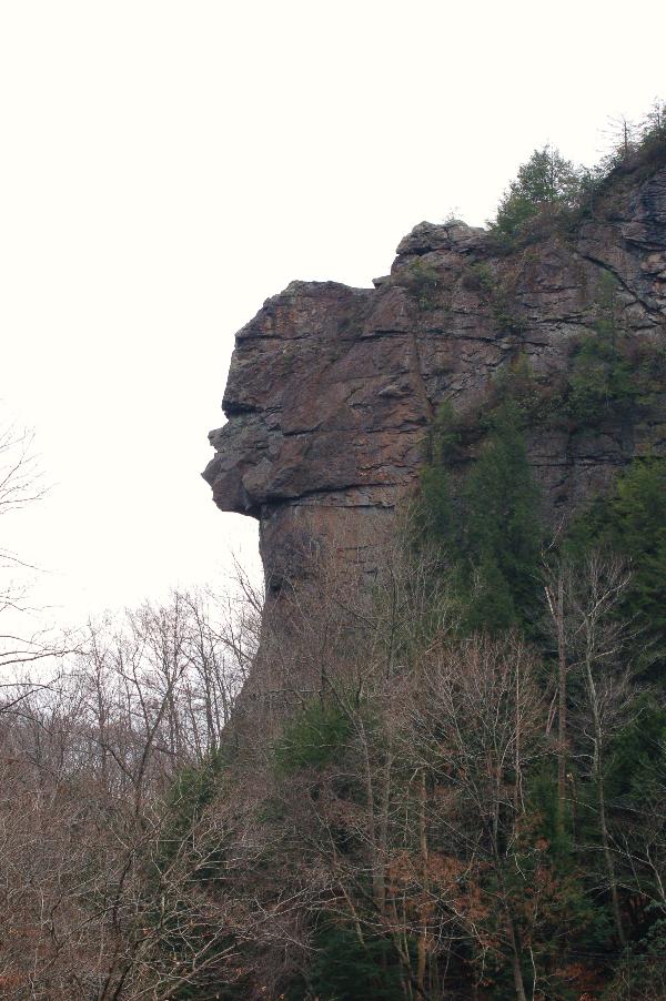
The type of sedimentary rock at this spot is mostly sandstone
and limestone.
All the mountains in this area were formed by tectonic forces.
There was a collision of the North American continent with the
African continent during the Paleozoic Era. This collision produced
a fold and thrust belt which produced large mountains. .
Lee County lies in the Valley and Ridge Province of Virginia.
The Valley and Ridge Province is characterized by long parallel
ridges and deep valleys. Water flows down these ridges to collect
in rivers which flow parallel to the ridges. At this spot the ridge
is Stone Mountain and the river is the Powell River.
The creation of the Great Stone Face is due to a natural process
called erosion. For millions of years the rock in this formation
has been broken and worn away by wind and water. At this point the
Powell River has cut a gap through Stone Mountain leaving behind
the Great Stone Face to watch over the area. The different types of
sedimentary rock making up the “face” produced different rates of
erosion. This produced the face you see today.
To claim a find for
this EarthCache you must post a picture of yourself with the Great
Stone Face in the background. You must also answer the following
two questions by email. Please do not post answers on the cache
page.
1. Estimate the
height of the Great Stone Face from the roadbed to the top of the
face.
2. Using GPSr or
compass determine the direction of flow of the Powell River as it
passes the Great Stone Face.