A glacier is a huge mass of ice slowing flowing over land, often described as a “river of ice”. Glaciers are formed when snow accumulates and does not melt throughout the year, allowing multiple layers of snow to compress into ice. Eventually, the increasing mass of ice is large enough where gravity begins to pull it downhill.
The size of glaciers is impacted by the mass balance, which is the difference between accumulation and melting. Warmer climates increase the rate of melting, leading to glacier retreat. Glaciers around the world have been mostly on the retreat since 1850, the end of a global cooling period known as the Little Ice Age. Crowfoot Glacier demonstrates a striking example of glacier retreat.
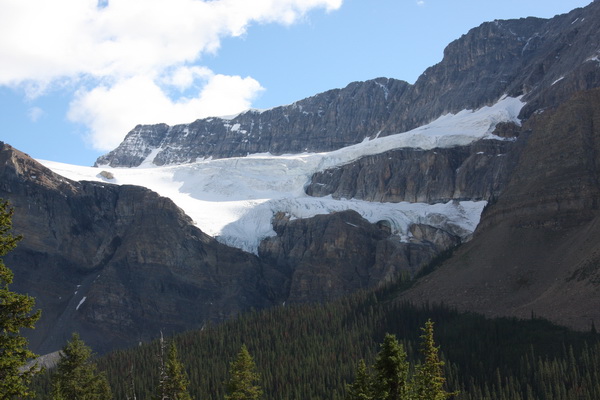
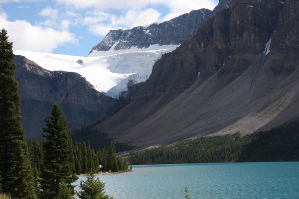
Crowfoot Glacier is situated within Banff National Park, about 32 km northwest of Lake Louise. It is one of over 100 glaciers that can be seen along the Icefields Parkway between Banff and Jasper. The glacier clings to the northeastern side of Crowfoot Mountain, overlooking Bow Lake. Runoff from Crowfoot Glacier flows into the Bow River, the main river that flows through Banff National Park, as well as the town of Banff and the city of Calgary.
The Crowfoot Glacier was originally named by early explorers for its resemblance to a crow’s foot, with three distinct “toes” extending out from the main glacier. However, the glacier has been retreating ever since the end of the Little Ice Age. By the middle of the 20th century, the bottom toe was no longer visible. Now down to only two toes, the middle toe is also retreating and is at risk of disappearing as well.
Originally, the glacier was connected to the Wapta Icefield, a large icefield straddling the continental divide. As the glacier and the icefield have shrunk, they have become separated.
In order to log this cache please email the cache owner the answers to the following questions, and post a photo of yourself and/or your GPSr and the glacier in the background. All the answers can be found on the informational signs in the parking area.
1) How thick is the ice at the edge of the glacier?
2) What famous building is used for size comparison?
3) In what year was the sign’s photo of the Crowfoot Glacier (showing all three toes)?
4) Remember to post your photo!
From time to time, this sign seems to go missing - if the sign is not present please estimate the thickness of the ice and e-mail that along with posting your photo.
Ref:
"Glaciers of the Canadian Rockies" - Ommanney, C. Simon L.
Glacier - http://en.wikipedia.org/wiki/Glacier
Informational Signs at Site – Parks Canada