
 Petrification – the initial coordinates
The Petrification of these logs is such good condition took a number of fortuitous events. These logs floated down an ancient river channel in the Triassic (approximately 208 to 225 million years ago) and piled up in slow moving waters. Waterlogged, these logs sank to the bottom and were quickly buried by sand and volcanic ash which is now called the Rainbow Forest Beds of Sonsela Member of the Chinle Formation. (The terms bed, Member, and Formation are just ways to specify individual groupings of rocks in a larger grouping, somewhat similar to the way biologists group things by Phylum, Order, Class, etc.)
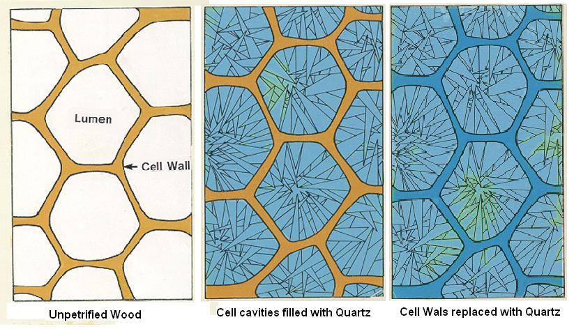 These waters and sands must have very little oxygen because the logs did not decay very much. Groundwater dissolved the silica from volcanic ash and began moving through the logs. Over time, the individual cells of the wood were replaced by silicon dioxide (quartz). Then the cell walls were replaced.
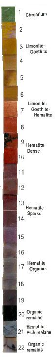 Various other trace compounds were included during the replacement of the wood to create the various colors of the petrified wood. Iron oxides created the reds, yellows, and browns; copper oxides produced the blue and blue-greens; and manganese oxides and carbon produced the black.
Then when the region was uplifted, the rock above the now petrified logs was eroded away. Quartz is a hard material, so it remains after the surrounding sandstone is eroded way.
As part of the logging requirement, figure out from the NPS signs why there are no limbs on the petrified logs.
 Moki Marbles – N34 51.974 W109 47.307
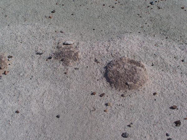
At this location numerous dark circular raised patches can be seen in the sandstone. These features are called Moki (Moqui) Marbles. Groundwater migrating through the sandstone slowly dissolves iron within the sandstone and collects along the bedding planes. As more and more iron ions are brought and deposited along the same layers, the iron begin to form concentric rings around each other forming spheres. These spheres tend to be more resistant to weathering and thus tend to stand out above the surrounding sandstone. In places, the Moki Marbles are so well developed that they remain intact after the sandstone has eroded out from around them, leaving fields of these spheres. For a photo see this photo.
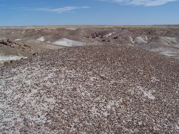
 Desert Pavement N34 51.880 W109 47.285
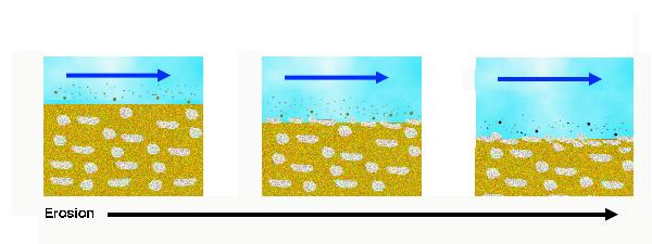
Desert pavement also forms in dry arid environments. Desert pavement refers to the area that is covered by small rocks that protect the smaller grains underneath. There are two ideas about how desert pavement forms. One is called deflation and the other is the gradual physical weathering of larger rocks into smaller rocks.
Deflation is removal of small grains from an area by wind. The frequent winds of the area blew away the smaller grains leaving the larger grains (rocks). Eventually, these larger rocks cover the ground surface protecting the smaller particles beneath from further erosion.
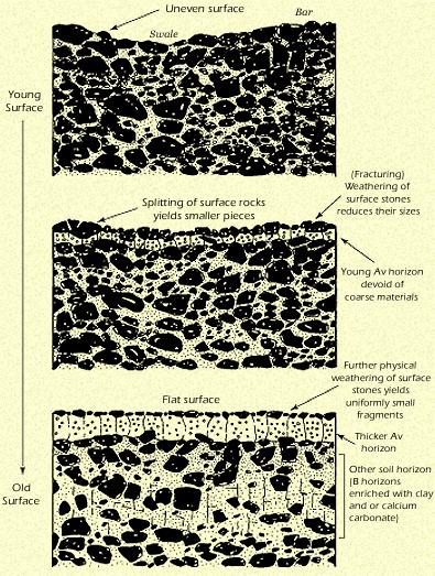 A more recent model of desert pavement formation begins with large rocks at the surface. Continued weathering of these rocks eventually breaks them down into smaller pieces that cover the surface of the ground. Winds bring in silt and clay material that is deposited in the crevices between and beneath the weathered rock forming a fine grained layer beneath. This model was put together by L.D. McFadden, S.G. Wells, and M.J. Jercinovich based on research in the Mojave Desert of California.
These researchers believe that this method of desert pavement is more common than deflation.
Logging requirements:
Send me a note with :
- The text "GCZ5G7 Crystal Forest" on the first line
- The number of people in your group.
- Send me a note describing why the logs have no branches, and
- Is deflation occuring at this location?
The above information was compiled from the following sources:
- Bezy, John V. and Arthur S. Trevena, 2000, Guide to Geologic Features at Petrified Forest National Park, Arizona Geological Survey Down-to-Earth 10
- Woody, Daniel T., 2006, Revised Stratigraphy of the Lower Chinle Formation (Upper Triassic) of Petrified Forest National Park, Arizona, in A Century of Research at Petrifed Forest National Park, Museum of Northern Arizona Bulletin No. 62, Parker, W.G., Ash, S.R, and Irmis, R.B., eds., 2006
- NPS, Field Signage
- Ash, S.R. 1987, Petrified Forest National Park, Arizona, Geological Society of America Centennial Field Guide – Rocky Mountain Section, 1987
- Association Publication 28 (second edition) D.A. Sprinkel, T.C. Chidsey, Jr. and P.B. Anderson, editors
- http://www.desertmuseum.org/books/nhsd_surfaces.html
- http://www.indiana.edu/~g103/G103/Week8/week8.html
- The Process of Petrification, http://www.geocities.com/Yosemite/Campground/5660/palette.html
Placement approved by the
Petrified Forest National Park