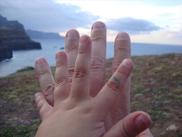
Com esta geocache pretendo, para além da temática abordada, relembrar o Dia do Pai 2014, pois nesta data tão especial a minha filhota ofereceu-me um “kit de Geocaching”. Ela já sabe que o pai gosta muito de “fazer caixinhas”!!
No Dia do Pai
Decidimos então que teríamos de esconder a “caixinha” algures nesse mesmo dia! Lembrei-me deste local de fácil acesso. Escolhi esta zona específica da ilha pois marcou-me na minha infância. Sempre que vínhamos passear em família para estes lados, era-me referido que este era uns dos poucos locais acessíveis por carro em que víamos simultaneamente o Mar da Costa Norte e o Mar da Costa Sul e as suas diferenças. Uma informação simples e curiosa que me era dada, mas que nunca esqueci até os dias de hoje. Sempre que passo lá lembro-me daqueles passeios.
Antes de mais, não é objetivo desta cache fazer uma dissertação científica acerca dos oceanos, mas sim uma abordagem a mero título de curiosidade e a nível local.
É de consenso público que o Mar da Costa Norte é quase sempre mais agreste que o da Costa Sul. Este contraste poderá ser constatado facilmente em muitos dias do ano desde a GZ desta geocache. Os ventos predominantes do sector Norte criam a agitação no oceano, ao passo que a Costa Sul está protegida desses ventos pela própria orografia da ilha, sendo predominantemente calmo e propício a banhos e à navegação de embarcações de recreio mais ligeiras.
Dando um exemplo prático, aqueles que já foram até à Ilha do Porto Santo por mar já terão muito provavelmente passado pela experiência de uma viagem calma e serena entre o Funchal e a Ponta de São Lourenço, mas assim que é dobrado o Ilhéu de Fora tudo se altera e o navio começa a oscilar mais violentamente. É o tão temido “Mar da Travessa” que por vezes mostra-se impiedoso para quem o desafia.
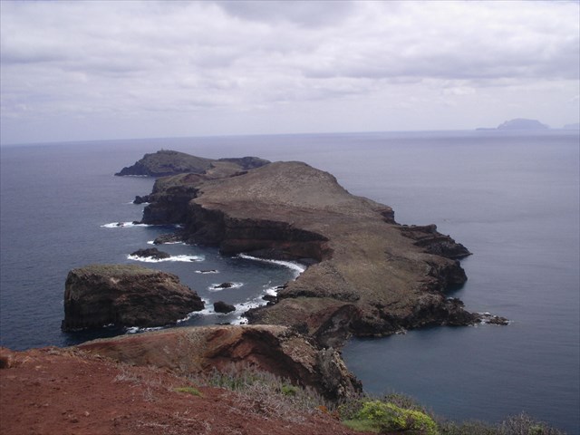
Mar do Norte vs Mar do Sul - aspecto mais comum
É claro que nem sempre o Mar da Costa Sul é tão brando, e algumas vezes no ano temos agitação forte de Sudoeste, que inverte o cenário e torna a Costa Norte uma bacia de proteção para a navegação. Na década de 80, num dos fins-de-ano, o grande e famosíssimo paquete “Canberra” abrigou-se todo o dia de 31 de Dezembro em frente ao Porto da Cruz á espera que a noite chegasse para navegar até à baia do Funchal e presenciar ao largo o espetáculo de fogo de artificio, pois nessa manhã as más condições de mar não permitiram que atracasse em segurança no Porto do Funchal. Temos um outro exemplo bem recente da “exceção à regra”, quando em Dezembro de 2013 o mar apresentou-se com uma agitação muito forte de Sul, algo que não se via à imensos anos, causando estragos graves em diversas estruturas portuárias e nas embarcações de recreio que nelas estavam atracadas.
Mar do Norte vs Mar do Sul - aspecto menos comum
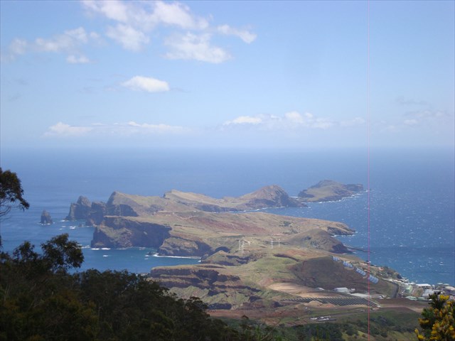
Da GZ desta cache tem-se uma perspetiva relativamente boa das duas costas, e muito provavelmente quem aqui vier poderá notar algumas das diferenças entre os "dois" mares acerca dos quais se escreve nesta listing.
Ao visitar esta geocache tente não estragar a cobertura vegetal que a circunda e evite estragar as frágeis rochas que a abrigam.
ENGLISH
With this geocache I intend, beyond the selected theme, to remember Father's Day 2014, since on this special date my little daughter offered me a "Geocaching kit". She knows that her father is very fond of "hunting the little boxes"!
We decided then that we would have to hide the "box" somewhere that day! I remembered this place for it's easy access. I chose this particular area of the island because it marked me in my childhood. Back then, where i've been going out with my family in these part of the island, it was referred to me that this was one of the few places accessible by car that we could see both the"North Sea" and the "South Sea" and their differences. A simple and curious information that was given to me, but that I have never forgotten to this day. Whenever I pass here I remember those family trips.
First of all, is not the objective of this geocache to make a scientific dissertation about the oceans, but a mere curious approach and at a local level.
It is of a public consensus that the North Sea is almost always more harsh than the South Sea. This contrast can be easily found on many days of the year from the GZ this geocache. Prevailing winds from the northern sector creates unrest in the ocean, while the South Coast is protected from these winds by the own topography of the island, being predominantly peaceful and conducive to swimming and navigation of lighter recreational vessels.
Giving a practical example, those who have been to Porto Santo Island by sea have probably gone through the experience of a quiet and serene journey between Funchal and Ponta de São Lourenço, but once you pass thought "Ilhéu de Fora" (islet with the lighthouse) the conditions of the sea change quickly and the ship begins to oscillate more violently. It's the dreaded localy named "Mar da Travessa" ("Cross Sea") that sometimes shows no mercy to that who challenges it.
Of course, not always the Sea of the South Coast is so soft, and sometimes in the year we have strong agitation from southwest sector, which reverses the scenario and makes the North Coast a bowl protection for navigation. In the 80's, in the new year's eve, the large and very famous liner "Canberra" housed up all day December 31 in front of the village of Porto da Cruz, waiting for the night to come to then navigate to the bay of Funchal and witness the spectacular fireworks, because on that morning the bad sea conditions have prevented safely docked in Funchal. We have another very recent example of the "exception to the rule" when in December 2013 the sea presented a very strong shake South, something not seen for many years, causing severe damage in various port facilities and pleasure vessels that were there moored.
The GZ of this cache has a relatively good perspective of the two coasts, and most likely those who come here may notice some of the differences between the "two" seas that we talk about on this listing.
THANK YOU!!