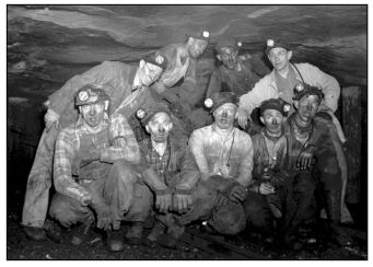
Railey Mine Tour- Midlothian Mine Series Multi-cache
Railey Mine Tour- Midlothian Mine Series
-
Difficulty:
-

-
Terrain:
-

Size:  (small)
Please note Use of geocaching.com services is subject to the terms and conditions
in our disclaimer.
This cache can be dangerous! If you take your kids on this one, keep them close to you and walk slowly. There are mine shafts, air shafts in the area. You take all responsibility for seeking this cache!
However, if you like to see cool things from the past and traipse around old mines, this is the cache for you!
PLEASE PRINT OUT THIS PAGE AND FOLLOW THE COORDINATES. ALSO WATCH WHERE YOU ARE STEPPING
Following the good karma of placing a cache when getting a FTF, this is a first of a series on the mines in and around Midlothian.
This cache is placed at the Railey Coal Mines, not too far from my other cache "Railey,it's that old?"
The Origins of the Railey Mines
Already a coal community by the second quarter of the 18th century (1730-1750), Midlothian was producing coal that shipped to multiple colonies.
During the Revolutionary War, Chesterfield County’s coal pits supplied the cannon factory at Westham (near Richmond) with fuel that was used in making shot and shells for the Continental Army. In 1781, British General Phillips and his men entered Chesterfield County; marched to the courthouse, which they set ablaze; and then continued on to destroy the county’s coal pits. This act attests to the importance of Chesterfield’s coal mining industry in the war for American independence.
Chesterfield County’s first railroad, which began operating in 1831, was the second commercial railroad to be built in the United States. It was a 13 mile long mule-and-gravity powered line that connected the Midlothian coal mines with wharves that were located at Manchester. The Chesterfield Railroad was supplanted by the Richmond and Danville Railroad, which reached Midlothian in 1850. THIS CACHE TOUR WILL TAKE YOU TO WHERE THIS LINE TERMINATED.
The ealiest mention of these pits is 1790, though there is an undated document that states the Railey and Heth mines were the first in the region.
1802 - 1808
Railey's pits worked:
a. 1802, Elizabeth Railey receives $8/m. bushel on coal raised. (The First Century and a Quarter of American Coal Industry by Howard N. Eavenson, page 66. Pittsburgh: 1942.)
b. 1803, Martin Railey states value of land as rents on 1/2 to 3/4 acre are $3,000/year. (The First Century and a Quarter of American Coal Industry by Howard N. Eavenson, page 63. Pittsburgh: 1942.)
c. 1803 - 1808, Elizabeth Railey receives higher royalty of $.01/bushel or $.25/net ton. (The First Century and a Quarter of American Coal Industry by Howard N. Eavenson, page 66. Pittsburgh: 1942.)
5/06/1811
Raileys make lease to Harry Heth of 103 acre "Railey's Coalpits" for 5 years from 1/1/1814 when previous agreement to Nicholson & Heth would expire (The First Century and a Quarter of American Coal Industry by Howard N. Eavenson, page 69. Pittsburgh: 1942.):
a. Royalty: $.02/bushel, $.50/net ton
b. Heth must keep books of account of coal shipped.
c. Work 25-30 able bodied laborers, exclusive of machine boys and mechanics.
d. Never employ more than 80 laborers.
e. Could search for new bodies of coal and sink shafts for them.5/06/1811
12/1840 Woodridge's and Railey's (property of Nicholas Mills) old pits, unwrought and exhausted, are abandoned. (The First Century and a Quarter of American Coal Industry by Howard N. Eavenson, page 108. Pittsburgh: 1942.)
LET US BEGIN THE TOUR!
Parking N 37 30.0711 W 77 38.290
In this area, Union Troops camped to protect the coalmines at the end of the Civil War. Relect can be found from time to time.
N 37 30.060 W 77 38.274
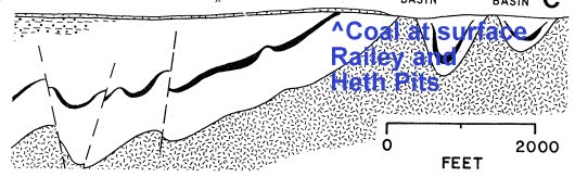
Here you see the edge of the coalfield. Pits and mine shafts are marked with orange ribbon. Look around your feet, old brick and coal are scattered around the ground.
N37 30.034 W 77 38.272
Small Pit, brick foundation and iron slag. There was likely an iron smiths shop here, as iron slag is scattered around. Some bricks are scorched on one side.
N37 30.013 W77 38.276
Mine pits
N37 29.994 W77 38.252
Look at the ground and around the trees. Coal still gets pushed up naturally by the roots. You can also see the various grades of coal all in one place
N37 29.954 W77 38.229
Where you stand here was the end of the rail line. The was Virginia's first railroad and the United States second. Empty coal cars would have been pulled up this hill by being weighted to full coal cars. You are surrounded by mine pits and shafts at this point.
N37 29.944 W77 38.237
Standing at these coords you are at a safe distance to view the entrance to a mine shaft. in the 1700's and early 1800s all mining was done in the pits, as the coal vein went deeper, shafts were dug.

N37 29.947 W77 38.207
Bricks and a pit. What do you think was built here around this pit? Most likely a pump house to keep water out of the mine.
N37 29.941 w77 38.207
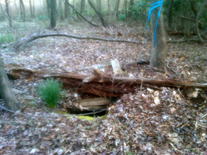
CAUTION, do not go within the blue ribbon!!! THIS IS AN AIR SHAFT. Looking at this you now know why this area can be dangerous. Air shafts buried over time can collapse under someones weight. The old rotted wood and rusted metal has outlived its purpose.
N37 29.944 W77 38.194
Another air shaft?
N37 29.939 W77 38.209
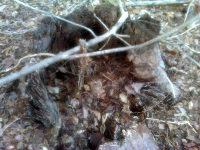
The final. Hidden in the cavity of an old pine tree stump.
I hope you enjoyed walking around some of this old history.


Additional Hints
(No hints available.)