In
this series, I have hidden silver/grey micro-cache capsules near to
each of the 17 parish churches, on (or just slightly off)
the route of the walk's course. Each capsule contains a rolled-up
log-book only (please bring your own pen/pencil).
This
cache is for the 17th (and last) in the series and can be
found near St. Peter's; the parish church of Onchan. The village of
Onchan (formerly known as Kirk Conchan, as it was dedicated to St.
Conchan) is situated on a headland to the north of Douglas (of
which it is a suburb), and has good views over Douglas Bay. The
parish stretches from Windy Corner on the TT course in the north to
Port Groudle and the town of Douglas in the south; it is bounded to
the west by the River Glass and the East Baldwin Valley, to the
east by the parish of Lonan and to the south by the Irish
Sea.
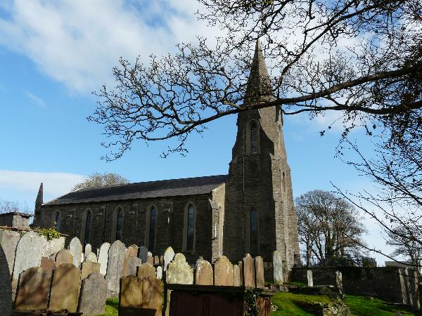
The main settlement in the parish is the village of Onchan which
has the second largest population on the island. The coastline
comprises the northern part of Douglas Bay and the Banks' Howe
headland (which is 120 m high). The highest peak in the parish is
Cairn Gerjoil, near Windy Corner, at 445m or about 1,460 feet (450
m).
This
final cache in the series is actually located in Port Jack Glen
(to avoid clashing with the caches near the church); a few
yards from where the walkers first see the finishing post at the
war memorial (albeit still about 1.5 miles away in the
distance). Parking is available right outside the glen on Royal
Avenue West. Please replace the cache exactly as found, and as
usual, WATCH OUT FOR MUGGLES!
Happy
caching!