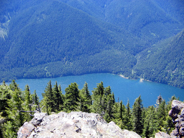
I love this mountain it's such a cute little mountain. But don't
let its small size fool you, it gets plenty of snow in the winter.
Mount Rose gets some hiker traffic but not a lot, I've never had to
share the summit with anyone. Hiking up Mount Rose is a great way
to whip yourself into shape (if you survive) and the view at the
top is nice too.
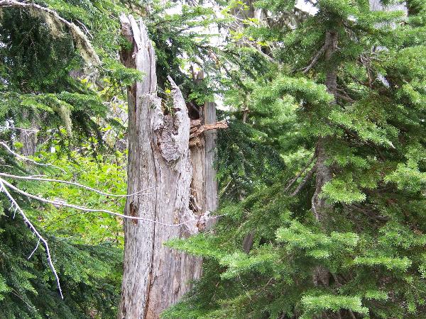
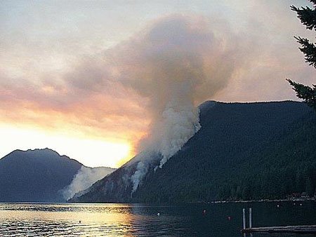
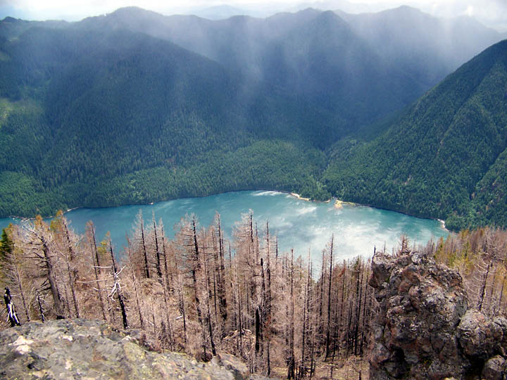
There was a fire on Mount Rose last year and the trail was used
as a fire break. The trail crosses in and out of the burned area,
but most of the trail is in old growth forest. All the biggest
trees show signs of fires in the past. I think that all of the big
trees on Mount Rose have survived at least a couple of fires.
This trail is maintained of by a group of volunteers who live in
Shelton. They call themselves the "Mount Rose Trail Crew" and they
do a great job on this trail. They also maintain the Big Creek
Trail, Copper Mountain Trail, the Mount Ellinor trail and a few
other trails in the area. This same group also cleaned up the Lower
Lena Lake trail after the December 16th windstorm.
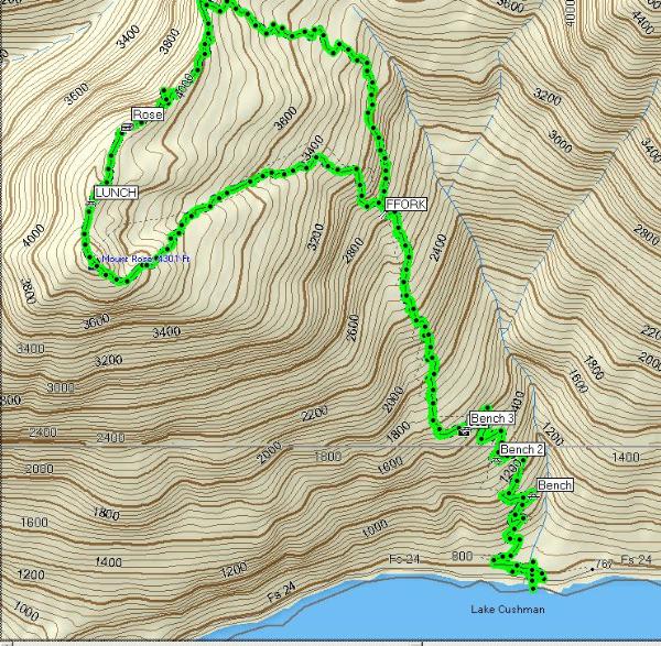
I've placed the cache up high to help cachers find it in the
snow. On your trip up when you reach the fork in the trail take the
 longer 1.6 mile (to the right) route to the summit. The
shorter 1.1 mile route is very hard to follow up if there is
any snow on the ground but it's not too hard to follow down.
The longer route has been marked for snow travel. Here is a
track
log in .GTM format, you can transfer it to your GPS using
the free program GPS
Trackmaker
longer 1.6 mile (to the right) route to the summit. The
shorter 1.1 mile route is very hard to follow up if there is
any snow on the ground but it's not too hard to follow down.
The longer route has been marked for snow travel. Here is a
track
log in .GTM format, you can transfer it to your GPS using
the free program GPS
Trackmaker
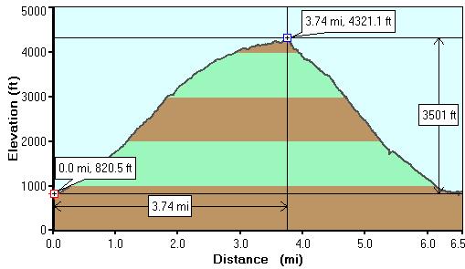
Cache elevation is 4,200 feet. Cache is hidden right before the
spot where I had to give up and turn around last May when the snow
was deep. I hope that this can be reached year round.
6.5 miles with 3,500 feet elevation gain and loss. For trail
details including instructions to reach the trail head see my trail
head cache
gc13516