Lagan Meadows is the last remnant of a formerly large riverside wetland system, much of which has been lost to modern housing and the development of sports facilities.
Now protected, the remaining woods and unimproved grassland are a suburban refuge for wildlife and rare flowering plants.
|
Directions: The co-ordinates at the top of this page are the most suitable parking place. From Malone Road, turn down Bladon Drive to join Knightsbridge Park opposite the entrance.
Parking is also available to the south, at Shaw's Bridge - but this will mean a longer walk.
|
|
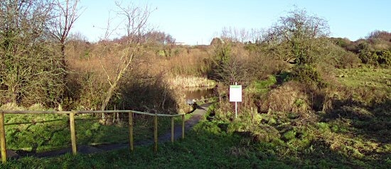
Lester's Dam
Vestiges of this reservoir, built in the 1790's, can still be seen. It was part of Belfast's first proper civic water supply, contructed to meet growing demands from the city's burgeoning textile industry.
The area is now managed as a nature reserve by the Ulster Wildlife Trust.
|
|
|
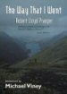
"The Way That I Went":- The name of this cache dedicates it to Robert Lloyd Praeger, and to his book of that title.
Born in Hollywood, Co. Down in 1865 of Dutch parents, Praeger was Ireland's most energetic and influential naturalist. During a lifetime of scientific achievement, he founded the Geographical Society of Ireland (1934), and served terms as President of the RHSI and the Royal Irish Academy. Praeger died at Craigavad in 1953. |
The Hunt: There are lots of things to see. To get to the final cache, you must explore the park and area round the nature reserve, and find the way that I went...
Visit the waypoints listed below, and find the answer to each question. All the waypoints are included in the GPX file which can be downloaded by clicking on the icon near the top of this page. The points are in no particular order, so you'll need to figure out your own route between them.
There is a map board at the entrance which may be of assistance - and might even save you some walking. The final cache is at:-
BG.FF.BBE B.BD.A(C+A)
The cache: A medium tab-lock box is hidden at ground level, containing the usual selection of swap items. Screening effects may affect your GPSr near the cache. The final co-ordinates have been surveyed to better than 1 metre (@ 95%) and there's plenty of open space for triangulation.
The cache is not hidden within, or near the boundaries of, the managed wildlife reserve. Please take care to replace the camouflage when re-hiding the box.
Tks.