Geological Lesson
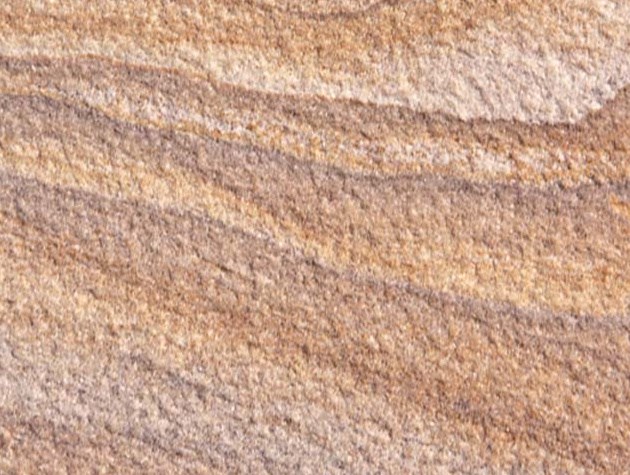
Sandstone is a clastic sedimentary rock composed mainly of sand-sized minerals or rock grains. Most sandstone is composed quartz and/or feldspar because these are the most common minerals in the Earth's crust and the rock feels rough. Like sand, sandstone may be any colour, but the most common colours are brown, yellow, and red. Since sandstone beds often form highly visible cliffs and other topographic features, certain colours of sandstone have been strongly identified with certain regions. Rock formations that are primarily composed of sandstone usually allow percolation of water and other fluids and are porous enough to store large quantities, making them valuable aquifers and petroleum reservoirs. Fine-grained aquifers, such as sandstones, are more apt to filter out pollutants from the surface than are rocks with cracks and crevices, such as limestone or other rocks fractured by seismic activity.
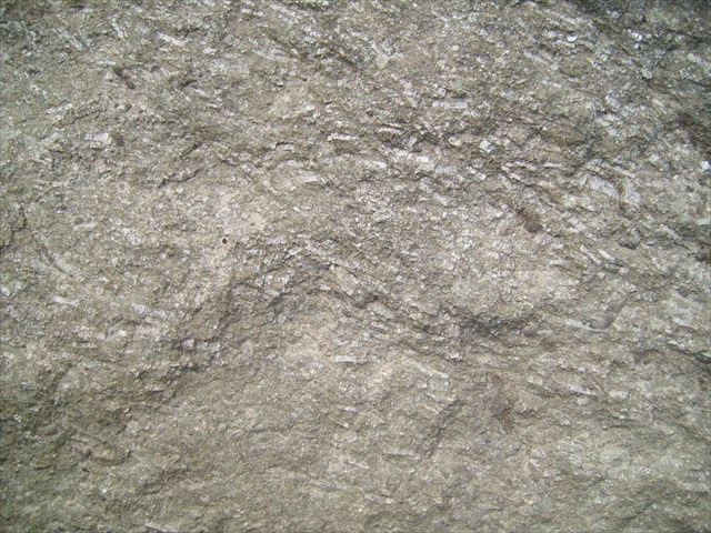
Limestone is a sedimentary rock composed largely of the minerals calcite and aragonite, which are different crystal forms of calcium carbonate. Most limestone is composed of skeletal fragments of marine organisms such as coral or foraminifera. Limestone makes up about 10% of the total volume of all sedimentary rocks. The solubility of limestone in water and weak acid solutions leads to karst landscapes, in which water erodes the limestone over thousands to millions of years. Most cave systems are through limestone bedrock. Limestone has numerous uses: as a building material, as aggregate for the base of roads, as white pigment or filler in products such as toothpaste or paints, and as a chemical feedstock. Limestone is usually smooth to the touch where it has been exposed to weathering due to rain disolving it very slowly, though it can be sharp and rough where it has fractured. It often has a white colouring though it can also be green where algie has colinated the very small fisures.
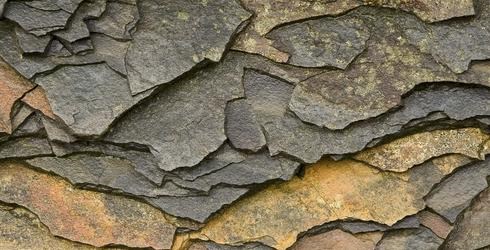
Shale is a fine-grained, clastic sedimentary rock composed of mud that is a mix of flakes of clay minerals and tiny fragments (silt-sized particles) of other minerals, especially quartz and calcite. The ratio of clay to other minerals is variable. Shale is characterized by breaks along thin laminae or parallel layering or bedding less than one centimeter in thickness, called fissility.
History Lesson
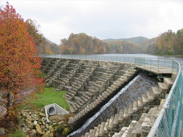
Bays Mountain is a range that extends from the Long Island on the Holston River in Kingsport, Tennessee to Blount County, Tennessee, some 115 miles to the southwest. The Cherokee referred to the eastern most part of the mountain as "Sentinel Point".
From 1915 to 1917 a series of events took place that would forever change the landscape and the course of history for a part of Bays Mountain. These events also set the stage for the creation of Bays Mountain Park.
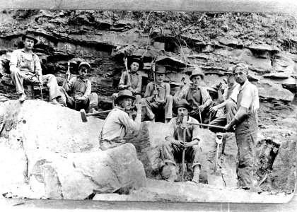
In 1915, trees and buildings were removed from the area to be covered by the lake. On April 1916 work began on the dam. Stone was quarried about a hundred and fifty feet below the dam itself. The remains of this quarry has been partially covered by the present park access road. The stone was hauled to the dam site by teams of mules. A crane at the spillway, powered by a mule, was used to hoist the stones up on the dam.
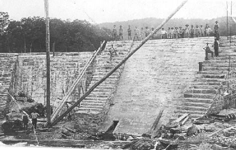
Water began flowing to Kingsport in November of 1916, three months before the city was incorporated.
To claim this Earth Cache, use the information above to assist in answering the following questions:
- Which of the sedimentary rocks are present?
- What is the height of the quarry?
- What is the estimated width of the quarry?
Congrats to jollymon9999 on the FTF!!
| I have earned GSA's highest level: |
 |