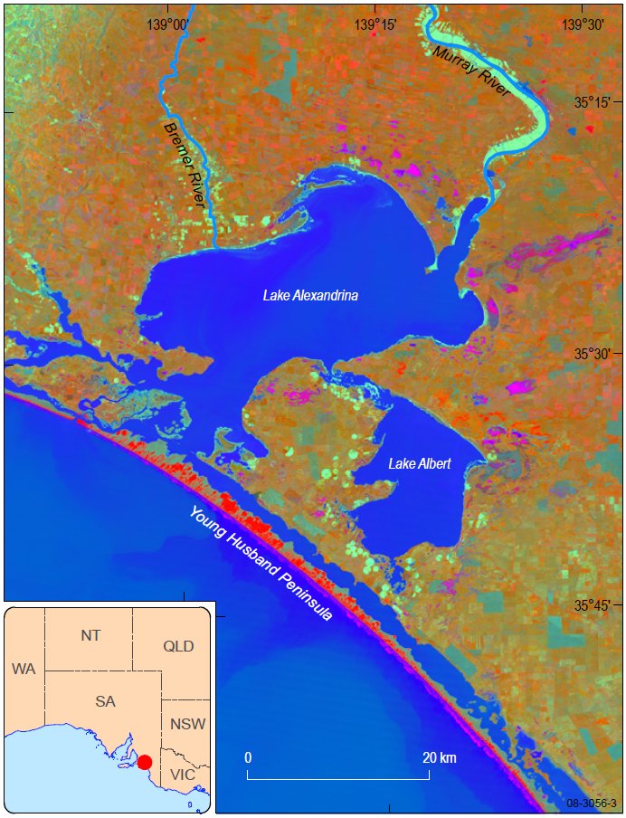
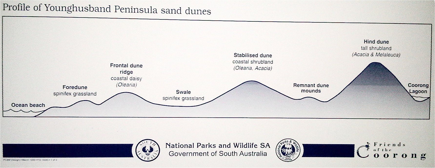
At 90 miles long from Goolwa to Kingston the Young Husband Peninsula is one of the longest established coastal dune systems in the world. The dune peninsula forms a barrier between the Southern Ocean and Coorong lagoon. The dune system consists of active beach and fore dunes, frontal dune ridge, swale, stabilised dune, remnant dune mounds and the hind dune. The purpose of this earthcache is to take you to the centre of the dunes on a mission to discover a rare form of fossil in a unique setting.
The cache is at a remote location. Essentially you will need a 4wd capable of driving in sand. Alternatively you are in for a long walk. Or perhaps a treacherous sea voyage. The suggested method of getting to the earthcache location is driving 21km north from the 42 mile crossing. Note between 24 October and 24 December the beach north of Tea Tree crossing is closed to vehicle traffic. In that case you will need to walk the last 9km. If the summer crossing is open you can cross at Tea Tree crossing and travel just 9km north to the cache. Again between 24 October and 24 December the beach north of Tea Tree Crossing is closed to vehicle traffic. In that case you will need to walk the last 9km.
You MUST park your vehicle on the beach. It is illegal to drive off track onto the dunes. From the beach you will walk 500m inland across the dune field to the earthcache site. Take note of the changes in vegetation as you transept the peninsula. At the cache location you will arrive a petrified forest exposed by weathering of an ancient dune. Take your time to examine the fossils. Do not enter the fossil field. These fossils are fragile features. The fossils are root casts called rhizocretions, the sand tubes cemented around the root of a living plant. The fossils are probably due to cementation around the original roots (forming external moulds), followed by cementation of carbonate sand that filled the moulds (making casts of the original root structures).

Your first earth science task is to estimate the remaining area of the fossil forest. Use the area measurement function of your GPSr or estimate using four waypoints. Your second earth science task is estimate the height of the highest fossil. Documenting the fossil measurements will assist to identify whether the fossil field is growing or shrinking as sand is deposited or removed from the dune field. Optional photo and opinion on the mode of fossil formation is recommended in your log.
Please note that vehicle access to the earthcache area may be closed from time to time due to beach conditions or weather. The area is adjacent to sensitive and fragile dune systems that may be damaged by indiscriminate vehicle use and the Coorong National Park also contains important Aboriginal cultural and heritage sites that should not be disturbed.