This beautiful residential community is the sight of many a wonderful sunset. Hence its name, Sunset Palisades. There are spicy stories of some of the structures along the bluffs having underground rooms, where liquor could be smuggled in from the cove during Prohibition.
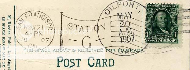
In 1905 an ill-fated oil port and refinery, California Petroleum Refineries, was started employing over 500 men. It was closed down in July 1907, just two weeks after it was completed, because a giant tidal wave completely destroyed the half-mile long pier and wrecked the refinery. avilabeachtrolley.org
The mighty Oilport, constructed up the coast from Pismo Beach at a cost of $1.5 million, and blasted away just one month after its inception by the unrelenting fury of a Pacific storm. historyinslocounty.com
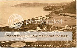
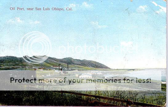
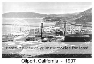 In July 1910, J. Smeaton Chase rode his horse from Mexico to Oregon. His observance of Oilport: "The coast here trends west and then south, to form the bay of San Luis Obispo. To this point come pipe-lines from the oil-fields in the interior, and from Port Harford, on the west side of the bay, cargoes of oil are shipped to many ports on this side of the globe. At Oilport I saw a deserted refining-plant, complete to every accessory, and representing a huge outlay. Its owners had been defeated in some bout of wits with the colossi of the industry, and there it remains, silent and inactive, an example to rash capitalists." CALIFORNIA COAST TRAILS: A Horseback Ride from Mexico to Oregon ventanawild.org
 When Calvert began to break ground for building houses he found skeletons of Indians who had died and were buried in the area. He also found bracelets of copper, arrowheads, spear head, and stone bowls, which had been used for grinding meal. Most of the Indian artifacts were found near the ocean between Placentia and Palomar Streets. Major archaeological sites have been noted in this area and that of Sunset Palisades. It was known as Oilport and was opened in August of 1907, quite different from today's residential Sunset Palisades area. Built with investor funds, it operated for only one month.
The plant, built by California Petroleoum Refineries Ltd., was to be the most modern on the West Coast. Nearly 2.25 million bricks went into the construction of the facilities. Financed primarily by investors, it cost over $2 million to build. It was to be the most complete refinery on the coast. It was set up to produce kerosene, gasoline, lubricating oil, and oil byproducts.
The refinery existed until just after World War II, when it was finally torn down. The land was sold, subdivided and replaced with housing. pismobeachrealestate.info