ATTENTION: This is an offset cache. It is about 2 miles from the listed coordinates.
WARNING: If you like woods and rivers and scenic vistas with your caches...this is not the cache for you – Stay Away! If you don't want to visit the "mean streets" of Indianapolis - Stay Away! But if your idea of scenery is tag art, and you wouldn’t mind a caching trip to Kurt Russell's blown out streets in Escape From New York…then this is the cache for you. But don't go alone!
Background:
Pogues Run is a creek that starts in Indianapolis near 34th and Arlington and ends about 11 miles southwest at White River, as described in the city’s webpage:
Pogues Run Trail Webpage
The intriguing part of the creek is the last couple of miles the city describes as flowing through an “aqueduct” under downtown. The majority of the aqueduct was built in 1914 – 15 and consists of two rectangular sections with a maximum height of 8’ and a width of between 16 and 19 feet. The last 310 feet was built in 1936 and consists of three 9’ by 12’ sections.
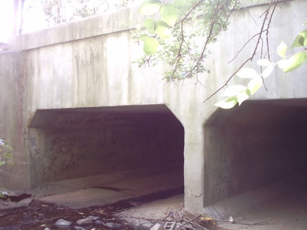
Your task is to find the cache at the end of this aqueduct (Point B). The cache is a waterproof match container in camo tape- log only – bring your own pen. There is a $5 bill for the FTF. The listed coordinates are the start of the aqueduct (Point A). Here are pictures of Point A and Point B:
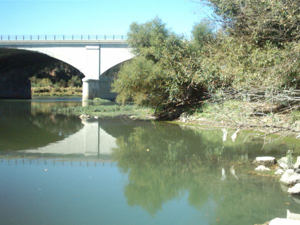
Point A (Listed Coordinates)
Point B (Cache site)

You can use various resources to determine where Pogues Run enters White River (Point B). Go there and find the approximate position that the picture of Point B was taken (middle of the “ramp” at the edge of the river) - the cache is 100’ at a bearing of 038° from this spot. You should be close enough that by using the hint you can find the cache. If the river or creek is too high to go out front, I have posted a spoiler picture of the cache location one hundred feet from where you would be.
Challenges: I’m rating this a 2/2 based on finding the needed information from other resources and going directly to Point B to get the cache. Still, it is not a cache to do alone or at night. You will see more trash (industrial strength) than could ever be CITO’ed – I wouldn’t touch any of it. Also, even if you identify the location of Point B you may not find a place to park. Email proof you know where Point B is and I will email you nearby parking coordinates and instructions.
Now there might be an adventurous group out there who realizes that there is a much more direct way to get from Point A to Point B – just start at the Point A listed coordinates and walk the couple of miles through the aqueduct to Point B. This then becomes a “5/5” cache with a whole new set of challenges. I would strongly recommend that you re-think this. I know people who have done it. They recommend good headlamps with lots of extra batteries, wearing high boots of some sort, and get an oxygen meter for your safety. A team of no fewer than 3 people should be used, and let others know what your plans are. Remember – this is an inner city creek and subject to sewer overflows during heavy rains – and sudden flooding during those times could be deadly to anyone inside at the time. Remember, you will have to repeat the walk back unless you have someone you can call to pick you up at Point B. I hope I have talked you out of such madness, but if this is your preferred method of finding the cache – Godspeed.
There may some people with access to boats that will have the easiest time with this cache by finding Point B from the White River. The only people I have ever seen at Point B have been fishermen in small boats not too far out on the river. Follow all boating safety procedures – have fun.
View from Point B