Siboutskerspel -
Bonnynggbroeck
Sijbekarspel is een dorp in de gemeente Noorder-Koggenland, in
de Nederlandse provincie Noord-Holland. Het dorp heeft 320 inwoners
(2004). Tot 1 januari 1979 was Sijbekarspel een zelfstandige
gemeente, waartoe ook het dorp Benningbroek en de buurtschap Het
Hoogeland behoorde. Sijbekarspel is gelegen tussen het dorp
Benningbroek en Gouwe net ten noorden van Wognum. Sijbekarspel kent
een dorpkern bij Benningbroek, de rest van de bewoning loopt in
lint naar Gouwe.
Sijbekarspel kent een duidelijk plattelandskarakter, grootdeel
van de dorpskern kan men omschrijven als pittoreskachtig. Dit dankt
men ook aan het feit dat het dorp is aangeduid als kleine kern, wat
inhoudt dat de uitbreiding vooral voor lokale inwoners moet zijn en
dat er rekening moet gehouden worden met de stijl van bouwen.
De plaats komt in 1310 voor als Siboutskerspel, in 1343 als
Syboutskerspel en in 1494 als Zypekerspel. De oorspronkelijke naam
zou verwijzen naar dit een parochie of kerkdorp was van of gesticht
door ene Sybout.
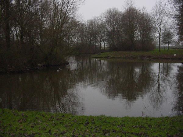
Bij de grens met Sijbekarspel is het natuurgebied Benningbroek
gelegen. Het gebied is één van de weinige plekken waar men
ongelijkje weilanden vind, waar men dus natte, drassige en droge
land kan vinden doorelkaar. Dit gedeelte wordt beheerd door
Landschap Noord-Holland. Op de meeste plekken van Westfriesland
zijn de gebieden vervlakt naar een gemiddeld niveau, slechts hier
en daar is dat niet het geval en daarom is een gedeelte een
natuurgebied geworden om dit bewaren
Benningbroek: Het dorp heeft 1350 inwoners (2004). Tot 1 januari
1979 behoorde Benningbroek tot de gemeente Sijbekarspel. Het vormt
met die plaats ook eenheid. De twee dorpen lopen via lintbebouwing
in elkaar over. Aan de andere kant van het dorp loopt het over in
de buurtschap De Buurt en het dorp Midwoud. Verder valt de
buurtschap Het Hoogeland onder het dorp, wat zijstraat is/heeft die
gelegen is aan Oosterstraat. Dankzij de lengte van het dorp wonen
er vrij veel mensen in dit dorp ondanks dat een duidelijk
plattelandskarakter heeft. Er kunnen in het dorp ook veel
stolpboerderijen gevonden worden. Het dorp wordt doorkruist door de
snelweg A7.
De plaats komt in de 13e eeuw voor als Bonnynggbroeck, de
plaatsnaam zou naar het drassing laagland waarin in het gelegen was
zijn genoemd die van persoon of familie Benning was. De kerk die in
het dorp staat, is gebouwd tussen 1505 en 1548.
Maar nu naar de cache!
U kunt de auto parkeren op: N52°42.213' E005°00.787'
Hier vind u het antwoord op vraag een: tel de oranje letters van
het witte bord aan de muur bij elkaar op. (a=1) (z=26)
Deel dit door 2, en tel er 2 bij op.
Dit is ABC
Ga naar N52°42.(A+A)B2' E005°00.(A+B)(A+B)(A+B+C)'
Dit is het voormalige gemeentehuis van Sijbekarspel. Nu doet het
dienst als woonhuis.
Hoe oud is de middelste geworden?
Dit is DE
Vervolgens gaan we verder naar N52°42.D(E+C)(A+D+E)'
E005°00.B(A+B+D)D'
Gebruik het nummer van dit object in de volgende som:
X+X+X+X-X-E
Dit is F
Dan lopen we een paar straten door de nieuwbouw van 35 jaar oud
en gaan we naar N52°42.DD(FxF)' E005°00.(B-A)(D+F)(C-A)'
Hoeveel verticale palen ziet u in dit bouwwerk?
Dit is G
Dan gaan we naar N52°42.A(D+F)F' E005°00.(F+D)G(G-B-C)',
en daar gaan we de bouten in de 2 hekjes tellen.
Tel het aantal bij elkaar op, en trek er 87 vanaf.
Dit is HI
Op naar N52°42.(A-C)(E+F)A E005°00.(B-A)I(A-C)',
Op hoeveel palen staat dit object?
Dit is J
We zijn er bijna! Nu naar N52°42.0HI' E005°00.EFB'
Over hoeveel planken gaan we lopen? (even)
Dit is KL
En dan nu naar de cache!
Deze ligt op: N52°42.(B-D-E)(G-J-H)(L-A+E-H)'
E005°00.(L-D)(K+C+A)(L-K-F+A)'
Denk om de meekijkers, en graag weer goed afdekken!!
English:
Sijbekarspel are a village in the municipality
Noorder-Koggenland, in the Dutch province noord-Holland. The
village has 320 inhabitants (2004).
Up to 1 January 1979 Sijbekarspel an independent municipality, to
which also the village Benningbroek and the buurtschap the
Hoogeland belonged, was. Sijbekarspel have been lain between the
village Benningbroek and Gouwe exactly at north of Wognum.
Sijbekarspel a village core knows at Benningbroek, the rest of the
bewoning runs in ribbon to Gouwe.
Sijbekarspel know a clear country character, one can define
grootdeel of the rural core as pittoreskachtig. This one also
thanks to the fact that the village has been indicated as small
core, what implies that the extension must be especially for local
inhabitants and that must become taken into account there the style
of to build.
The place occurs in 1310 as Siboutskerspel, in 1343 as
Syboutskerspel and in 1494 as Zypekerspel. The original name would
refer to this a parish or church village had been founded of or by
one Sybout.
At the border with Sijbekarspel the nature area Benningbroek has
been lain. The area is one of weinige the spots where one
ongelijkje find pastures, where one can therefore wet, swampy and
dry country find doorelkaar. This part is managed landscape
noord-Holland. On most of the spots of Westfriesland the areas have
been evened to an average level, only here and there is that the
case and for this reason a part a nature area has become keep
this.
Benningbroek: The village has 1350 inhabitants (2004).
Benningbroek to the municipality Sijbekarspel, belonged up to 1
January 1979. It forms entity with that place also. The two
villages overlopen by means of lintbebouwing in each other. On the
other hand of the village it overflows in the buurtschap the buurt
and the village Midwoud. Furthermore the buurtschap the Hoogeland
under the village fall, what they street is/has that located is to
Oosterstraat. Thanks to the length of the village live there rather
many people in this village in spite of that a clear country
character has. There can be found in the village stolpboerderijen
also many. The village becomes crosses out by the motorway A7.
The place occurs in the 13e centuries as Bonnynggbroeck, the
name to the drassing layer country in which was in located be
mentioned that of person or family Benning was. The church which
stands in the village, has been built between 1505 and 1548.
Now to the cache!
You can park your car on: N52°42.213' E005°00.787'
Find the awnser for question one: count the orange characters of
the white chalkboard to the wall at each other. (a=1) (z=26) Share
this by 2, and add 2.
This is ABC
Go to N52°42.(A+A)B2' E005°00.(A+B)(A+B)(A+B+C)'
This is the former municipality house of Sijbekarspel. Now it does
service as a normal house.
How old middle has become?
This is DE
Then we go further to N52°42.D(E+C)(A+D+E)'
E005°00.B(A+B+D)D'
Use the number of this object in the next sum: X+X+X+X-X-E
This is F
Then we run a couple streets by the newbuild of 35 years old and
go we to N52°42.DD(FxF)' E005°00.(B-A)(D+F)(C-A)'
How many vertical piles see you in this construction work?
This is G
Then we go to N52°42.A(D+F)F' E005°00.(F+D)G(G-B-C)',
and we will there crap in 2 the hekjes to count.
Count the number of at each other, and appetite there 87 as
from.
This is HI
On to N52°42.(A-C)(E+F)A E005°00.(B-A)I(A-C)'.
On how many piles this object stands?
This is J
We are there almost! Now to N52°42.0HI' E005°00.EFB'
How many beams we concern and run? (even)
This is KL
And then now to the cache!
These lie on: N52°42.(B-D-E)(G-J-H)(L-A+E-H)'
E005°00.(L-D)(K+C+A)(L-K-F+A)'
Think for the spypeople, and gladly well cover!!