-------------------------
-------------------------

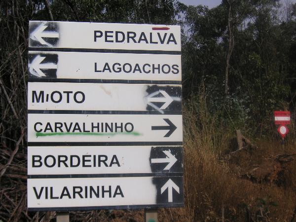
The cache is deliberately placed outside the Mata Nacional (National Forest) of Barão São João (BSJ). This is because there are restrictions on movements of vehicles and pedestrians within the Forest between 1st July and 30th September due to elevated fire risks. Outside this period the route to the IP cache is simply from the entrance to the forest NW of BSJ and follow the GPS indications through the area. During the restricted period, it is necessary to access via a turning off the BSJ to Bensafrim road, signposted Machada and Vale de Joana, which is about 700 metres from the BSJ church, and is signed from both directions. Having turned up this road, you will reach a crossroads after about 350m and go straight across onto a dirt road. From there it is relatively easy to follow GPS indications to reach the IP after about 5.4 km. The dirt road is passable for most normal cars, but it would be preferable to use a 4x4.
The IP cache contains sets of instructions in the form of “ Bamboo Diagrams” which will lead you to the Main Cache. Please use only one.
Bamboo Diagrams:
I developed Bamboo Diagrams as a guidance method for walking in areas where the mapping was poor or non-existent (Algarve!). They are derived from the Tulip Diagram system used for motor rallying.
Each row of the chart gives an instruction for a waypoint on the route. The information given is; distance (in km and miles); cumulative and interval time, in hours and minutes, based on the time it took me to walk between each point,as an indication (you may be slower or faster than me, and can adjust the times accordingly as you progress); a graphic, which represents in plan form, the point you are at,(you are at the dot and turn to follow the arrow head); and “remarks” to assist in interpretation. You will need to know how to set your GPS display to show elapsed distance and moving time, after zeroing the trip meters.
It is STRONGLY recommended that you park your vehicle near the IP and walk the route. Most of it is impassable even in a 4X4, walking is good for you, and you will understand this recommendation as you go through the route!
Good Hunting!
....................

A cache está colocada propositadamente fora da Mata Nacional de Barão São João(BSJ), devido às restrições no movimento de veículos e pessoas dentro da Floresta entre 1 de Julho e 30 de Setembro que é o período de risco elevado de incêndios.
Fora deste período, pode chegar à Cache PI partindo da entrada da Mata no NW de BSJ e seguindo as indicações do GPS. Durante o período restrito, é necessário utilizar o acesso através duma via de BSJ para a estrada de Bensafrim, assinalada Machada e Vale da Joana, a cerca de 700 m. da Igreja de BSJ. Existem sinais em ambas as direcções. Entre nesta estrada, cerca de 350 m. depois, chegará a um cruzamento, siga o caminho da terra batida. Daí é relativamente fácil seguir as indicações do GPS para chegar ao PI depois de 5.4 km. O caminho da terra batida é acessível para a maioria dos carros normais, mas um 4 x 4 é mais indicado.
A Cache PI contém um conjunto de instruções na forma de “Diagramas Bambu” que o leverá à Cache Principal. P. F. tirar só uma folha.
Diagramas Bambu:
Eu desenvolvi o "Diagramas Bambu" como um guia para andar em áreas onde a cartografia é pobre ou simplesmente inexistente (como é o caso do Algarve). São derivados do sistema “Diagrama Túlipa” usado pelo rali dos automóveis.
Cada fileira de "Diagramas Bambu" dá uma instrução para uma paragem na rota. As informações dadas são: distância (km. ou milhas), tempo cumulativo e intervalo, nas horas e nos minutos, baseado no tempo que levei a caminhar entre cada paragem (você pode ser mais lento ou mais rápido do que eu, e pode ajustar os seus tempos conforme o seu progresso); uma figura, representa na planta, o ponto onde você está (está no ponto preto e siga a direcção da seta); e observações que ajudam a interpretação. Precisa de ajustar o seu GPS para mostra a distância decorrida e o tempo decorrido, depois de ter colocado os contadores a zero.
Recomenda-se fortemente que estacione o seu veículo perto do PI e vá a pé. A maioria da rota é mesmo inacessível num 4 x 4. Andar é bom para si, e você compreenderá isso enquanto efectua o percurso!
Boa caça!
---------------------
Cache 22.5 House: Introduction
Situated back from the coast in a range of low hills, the village of Barão de São João is one of the most typical rural parishes in the district of Lagos which still has many original characteristics. The parish covers a little more than five thousand hectares. With religious origins, the settlement of S. João Baptista (named after the patron saint) developed a rural economy in the XVI century which was supported by income from land owners and religious orders. In the time of the Portuguese Discoveries, the hills and forests of BSJ provided the raw material for naval construction in Lagos.
When it became a village in 1933, the settlement was freed from a prolonged medieval era, without affecting its rural life style which was determined by its geographical position.
The National Forest of BSJ is one of the places of great natural resource in the district of Lagos. Part of the countryside heritage, the forest has Mediterranean species of trees (pine, acacias and eucalyptus) and has a wide variety of wildlife which contributes to the equilibrium of the ecosystem.
Pedra Branca, as well as having a wonderful view over the range of hills, is also a place of archaeological importance because of the existence of a palaeolithic standing stone (Pedra do Galo).
Within the Forest there are: a Fitness Circuit, a Picnic Area and six circular walking/cycling trails marked by wooden posts painted with different colours.
Lost in time, the parish of BSJ is an authentic peaceful and relaxing place for those who prefer a type of tourism entirely connected with nature.
..........................
Dividida entre serra e o litoral, a povoação de Barão de S. João constitui uma das mais típicas freguesias rurais do concelho de Lagos e conserva até hoje as suas características genuínas. De raízes eclesiásticas, a povoação de S. João Baptista (padroeiro da freguesia) desenvolveu, no século XVI, uma economia rural sustentada pelas receitas provenientes das Mordomias e Confrarias.
Na Época dos Descobrimentos as matas e florestas de BSJ forneciam a matéria-prima para a construção naval de Lagos.
A implantação freguesia em 1933 libertou a povoação duma prolongada época medieval, sem contudo, afectar a suavivência rural determinada pela localização geográfica.
A Mata Nacional de BSJ é cartão de visita a um dos locais de grande riqueza natural do Concelho de Lagos. Inserida no património paisagístico do município, a Mata contém espécies arbóreas do tipo mediterrânico (pinheiros mansos, acácias e eucaliptos) e uma importante reserva de fauna cinegética, que contribui para o equilibrio do ecossistema.
A Pedra Branca, para além de ser palco de uma admirável paisagem sobre a serra, é também um local de importância arqueológica, em virtude da existência de um menir do Paleolítico (Pedra do Galo).
Dentro da Floresta existem: um Circuito de Manutenção, um Parque de Merendas e seis Percursos em circuito para pedestrianismo/ciclismo, sinalizados por estacas de madeira com marcas de tinta.
Perdida no tempo, a freguesia de BSJ constitui uma autêntica estância de repouso para quem prefere um turismo inteiramente voltado para a natureza.