INFO AT A GLANCE:
2L Sistema at ground level on a 3km walk at Turakirae. To use the camera in the cache, climb atop a high spot and snap a photo. For more detailed information, refer below.
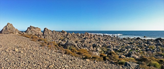
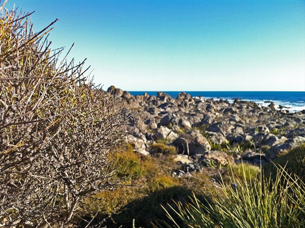
| A panorama looking southwest on the second beach ridge. |
Turakirae Head
A promontory on the southern coast of the North Island, Turakirae Head is located at the western end of Palliser Bay, 20 kilometres southeast of Wellington, at the southern end of the Rimutaka Ranges where the foothills slope into the sea.
Turakirae Head is world renowned and is possibly one of the most geologically active locations in New Zealand, preserved through the Turakirae Head Scientific Reserve, this internationally famous reserve provides valuable habitat for a myriad of plants and wildlife and preserves a well-defined sequence of earthquake-raised beaches.
Turakirae Head is constantly being battered by the ferocious winds that are present in the roaring forties, which continuously circle right around the southern ocean in a easterly direction unstopped by land – the wind and rains these storms bring erode the coastal platforms and can cause colossal, monumental landslides to the size commonly known to cause tsunamis. Also present in the area is the visible signs of successive uplift of the gravel beaches caused by major earthquakes over many thousands of years. Fluctuations in the mean sea level over thousands of years also changed the geography of the area. All of this aforementioned geological and geographical activity contributes to make the area very young and highly changeable.
 |
| A virtual model of Turakirae Head from Google Earth. Visible and annotated are the 5 beach ridges (labeled BR1-5), and past the Orongorongo River, the 2 Interglacial Marine Terraces. |
Geology & Geography
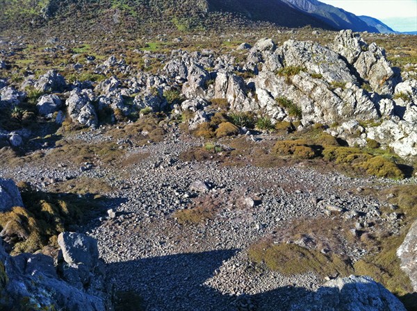
The various earthquakes and episodic tectonism that have occurred across the lower North Island over few thousand years have resulted in a series of successively uplifted beaches which number at least 5, with much older and more ancient beaches and coastal platforms stepped back into the foothills surrounding Baring Head, Turakirae Head all the way east to Windy Point dating back to the last two interglacial periods – these however are severely eroded.
The various ages of all the beaches and earthquakes has been determined through historical observation, radiocarbon (14C) dating, Beryllium (10Be/9Be) exposure ages, and model aging from slip-predictable uplift.
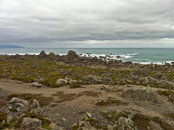 |
| Looking southeast towards Cape Palliser (July 2011). |
The modern beach (BR1) is best recognized as the lowest of the large gravel ridges about 3 metres above the highest waves on a clam day. This ridge is the most recent and is the current beach, and was lifted out of the sea after the magnitude 8.2 1855 Wairarapa Earthquake on January 23 along the Wairarapa Fault. This beach was at one point recognized as the pre-1855 beach, but is now known to be the current storm beach.
The next beach ridge (BR2) forms part of the walking track around Turakirae Head and was uplifted out by the same Wairarapa Earthquake and now rest at an elevation of 7.8m ASL. This beach ridge would’ve been the beach before 1855, and is commonly called the pre-1855 beach. BR2 formerly was thought to date from the Haowhenua earthquake at around 1460AD, but this has now been discounted and no beach was raised at the time of the Haowhenua event. All of the episodes of beach uplift are accounted for at other times.
The third uplift, BR3, is inland of the walking track at a height of 16 metres ASL and was the beach until an earthquake around 330 BC (~2340 yrs BP) raised it out. This date was determined through the radiocarbon dating of micro-mollusc shells picked out of the beach ridge.
The fourth beach (BR4) is the last well-preserved beach after it was uplifted and now lies at the foothills of the Rimutaka’s, some 22 metres ASL. It is estimated BR4 was uplifted between 2760-3400 BC (~5030±190 yrs BP), or roughly 5000 years ago, when global sea level was 1.32 metres below present sea level.
The last undisputed beach (BR5) lies low into the foothills very near to BR4 at an elevation of 24-25 metres ASL, and radiodating of old driftwood and peat accumulated just behind BR5 indicates an uplift occurring circa 4660-4970 BC (~5946±54 yrs BP), nearly 6000 years ago, and probably formed circa 7000 BC, and rose with the rising sea level at the time.
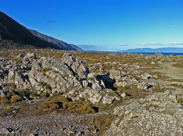 |
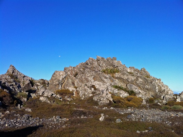
| Looking east out towards the Wairarapa from Turakirae Head. |
BR5 is neither the oldest nor the highest former shoreline in the area. It is however the last of the Holocene (past 10,000 years) marine platforms. Two higher, much older, marine platforms (called the “Interglacial Marine Terraces”) can be seen west of the Orongorongo River, with the lower being very prominent at Baring Head. These are inferred to data from the preceding two Interglacials. Each probably has multiple beach deposits much like those at the Holocene Turakirae Head, but thick cover beds obscure them.
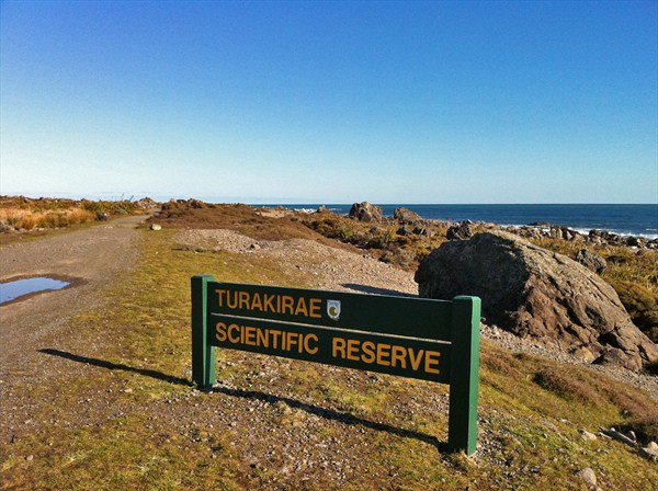 |
| The sign at Turakirae Scientific Reserve. |
Wildlife & Flora
There is a large variety of both vegetation and wildlife in the area. In the winter, 500 New Zealand fur seals stay at windswept Turakirae Head in a colony, which formed in 1950. Banded dotterel, Caspian tern and oystercatchers are among the bird species that can be seen. On land, copper skink, spotted skink, common skink and the common gecko are all present – along with two rare species of cicada which have been found at the mouth of the Orongorongo river. And in the intertidal zone, shell fish and at least 97 different species of molluscs.
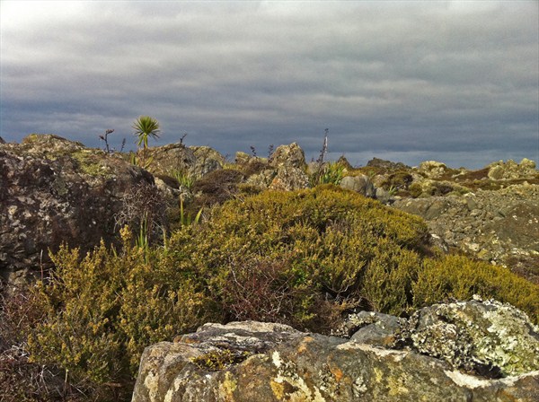
The vegetation within the reserve consists of a mixture of salt-tolerant herbs, tussocks, and reeds – interspersed between unusually large boulders which provide a microhabitat for these plants along with ferns, lichens and mosses. A nationally threatened plant, the Shrubby Tororaro (Muehlenbeckia astonii) also occurs within the reserve.
 |
| An example of the diverse flora present at Turakirae Head |
Geocache
We have been wanting to place a geocache out here since we visited Turakirae Head in July 2011, when we completed all the caches in the area, and we even visited the spot where this geocache currently sits. It’s situated in a location we named “The Amphitheatre”. The Amphitheatre is a natural bowl, and forms part of BR2 – the beach ridge before the 1855 earthquake, at which point it was probably a shallow pool of water. It is delineated by some very large rocks on nearly all sides, from where it gets its namesake.
The geocache is a 2L translucent snaplock Sistema hidden under a bush in amongst some rocks. As it is a very popular spot, please use stealth when retrieving and replacing the cache. When hidden it contained an A6 logbook (notebook) a pen, a disposable camera (see below for more information), and a prize for the FTF (all within a snaplock bag). Please do not remove the disposable camera!
 |
| Looking down into Turakirae Amphitheatre from the rocks. |
Camera Photolog
We have decided that since Turakirae is such an awesome spot, we would leave a disposable camera in the cache so that us cacher’s can start a photolog of the area, in all weather, at any time of the day, from any location. Essentially, it’s a neutral, objective sampling of the entire Turakirae area.
The rules are simple. Take the camera out of its case, climb atop a rock or find a high place, and snap a picture of the view in any direction, put the camera back in its case and then back in the cache. A maximum of 1 photo per group please, and no silly photos either (the ground, the sky, that piece of rubbish etc.). Once either the film expires or the camera becomes full, we will take it out of the cache, get the photos developed, and the scan and upload them to here! If you do not wish to participate, you don’t have to. We’ve started it off with our photo. 26 left!
 |
| Moonrise at Turakirae. |
Access
Accessing Turakirae Head is a lot more difficult than it should be and it requires a 3km+ walk over grass, sand, mud, shingle, and rock. The return trip shouldn’t take any longer than 2 hours if you walk at a reasonable pace. As hardly a day goes by without winds below 20km/h out there, it’s definitely advisable to bring a jersey and/or jacket – along with a snack or two and some water, along with boots – it can be quite muddy and wet out there. And don’t forget your camera.
To start, park at the parking coordinates we have provided (yes, you can’t park any closer than this!), and walk for about 500 metres along the sealed road until it turns to gravel. Walk another 600 metres along the gravel road, cross the Orongorongo river bridge (this can be flooded with water at times), and then go through the gates and walk on the seaward side of the fenceline for 1600 metres. At this point cross the stile and you will be in Turakirae Scientific Reserve. Walk a bit more (another 800 metres), and you will be in Turakirae Amphitheatre and at the cache!
Enjoy the views!
 |
| Turakirae Head is a labyrinth-themed maze of spiky plants and strewn boulders. |
Citations, Sources, & References
- McSaveney, M.J ., Graham, I.J., Begg, J.G., Hull, A.G., Kim, K., Zondervan, A. 2006. Late Holocene uplift of beach ridges at Turakirae Head, south Wellington coast, New Zealand. New Zealand journal of geology and geophysics 49: 337-358 & http://www.tandfonline.com/doi/abs/10.1080/00288306.2006.9515172. Accessed 10 October 2011.
- McSaveney & Kennedey. 2008. Beach Geology and Geomorphology at Turakirae Head, Wellington. http://www.gsnz.org.nz/file_downloads/fieldtrip/MP124B_FT2.pdf. Accessed 10 October 2011.
- Goff. 2001. Catastrophic events in New Zealand coastal environments. http://www.marinenz.org.nz/documents/Goff_2001_Catatrophic_Events.pdf. Accessed 10 October 2011.
- Department Of Conservation. 2006. Turakirae Head Scientific Reserve. http://www.doc.govt.nz/upload/documents/about-doc/concessions-and-permits/conservation-revealed/turakirae-head-lowres.pdf. Accessed 10 October 2011.
- Cotton, C.A. 1956. Tectonic Features in a Coastal Setting at Wellington. http://rsnz.natlib.govt.nz/volume/rsnz_84/rsnz_84_04_007580.pdf. Accessed 10 October 2011.
- Burbank D.W., Anderson R.S. 2001. Tectonic Geomorphology, Figures 2.6, 6.14. http://projects.crustal.ucsb.edu/tectgeomorphfigs/. Accessed 10 October 2011.

| Looking back at the foothills at Turakirae Head. |