RIVER VIEW - is - 7 kms north Multi-cache
RIVER VIEW - is - 7 kms north
-
Difficulty:
-

-
Terrain:
-

Size:  (small)
Please note Use of geocaching.com services is subject to the terms and conditions
in our disclaimer.
The above co-ordinates are NOT the actual co-ordinates for the cache.
The starting and parking co-ordinates are along one of the two streets next to a different 'Conservation Area'.
Start at the parking co-ordinates. below....
North 43°-54.442
West..78°-57.905
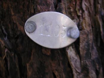
The actual location is found by finding the hydro pole across the street from the path entrance with a 4 digit number stamped on a metal tag. You then look at the 2 houses directly on either side of the pole and note their numbers.
- Deduct the 2 house numbers (as a four digit number) from the number on the post. This gives you another 4 digit number which you add to the 'North' co-ordinates.
Not to the parking co-ordinates
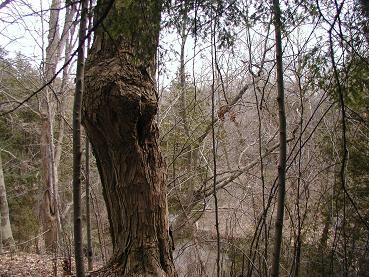
You then turn around 180° and follow the paved path down until you reach 'Eagle Bridge' spanning a small river. On the right hand side you will find a tag welded to the bridge face.
- Subtract the last 4 digits of the telephone number listed as 519-743-XXXX from the last 4 digits of the E45-0-XXXX code and add it to the west co-ordinates.
Not to the parking co-ordinates
This will be your final destination.
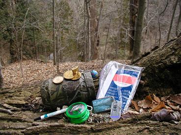
A tree with I.D.tag.


Additional Hints
(Decrypt)
Fgergpu ! ~ Abg sbe n fubeg crefba. [slippery when wet]