Tim's Airpark / Austin Executive Airpark (3R3), Austin, TX
30.42 North / 97.67 West (Northeast of Austin, TX)
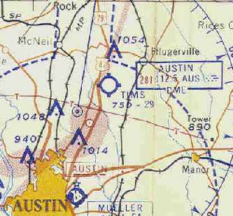
Tim's Airpark, as depicted on the April 1959 Austin Sectional Chart (courtesy of Chris Kennedy).
This former general aviation airport began life under the name of Tim's Airpark.
The airfield was evidently established at some point between 1943-59,
as it was not yet depicted at all on the July 1943 Austin Sectional Chart (courtesy of Richard Doehring).
The earliest depiction of Tims which has been located
was on the April 1959 Austin Sectional Chart (courtesy of Chris Kennedy).
It depicted the field as having a 2,900' unpaved runway.
Tim's Airpark apparently gained a paved runway within the next year,
as the 1962 AOPA Airport Directory described the field as having a single 2,800' asphalt Runway 17/35.
It listed the operator as Tim's Airpark Inc.
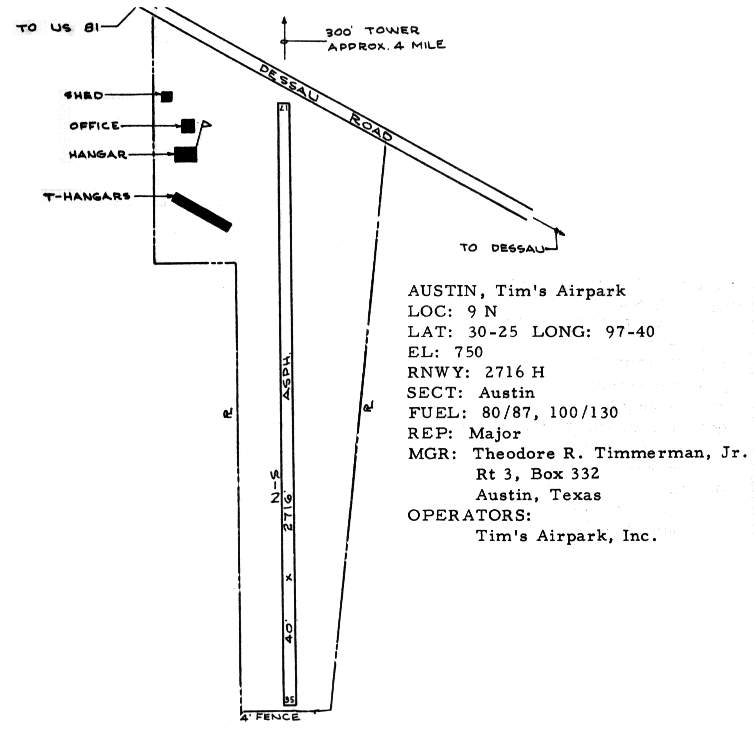
The 1963 TX Airport Directory (courtesy of Steve Cruse)
depicted Tim's Airpark as having an office & 2 hangars,
situated west of the runway along Dessau Road.
The manager was listed as Theodore Timmerman.
By the time of the 1970 TX Airport Directory (courtesy of Ray Brindle),
the runway had been lengthened to 4,000' with a full-length parallel taxiway,
a larger ramp had been built along the west side of the runway,
and several new hangars had been built along the southwest side.
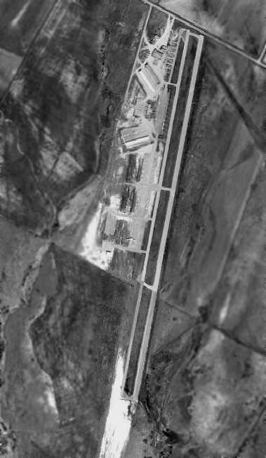
The earliest photo that has been located of Tim's Airpark was a 1973 aerial view.
It showed that the new runway was oriented differently compared to the former runway (as depicted in the 1963 directory above).
Several hangars were located on the west side of the field,
along with a large number of aircraft, including a DC-3.
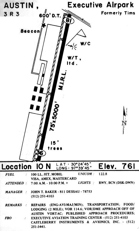
By the time of the 1985 TX Airport Directory (courtesy of Steve Cruse),
the airport had been renamed Austin Executive Airpark.
Austin Executive Airport was apparently well used,
as over 50 aircraft were visible parked in the 1995 USGS aerial photo.
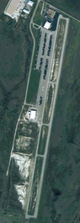
A circa 2000 aerial view, shortly before the field was closed.
Austin Executive Airport closed unexpectedly in 2000.
This came as a double blow to the general aviation community in Austin,
which in the preceding year had lost its only other airport supporting general aviation (Austin Mueller).
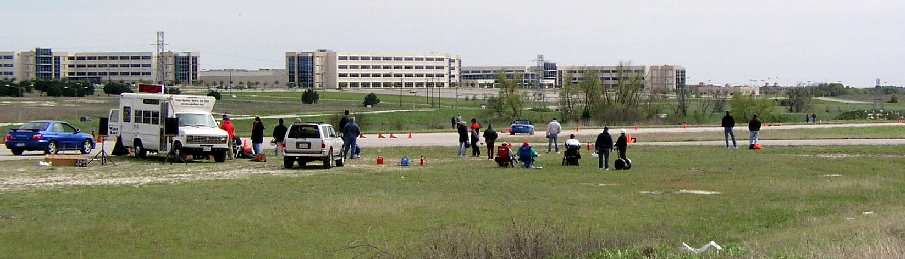
A 2003 photo by Kent Dyer of the former runway at Austin Executive Airport, now reused for car racing by an firm called Tech.Ridge.
Nearby resident Kent Dyer reported in 2003 that the large buildings northeast of the airport are Dell Computer Corporation factories,
offices for NCS Pearson, and various tech vendors to Dell.
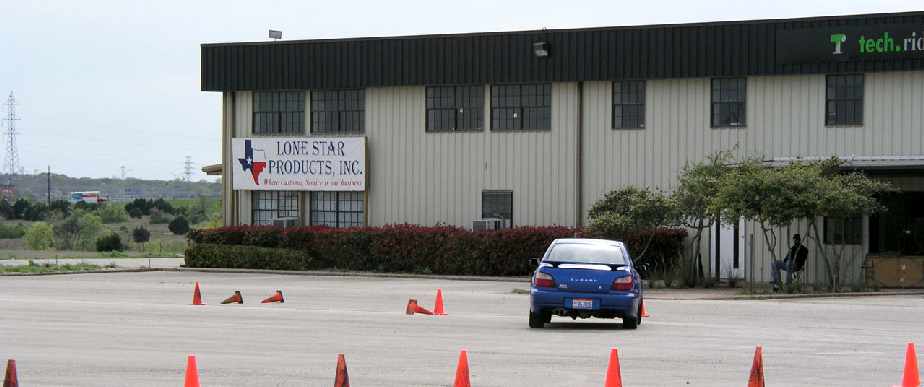
A 2003 photo by Kent Dyer of the former hangar at Austin Executive Airport,
now reused for non-aviation purposes by Lone Star Products.
A circa 2001-2005 USGS aerial photo showed quite a difference compared to the earlier aerial photo.
Large industrial buildings covered the northern end of the former airfield,
but the original airport buildings remained intact at the northern end,
as well as one building on the west side of the middle of the runway.
A significant portion of the middle of the runway & taxiway pavement remained intact as well.
Kent Dyer reported in 2005, “Car racing is no more at the old Austin Executive Airpark location.
'No Trespassing' signs are up all over the place,
and Wackenhut security patrols the location regularly (I believe they provide security for the Dell factories across the street).
I understand the racing kabosh is due to insurance liability issues -
and also it seems that the development of the area is really taking off.
Recently Dell Computer Corporation has begun parking empty trailers on the old tarmac,
and the old road that led into the airport from Howard Lane has been turned under by bulldozers,
and a City of Austin Metro Transit center is being built just west of where the airport used to be.”
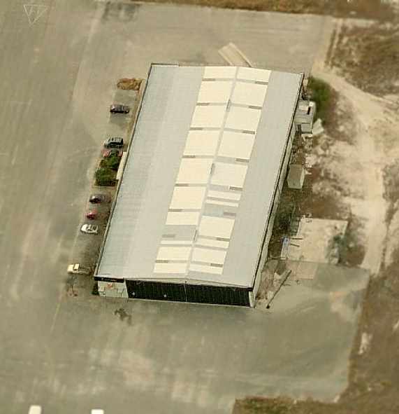
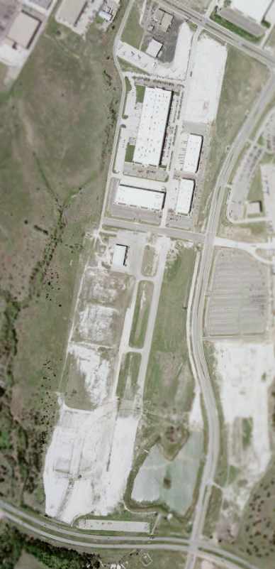
A circa 2005-2006 aerial view looking south at the former hangar
which remains standing on the west side of the former Austin Executive Airport.
Note the heliport symbol still perceptible at the top-left.