PLEASE NOTE: There have been a proliferation of cache logs received recently where answers to the earthcache questions are never sent. This will no longer be permitted. I reserve the right to delete all logs not meeting this basic earthcache requirement. Effective 8/12/20, all cachers must submit an email or a message with answers to the questions below, ideally before, but within seven days of logging this cache as a find. I understand there are times when access to the internet is limited. When that is the case, I will be happy to work with you on timelines if needed.
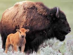
St. Jacob’s Well is located 1.7 miles from the highway entrance in the Big Basin Prairie Preserve Wildlife Area, which is managed by the Kansas Department of Wildlife and Parks. This serene pool of water, a sinkhole which is also considered a spring, was a welcome spot in this arid area for Native Americans, explorers, pioneers, and cattlemen heading for Dodge City. Please use caution as you drive to the well, as the road is rough, and although a high clearance vehicle is preferable, the trip can be made in a lower clearance car, too. Also, bison graze freely throughout the 1,818 acres of open, native prairie. You are advised to keep your distance from these beautiful but unpredictable animals.
The well has been the subject of many local legends. It was once believed that blind fish inhabited the well, that it was bottomless, and that an underground stream which fed the well would carry away anything that fell inside. No evidence of blind fish or an underground stream has ever been found, however.
Research has shown the well to be roughly funnel shaped, 60 feet deep, and 84 feet in diameter. The well is contained within the Little Basin, another sinkhole approximately 280 yards in diameter and 35 feet from rim to floor. Adjacent to Little Basin is Big Basin, a larger circular depression one mile in diameter and approximately 100 feet deep.
St. Jacob’s Well, Little Basin, and Big Basin were all formed within the last few thousand years by a process known as solution-subsidence. At one time, massive gypsum and salt deposits existed several hundred feet below the surface of the Big Basin Prairie Preserve Wildlife Area. Surface water gained access to these deposits and dissolved them, causing them to collapse. The overlaying layers of rock and minerals then fell, filling the empty space created by the dissolved deposits. The process of solution-subsidence is still occurring, as small depressions have been noted to be forming within Little Basin.
A stone pillar called the Living Waters Monument marks the highest point in the area. The monument was originally built of loose stones in the 1870s by Plains Indians as a marker to indicate that water was available at the well. The pillar was fortified in later years by cementing the stones together permanently.
In order to log this cache as a find, please send me an email or message with answers to the following questions:
- What geological process caused the formation of Big Basin, Little Basin, and St. Jacob’s Well?
- Research has shown the well to be roughly ________ shaped. Fill in the blank.
- Sinkholes are still forming within Little Basin. How many developing sinkholes do you see? What clues in the landscape led you to this conclusion?
- Please provide an estimate of the diameter of the largest developing sinkhole.
Although not required, feel free to post photos. I love looking at them!
EarthCaches are for those who want to learn more about our planet.

The treasure you find is in the lessons you learn.
Information for the development of this EarthCache came from the websites for the Kansas Geological Survey, University of Kansas; the Kansas Travel and Tourism Division, Kansas Department of Commerce; and the Kansas Department of Wildlife and Parks.
I would like to thank the land manager at the Big Basin Prairie Preserve Wildlife Area for granting permission for this EarthCache. While in the area, don't forget to complete the Virtual Cache, Why I Love Kansas #1, GCG34V.

Congratulations to Pullings for being First to Find!
