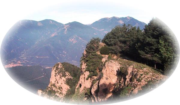
Geocaching - The Official Global GPS Cache Hunt Site

You are not logged in. Log in.


GCQGH2

Traditional CacheEl Sobrepuny

A cache by pelaroques     Hidden: 9/10/2005

Size: Size: Other (Other)     Difficulty: 3 out of 5     Terrain: 3 out of 5 (1 is easiest, 5 is hardest)


You Are Not Logged InYou must be logged in with an account to view the detailed Location Information. It's free!

N/S ? ??.??? W/E ??? ??.??? 
In Cataluña, Spain

Print:
 5 Logs 10 Logs | 

Download: Read About Waypoint Downloads

| | |

Warning

Please note: To use the services of geocaching.com, you must agree to the terms and conditions in our disclaimer.

Català

El Sobrepuny és un cim de la Serra del Catllaràs, a la comarca del Berguedà, situat entre les poblacions de La Nou de Berguedà i Vilada. una alçada de 1.655 m.


Dels diferents itineraris el més assequible comença al Coll de la Plana, a 1.460 m: N 42º 10.558  E 001º 54.847. Per anar-hi, s’agafa la C-16 fins passada la central tèrmica de Cercs, on s’agafa la BV-4022, fins a La Nou, a 900 m. d’alçada. Ara podem deixar el vehicle i prendre el GR-4.1.O seguir per la carretera que travessa el poble en direcció nord. A un km. es deixa una bifurcació que duu a Malanyeu, i es segueix a dreta, direcció a Sant Romà de la Clusa. Més endavant la carretera esdevindrà pista forestal. Des del coll un camí indicat direcció sud porta al cim en uns 30 minuts.

Un recorregut més atractiu alhora que incert comença al santuari de la Mare de Déu de Lourdes de La Nou, a 1 km. del poble. Deixem el vehicle al punt N 42º 09.798  E 001º 53.061. El camí comença al punt 42º 09.824  E 001º 53.104. Hem de seguir unes velles marques vermelles que sovint es perden. Per referència i per aquest ordre es passa per: una cruïlla a N 42º 09.844  E 001º 53.192, un rètol a N 42º 09.752  E 001º 53.374, una casa ensorrada a N 42º 09.849  E 001º 53.494, una pista a N 42º 09.813  E 001º 53.679, vora la Fontdel Faig a N 42º 10.175  E 001º 54.331. Les coordenades del cim son N 42º 10.064  E 001º 54.643.

English

The Sobrepuny is a mountain of Serra del Catllaràs, at Berguedà region, between villages La Nou de Berguedà and Vilada. The top is a 1.655 m.

For find this cache, the easiest starts to Coll de la Plana, at 1.460 m.: N 42º 10.558  E 001º 54.847. Take C-16 road until crossroad BV-4022, passed electric central of Cercs. Go to La Nou, at 900 m. high. Leave the car and take path GR-4.1. Or continue for road across the people in N direction. Passed one km. take all right direction Sant Romà de la Clusa, and leave left direction Malanyeu. Later the road turned into a rural road. From the mountain pass, take one path to south and go to top in 30 minutes.

One route most attractive and uncertain starts in the sanctuary of the Mare de Déu de Lourdes de La Nou, at 1 km. of the village. Leave the car in point N 42º 09.798  E 001º 53.061. The path starts at 42º 09.824  E 001º 53.104. Follow old red marks than frequently loosed. For reference and for this order to pass for: crossroads at N 42º 09.844  E 001º 53.192, one sign at N 42º 09.752  E 001º 53.374, one ruinous house at N 42º 09.849  E 001º 53.494, one rural road at N 42º 09.813  E 001º 53.679, near the fountain at N 42º 10.175  E 001º 54.331. The coordinates of the top are N 42º 10.064  E 001º 54.643.


4 user(s) watching this cache.

No Attributes Present No Attributes Present

Inventory Inventory

There are no Travel Bugs in this cache.
See the history
What is a Travel Bug?

Additional Hints (No hints available.)

(Decrypted Hints)

Find...

El cim.JPG

El pessebre.JPG

Emplaçament.JPG

Font del Faig.JPG

La Nou de Berguedà.JPG

pelaroques.jpg

Portada.jpg

Logged Visits (30 total. Visit the Gallery (49 images))

Found it27     Didn't find it1     Write note1     Publish Listing1     

Warning. Spoilers may be included in the descriptions or links.
Cache find counts are based on the last time the page generated.

 September 20, 2009 by jcp1698 (133 found)
Trobat amb l'equip pedraforca i companyia. Una vista impressionant des del cim!

Merci pel caché!

IN: Pilota inflable
OUT: Llantió

View This Log

 September 20, 2009 by pedraforca (52 found)
Trobat!!!!

Quina pujada més dura. Val molt la pena, per les vistes magnifiques que hi ha.
Trobat amb companyia de jcp1698.
GPC

IN: Braçalet
OUT: Llantió

View This Log

 June 21, 2009 by Sant48 (186 found)
Trobat a las 11h amb una pujadeta que deunido pro a dal una vista que tela, molt guapo tot i el pesebre
GPC
IN out res
Apa adeu


View This Log

 October 4, 2008 by Lapa's Power (13 found)
Avui hem pujat el Sobrepuny des de Vilada i un cop hem fet el cim en cercat i trobat el cache. La vista ha estat esplèndida, hi havia molt bona visibilitat. Hem vist des de la Serra Cavallera, el Montseny, el Montacau, Montserrat i inclús, amb binocles, es distingia perfectament Collserola i la Torre Foster.

Consell: Quan arribeu al cim i el GPS us dirigeixi 18 metres cap al precipici, no cal que us hi llenceu!!!

Out: Res
In: Res

View This Log

 August 24, 2008 by Ventures Team (82 found)
Trobat !!
Hi havia una colla de nens, que no conexian el joc i ho varen trobar molt interesant, els vaig tenir de permetre de fer un petit "expoliu"
In . RES
out: RES

View This Log
Photo El Caché de Sobrepuny

There are more logs. View Them All on One Page

Current Time: 2/10/2010 4:03:32 AM (GMT-08:00) Pacific Time (US & Canada) (12:03 PM GMT)
Last Updated: 1/8/2010 9:25:00 AM (GMT-08:00) Pacific Time (US & Canada) (5:25 PM GMT)
Rendered: From Database
Coordinates are in the WGS84 datum


Geocaching, a Groundspeak Project.

Copyright © 2000-2010 Groundspeak, Inc. All Rights Reserved.
About Groundspeak | Contact Us
Designated trademarks and brands are the property of their respective owners.
Use of this Web site constitutes acceptance of the Groundspeak Terms of Use.
Read our Geocaching Logo Usage Guidelines.
Hotels | Altrec Gear | GPS Reviews