Outeniqua Mountain Cross (602 meters ASL)
This cache is a traditional cache which contains the normal goodies. The cache itself is a small container hidden inside a crevice covered with a large rock. The cache is to the right when you face George from this location. Make sure the cache is well hidden. Please trade only small items. The cache container is a Tupperware container which locks on all four sides. You will encounter one railway tunnel on route. The railway line is not in daily use and Forestry approved this walk. The tunnel is situated where the railway line is forming a 90 degree bend and you must make sure that this line is clear. There is a walking trail that you could use to bypass the tunnel if needed. There are many paths to this cache.
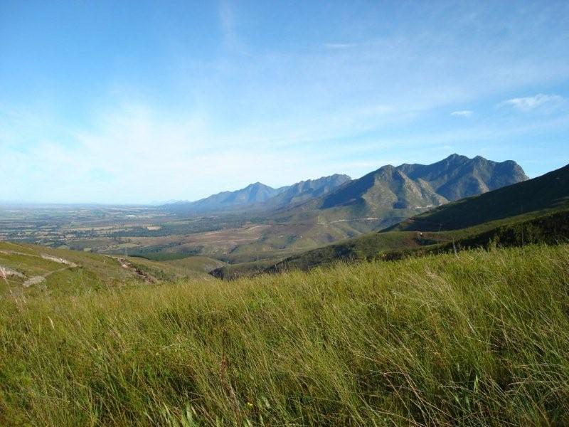
This cache will introduce a different world to you - from the ordinary to a location high above George. The motive for this cache is to show you some beautiful scenery along a relative safe route without any special climbing equipment. This cache is for the ones that are not interested in going up the mountain or as a test trial before doing the Cradock and/or George peak caches. There is a path leading directly to Power Station which bypasses the tunnel but thus was not tested.
To attempt this cache please park at waypoint as given below. The Forestry Offices have a register that you need to complete before the hike. This is the safest way. There is no monies payable. This cache will bring you to a location where a cross is erected which can be seen from George. During the night this cross is illuminated. This cross is also the symbol of your trip up to George and Cradock peak.
There is a footpath leading from this cache up to George peak but the path is overgrown and very wet with some nasty inclines in certain places and should not be attempted. I used this foot path to plant the three caches. The reason I used this footpath is that you can go directly and quickly to George peak and then to Cradock, with other words all three caches are in line. This path was the cause that I only arrive back at the forestry office at 21h15 with hyperthermia. All plants in this area are pointing downward and you have to move up the incline with bushes dragging you down. The worst is that they are wet and you will stay wet up to waist height for more than 8 hours. The official route is much easier although a little bit longer.
On your way you have to pass the FM transmitters on your way to the cache. You are not allowed to enter this area and you have to walk around the fence and transmitter. Under no circumstances are you allowed to cross directly.
Special Instructions:
- Please do not drop coins and trackables at these caches. It could be in the cache for many months/years and most owners will not like this, they are called travellers and not campers.
- As usual you need to take care when lifting stones.
- Refer to “ http://www.samdt.co.za/links.htm” for hints on equipment and preparations.
- Please cover cache well. This cache will not receive many visits.
- My cell number - 082 339 8842
FTF Honors:
- Platinum: iPajero
- Gold: Tigers Two
- Silver: jtolken
- Bronze: LFN59
Risk and Hazards (1 is low, 3 is average, 5 is extreme):
- Snow - 3
- Mist - 3
- Heights and falls: 2 (No dangerous cliffs or ledges)
- Lightening - 4 (You are the highest point at the final location)
- Ankle and Knee Twists - 3
- Slipping - 2 (Consequence is low, will fall down but not down the mountain)
- Strong winds - 2
- Wet weather - 3
- Snakes - 3
- Spiders - 2
- Muggles and muggers- 1
- Night Time - 3 (can get down with light, stick, back tracking, otherwise not possible)
- Roads - 1
- Children - 3 (Above 9 of average fitness should be ok)
- Fitness & Health - 2 (below average fitness should do it, slow and early, take energy drinks)
- Distance - 3 (longer than normal cache trips but a morning day trip should be ok)
- Water from river - 1 (No settlement areas above river)
- Emergency - 2 (Cell Phone Reception and use cache owner as backup)