Not only Tenerife but all the other Canary Islands have their origin in huge undersea volcanos (3000 meters below sea level), whose eruptions built the islands how they look like today over several millions of years between 12 and 7 millions of years ago. Initially Tenerife consisted of 4 islands:
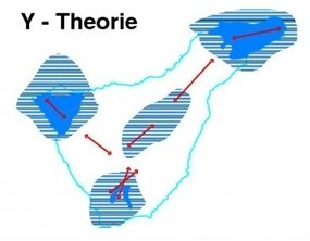
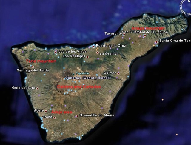
These 4 islands form today the Teno mountains in the west, the Anaga mountains in the east, the Adeje area in the south and the Cañadas with the Caldera in the center of the island. Over time and through all the volcanic activities these four islands slowly grew together until the shape of today's Tenerife was formed:
Around 170 000 years ago still existed a huge volcano in the center of the island, where today's caldera resides. The permanent eruptions of this huge volcano emptied the magma chamber below and beneath it, the emptied chamber was not able to support the weight of the volvanic edifice any more, which finally caused this huge volcano to collapse and leave the structure of the today's Caldera (cauldron).
The Caldera (cauldron) of the 'Cañadas del Teide' is considered as one of the largest Calderas on earth. Their walls are at approx.. 2200 over the sea level. It forms an elliptical structure with a size of 16 * 9 km and maximum depth of 600 m with the Montaña Guajara (2717 m) as part of the Caldera wall.
A set of large rocks 'Roques de Garcia' ( near the Parador and the small museum, which I also recommend to visit), divides the Caldera into a western and an eastern sector, whereby the western sector lies 150 meters below the eastern sector. The 'Roques de Garcia' and its surroundings with the so called cathedral are leftovers from the collapse of the huge volcano.
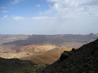
SouthEast part of Caldera SouthWest part of Caldera
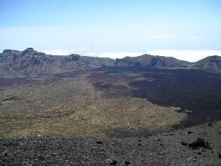
view from Pico del Teide at 3200 m view from Pico viejo at 2600 m
On the northern side of the caldera still exist two active volcanos the 'Pico del Teide' with 3718 meters, who last erupted in 1492 and 'Pico Viejo' with 3135 meters, who last erupted in 1798. The 1798 eruption consists of 2 main craters on the southwest side of Pico Viejo, which are called 'Narices (nostrils) del Teide. From the cache point, you can see all the black lava to your left from that eruption. In northwest direction you also can identify the craters.
There is also an interesting phenomen with eruptions of volcanos on the island, which might be worth to notice. Within the last 5 centuries since 1492 there was always a volcanic eruption around the turn of the century no more than 10 years before or after: in 1492 - Pico del Teide, 1604 - Siete Fuentes, 1706 - Montaña Quemada, 1798 - Pico Viejo, 1909 - El Chinyero. Actually in the year 2003, there was a lot of seismic activity in the southwest part of the island and people feared another eruption. Meanwhile the activity has calmed down for the moment, but living on this island I still have hopes to experience a live eruption until the end of my life.
One more historical comment. Christóbal Colón (Christopher Columbus) started its journey for the discovery of India/America in La Gomera, the island next to Tenerife, in 1492. At that time the Pico del Teide had just erupted and the people in the whole team took this as a very bad sign for the trip. He had a lot of problems to get his ships to go on over the ocean, but as we all know, he finally was successful.
To be allowed to log the cache, you have to do the following:
1) Send me a mail with the answers to the following questions:
a) What might be the height (or altitude) of the border (or brim) of the caldera crater near the point, where you stand?
b) How many and which colours of lava streams can you detect from the point, where you are?
c) The lava stream with which colour do you think is the newest one? To answer the question, you
might use the information on the info board.
Optional: Make a picture of you with your GPS and the Pico Viejo (it MUST be the Pico Viejo and NOT the Pico del Teide) in the background and upload it with the log.
Note added 3/21/2013: Just send me the answers to the questions and log the cache. I will contact you, if one or more of your answers are wrong.