The Tiger Mountain Trail is 16 miles long and has an elevation
gain of 3,140 feet (South to North)
The coordinates for this cache may be obtain by hiking the
length of the trail starting at the classical beginning, the South
Trailhead and finding two caches along the way:
Hints and coordinates to find this cache are described in the
Midpoint cache logbook. The intention is to complete the
whole trail in one fell swoop. When logging your success,
describe the start and end time and the time you encounter each
mile marker. Pictures of each mile marker with you in it will
go far to document your quest.
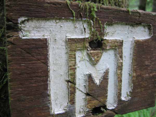
Tiger Mountain Trail
The following text is
from the "Guide to Trails of Tiger Mountain" by William K. Longwell
Jr., published by "Issaquah Alps Trails Club," 10th revision,
August 2006:
The idea of Tiger Mountain Trail
may be said to have been hatched at a meeting on May 10, 1972, but
it wasn't until 1977 that actual construction began, and only in
1979 was the entire route "officially opened" on an IATC hike held
October 13, 1979. Some 891 person-days, about 4,480 hours,
have gone into the trails as of March 1, 1998. Finding a
route took 45 trips. Then came 388 work parties - plus at
least 100 occasions when individuals worked solo, no "Party."
The work continues. Work parties are always tinkering with
the route. Join us.
Numerous IATC work parties build bridges, clear away
obstructions, continually brush the trail and try to keep this
trail in as good a condition as possible. The DNR has even
built super bridges across Fifteenmile Creek and Highpoint
Creek. Trail builders in 1989-90 extended the TNT from the
West Side Road south to the Issaquah-Hobart Road and from Tradition
Lake to Dwight's Way, giving the trail it's present 16 mile
length.
The TMT begins and ends in deep woods; both north and south
trailheads begin at 500 feet elevation. It winds along 1920's
logging railroad grades, crosses numerous creeks on rustic bridges,
looks out to hundred-mile panoramas, passes beaver dams and wanders
through deep cathedral forests. In summary, the TMT traveler
can expect varied scenery on the TMT. Tiger walkers agree it
is the classic route on the mountain. It is not easy.
The direction walked largely determines the scenery. The
views walking northward generally more spectacular than those
south. Also, the walk north is less strenuous than the walk
south. However the north trailhead is more conveniently
located and likely will receive more use - at least for part way
trips, such as to West Tiger and vicinity.
The classic way to hike the TMT is the way the IATC schedules
this hike - using a two-car shuttle system, permitting completion
of the whole trip in one long day. The start is the south
trailhead, and that's how this quest is laid out.
Check out the "Guide to Trails of Tiger Mountain" for a detailed
description of the trail. The Green Trails Maps #204s should
be packed as well as the Ten Essentials.