

Buntven.
 Nederlands

Het Buntven is gelegen in het Zandbosch, een bosgebied van
ongeveer 250 hectare dat in eigendom is van de gemeente Deurne.Het
ven is groot en uniek in Brabant en is een gesneden bocht van de
Bakelse Aa.Deze is ontstaan zo’n 10.000 jaar geleden in de laatste
ijstijd.
Het ven is van oorsprong arm aan voedsel voor de verschillende
plantensoorten. Door meststoffen, zure regen en verdrogingen wordt
het ven zuurder en voedselrijker. Daardoor vormt zich een
organische laag op de oevers en de bodem van het ven. Door
verhoging van de voedselrijkdom en de verzuring in het ven
verdringen agressieve plantensoorten de oorspronkelijke vegetatie.
Dit heeft ook nadelige effecten op de bij het ven levende
amfibieën, reptielen en libellen.
Parkeren kun je op: N 51°28.114 E
005°44.750. Let op
parkeerverbod!
Loggen van deze cache:
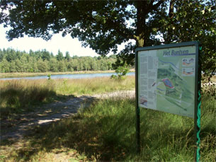
1.Maak een foto van jezelf met GPS bij het informatiebord
op N 51°28.297 E 005°44.781.
2.Beantwoord de volgende 2 vragen:
a. Hoe groot is het ven?
b. Wat komt hier nog voor en is
landelijk zeer zeldzaam en heeft een beschermde
status?
Stuur de antwoorden via e-mail naar de maker van deze earthcache
en voeg de foto bij de log.
Logs zonder foto en zonder goed beantwoorde vragen zullen worden
verwijderd.
 English
The Buntven have been laid in the Zandbosch, a bunch area of
approximately 250 hectares that in property is of the municipality
Deurne. The fen is large and unique in Brabant and is a cut turning
of the Bakelse aa. These have arisen about 10,000 years suffered in
the last ice age.
The fen is of origin poor to food for the different plant
varieties. By fertilizer, acid rain and dry up the fen more acid
and food-richer become. As a result, forms itself organic low on
the banks and the floor of the fen. By increase of the food wealth
and the acidification in the fen aggressive plant varieties repress
original vegetation. This has also disadvantageous impact on at the
fen live amphibians, reptiles and dragon-flies.
You can park on: N 51°28.114 E 005°44.750. Pays
attention to prohibition!
To log this earthcache:
1.Make a picture of yourself with GPS at the notice-board
N51°28.297 E 005°44.781.
2. Answered the following 2 questions:
a. How large is the fen?
b. What comes for this still and is
rurally very rare and has a protecting status?
Please send me an email containing the answers of the questions
and add the picture to your log.
Logs without a photo and without the right answers will be
removed.