Cedarburg Bog #1 - Laying the Foundation EarthCache
Cedarburg Bog #1 - Laying the Foundation
-
Difficulty:
-

-
Terrain:
-

Size:  (not chosen)
Related Web Page
Please note Use of geocaching.com services is subject to the terms and conditions
in our disclaimer.
An EarthCache adventure is treasure hunting for the caches that the
Earth has stored. EarthCache sites do not use stored containers;
their treasure is the lessons people learn about our planet when
they visit the site. Visitors to EarthCache sites can see how our
planet has been shaped by geological processes, how we manage the
resources and how scientists gather evidence to learn about the
Earth.
Cedarburg Bog began 12,000 years ago as a large post-glacial lake
which was carved out by the action of glaciers. As the glaciers
receded, a tight gray clay was deposited, which lines most of the
basin today. This layer of clay created a shallow, irregularly
shaped bowl with an overflow point at its southwest corner near Mud
Lake. This lake had an undulating basin with scattered islands of
till.
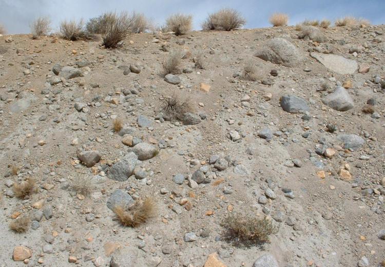
Till, or glacial till, is unsorted glacial sediment. Glacial drift
is a general term for the coarsely graded and extremely
heterogeneous sediments of glacial origin. Glacial till is that
part of glacial drift which was deposited directly by the glacier.
As a glacier melts, especially a continental glacier, large amounts
of till are washed away and deposited as outwash. In general, till
may vary from clays to mixtures of clay, sand, gravel and boulders.
Here at the Cedarburg Bog, the till is dominated by dolomite
cobbles and boulders, and also includes various igneous and
metamorphic rocks (feldspar gneiss, quartzite, red granite,
monzonite, diorite, basalt, gabbro) and sedimentary rocks
(sandstone, conglomerate, dolomite breccias).
In some places, the lake that would eventually become Cedarburg Bog
was over 50 feet deep. For thousands of years, oozy gray lake
sediment (aquatic plant parts, shells, marl, silt, diatoms, pollen
and material transported from the surrounding uplands) was
deposited on the bottom. This sediment currently fills the basin to
within 8 to 9 feet of the Bog's surface.
You will notice that there is a mound ringing most of the
undisturbed perimeter of the Bog. This is an ice push ridge that
stands as evidence of the thousands of years that this basin
contained a lake. The repeated expansion and contraction of ice in
the lake created a tremendous force, capable of heaving huge
boulders. The Bog's ice push ridge is higher than is typical for a
lake with a surface elevation of the present peat surface,
suggesting that the lake surface may have at one time been that
much higher than the present bog water levels.
This is a DNR State Natural Area. Please stay on the public
trail. NO rock climbing and NO collecting of plants (including
fruits, nuts, or edible plant parts), animals, fungi, rocks,
minerals, fossils, archaeological artifacts, soil, downed wood, or
any other natural material, alive or dead.
Making your observations at the posted coordinates, please email me
the answers to the following (NOT in your "Found It" log):
1. What is the glacial term for the material seen on the North side
of the trail?
2. How would you describe its composition (meaning the size and
color of the individual components)?
3. Using your GPS, how long is the exposed portion of this
ridge?
4. What is the approximate height above ground level of this
ridge(using the floor of the forest on the South side of the trail
as your reference)?
DISCLAIMER: I am not an Earthcache expert, but I do enjoy
finding and creating Earthcaches. The information I present is not
my own. For this Earthcache, the majority of the information came
from A Guide to the Natural History of the Cedarburg Bog by
James Reinartz of the UWM Field Station (
http://www4.uwm.edu/fieldstation/ ). It was supplemented by
information found on other Internet resources.
Additional Hints
(No hints available.)