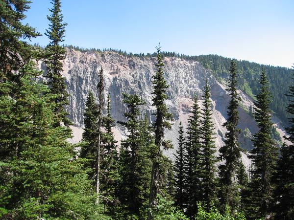
Mt. Garibaldi last erupted about 13,000 years ago at the time when glacier ice filled nearby valleys. A lava flow came into contact with the Cheakamus valley glacier and froze in a steep face several hundred metres high ("The Barrier"). Since then, the fractured face of The Barrier has repeatedly collapsed, producing large landslides along Rubble Creek, most recently in 1856. In 1981, the Provincial Government designated the Rubble Creek area along Highway 99 as being too hazardous for human habitation and spent $14 million to buy out property owners.
The Garibaldi Lake trail leads into to one of the most beautiful areas in the world. It is a turquoise lake formed by volcanoes and glaciers. From the edge of the road before you turn into the parking lot, you have a great view of the 1000 ft (300 m) high lava wall called The Barrier. The Barrier was formed during a volcanic eruption on Price Mountain when the lava flowed into the valley and formed the dam that created Garibaldi Lake. Price Mountain is now half the height it was before the eruption.
As of November 20, 2006 to log this Earthcache:
You must e-mail me some unique bit of information regarding the site that you learnt while there. This can be done by answering the following question: What is your estimate of the height of cliffs from your vantage point? Posting a photo is not required but appreciated. I will monitor logs and check my e-mails for appropriate information. Unfortunately, any log that does not meet the requirements will be deleted. Thanks for visiting an Earthcache!