Whichever route you choose to get up close and personal with the Black Tusk will give you stunning views of alpine meadows, fields of flowers in the summer, and the surrounding glaciers and volcanoes.
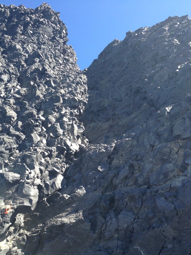
Black Tusk itself was once a typical cinder cone type volcano made up of layer upon layer of loose material that has piled up from episodes of material being thrown up into the air then raining back down and forming a pile much like sand piles up when poured onto the ground. Except the material does sometime stick together when landing so the cone can build up quite high. The central core of the Black Tusk is a basaltic plug of material that cooled in volcanoes neck and was not thrown into the air. Since it had longer to cool it formed a very hard core that still stands today. With the erosion of the loose cinder cone and the effects of glaciation stripping away much of the loose material we see today just the basaltic core of a volcano piercing over 100 m into the sky.
The trail does lead to a chimney of 300 ft that gives access to the top of the Black Tusk but due to erosion over the last 30 years many of the handholds have deteriorated. There are plenty of views from the eastern shoulder to satisfy all but the most arduous of hikers.
**Do not climb the rock face unless you are experienced at rock climbing as the rock is unstable and loose rock may rain down on your head.
As of November 20, 2006 to log this Earthcache:
You must e-mail me some unique bit of information regarding the site that you learnt while there. You would think getting there would be enough but no! This can be done by answering one of the following questions: Estimate the angle of repose (the angle the slope makes with the horizontal)of the loose rock and what is the average size of the rocks? If there is snow covering the rock you still need to provide the angle of repose and which way the wind is blowing creating snow drifts in the area? Posting a photo is not required but appreciated. I will monitor logs and check my e-mails for appropriate information. Unfortunately, any log that does not meet the requirements will be deleted. Thanks for visiting an Earthcache!