A geological expedition to the
origins of the Muellerthal region
|
Geological composition of the
region
|
"Luxembourgish
Switzerland" and in particular the Muellerthal, through which the
small river Ernz Noir curls before joining with the Sauer river,
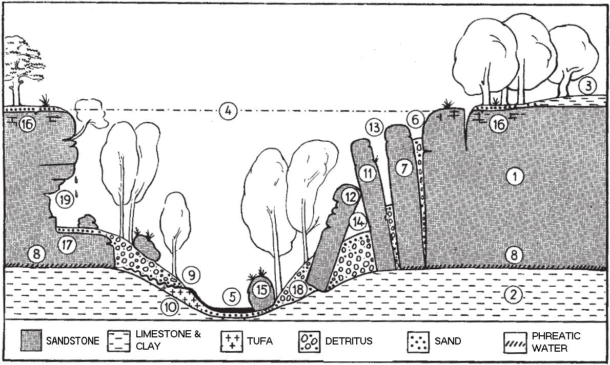
has a very particular geological composition. The ground is
composed from Luxemburgish sandstone with a thickness of up to 100
meters (1). The sandstone is composed from a layer of clay and
limestone (2), which also covers the sandstone in locations that
have not been eroded (3). The originally plain massive sandstone
formation (4) was eroded to today´s level (5) and formed the
current valley form of the Muellertal. Wide joints can be found on
either side of the valley (6). Those have been formed by changes in
pressure and constant erosion. As a result, giant sandstone blocks
(7) have separated from the walls and travel slowly (over thousands
of years) down the sides of the valley. The layer of clay and the
groundwater between clay and sandstone support this movement (9).
The groundwater cannot pass through the clay and accumulates on top
of the clay layer. Many springs in the valley attest the existence
of his water, which has also sedimented a large amount of
calcareous sinter also called tufa (10) at the bottom of the
valley. Large blocks of sandstone lean forward and form small
canyons (13) or they neal against the brim and form grottos and
caves (14). Medium-sized blocks (15) have rolled down into the
river and formed a number of waterfalls throughout the valley.
Erosion sediments, sand, and gravel accumulate on the plateau (16),
on the base of the rocks (17), and on the slopes (18). In some
places, overhangs form natural canopies (19) (cf. Heuerts,
1966).
|
|
| The terminology
"Luxembourgish sandstone" was introduced by the German
geologist Johannes Steininger (1794-1874). He was teaching physics
at a high school in the nearby town of Trier. The sandstone was
formed in the Lias sea around 195MJ (early Jura) and is composed
from a layer of marley and clay from the Keuper-Rhaetium (Trias)
time. (cf. Massard, 2008) |
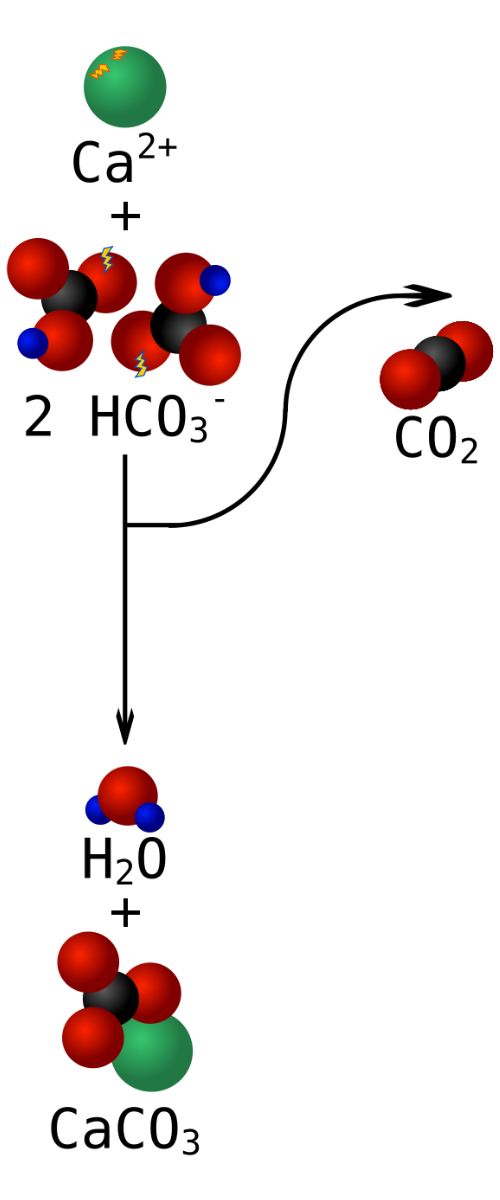 |
Tufa is
generally formed through spring water which is hypersaturated with
carbonates. Calcium carbonate (CaCO3) is hardly soluble without
CO2, in consequence the high CO2 concentration is mandatory to
solve it in the water in the form of calcium bicarbonate
(Ca(HCO3)2). Water in aquifers underground can be exposed to levels
of CO2 much higher than atmospheric. When the environment the water
runs through changes significantly (mainly changes in partial
pressure), by emerging for instance from the tab, in time it comes
into equilibrium with CO2 levels in the air by outgassing its
excess CO2. A quick outgasing reaction will also take place when
running through the turbulences of a waterfall. After releasing the
CO2, the calcium carbonate then precipitates, sink to the ground
and begin to recrystallize. Over time the layer is overgrown by
vegetation and the cycle starts new. By repetition of this cycle,
the number of layers increases and forms a massive rock. The high
concentration of aragonite in the Muellerthal supports the
crystallization into calcite. In some of the caves, large deposits
of monohydrocalcite (another limestone precipitate) also called
"moonmilk" can be found. This generaly clalcite, aragonite or
hydromagnesite based cheese-like white substance has the unique
quality not to harden and turn to stone due to enclosed water
molecules.
|
|
| Cave Structure |
|
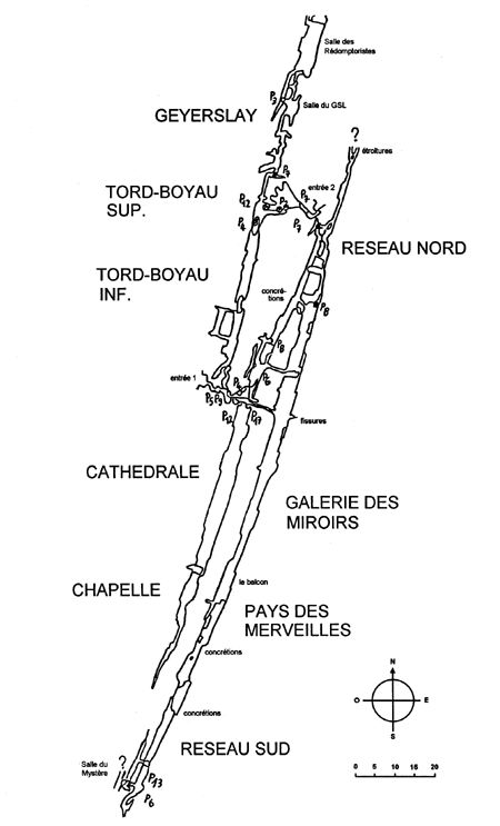
The Grotte St.
Barbe is a unique cave that is completely formed by boulder chokes
(12). Usually, one would expect a typical sandstone cave which is
small and dry, but St. Barbe is different. Two large, parallel
joints form a cave system with a total length of 600 meters and a
maximum depth of 40 meters. The entry passage is characterized by a
small vertical crack, where a steel rope is fixed to ease the
passage. Following this, visitors go encounter a number of small
halls that are stacked and very representative for a cave of this
type. In this area some "moonmilk" deposits can be found on the
walls. Afterward the path continues until a chimney is reaches,
which needs to be climbed (fixed ropes present). While water flow
forms a monotone decline in usual caves, boulder choke caves are
very chaotic and do not contain such a monotone decline. After
arriving at the "cathedral", the visitor encounters first evidence
of the clay layer, on which the sandstone resides. Later, when
reaching the "pays de merveilles" area, the visitor encounters
large sinter sediments and stalagmites. Such formations are
completely uncharacteristic for sandstone caves. They prove the
continuous presence of carbonated water.
|
 |
|
| The Muellertal caves
are also the home of many cave organisms. A big part of them are so
called trogloxene inhabitants, animals that only pass some time of
the life in the subteranean world. These are mainly hibernating
mamals with the need to get back to the surface to get food. Some
animals living normally at the surface have developed the capacity
to survive in the underground and pass the entire life in caves,
they are called troglophile. Finally, the evolution has generated
fully adapted animals that are specialized for the life in the
caves. Those troglobites need extended underground ecosystems and
are mainly absent from small cave systems like the Ste Barbe
cave. |
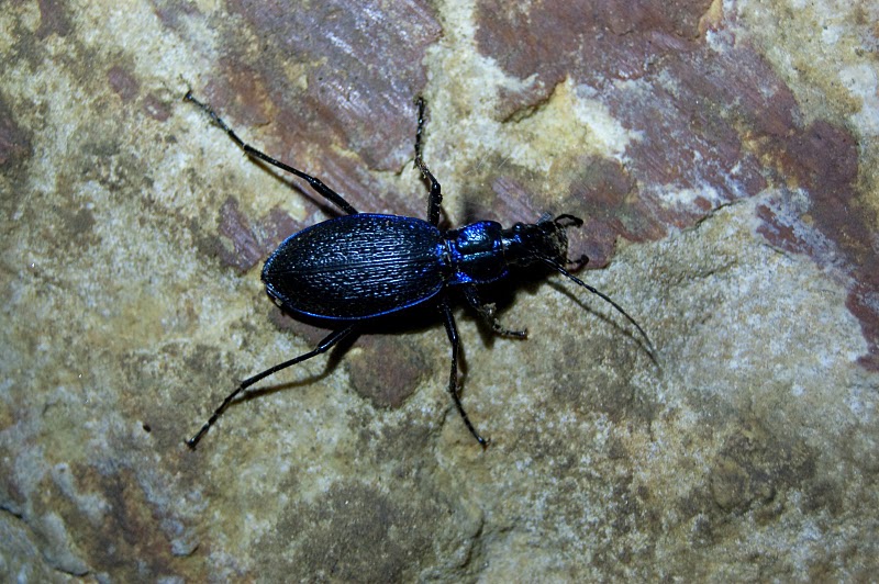
A carnivorous beetle of the family of carabidae |
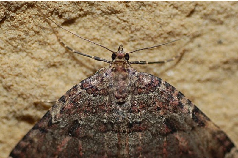
A geometer moth |
|
| Equipment |
| Complete personal speleological equipment |
| Team-equipment according to topography (can be found under
www.speleo.lu) |
| Thermometer |
| pH-meter or pH Indicator Paper (available in drugstores,
aquarium shops...) |
Camera
|
|
Questions
| 1. Guess the height of the ceiling in the "pays des
merveilles" |
| 2. Take a water sample and measure its PH value |
| 3. Measure the temperature on the ground level of the
cathedral |
| 4. Take a photo of yourself in front of a stalagmite (Optional,
however, for reasons for fairness, please upload a photo) |
5. Find evidence of subterranean biology (living or dead
animals, traces, remains,..). Take a photo and try to classify the
found. Also indicate where in the cave you found the
evidence.
|
|
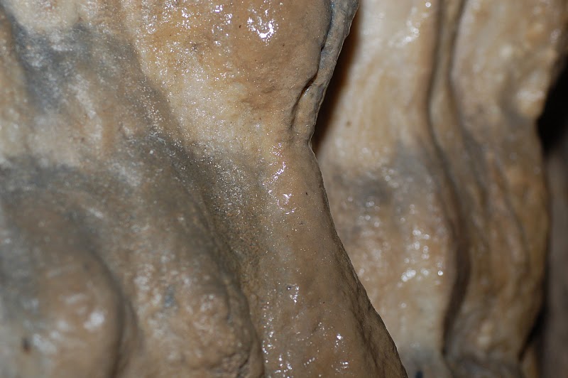
Limestone formations
on the cave walls |
|
| Methodology: |
After abseiling down
into the cathedral, put the thermometer on the ground and continue
to the pays des merveilles. There you can take the water sample. On
the way back, you can collect the thermometer and note down the
temperature.
|
How to get to the
cave:
|
To get to the cave,
follow up the trail starting at the parking area to join the track
called "Fred Welter" until you reach the Keltenhiel. From there you
have to climb about 30m east to find the entrance of the St Barbe
cave.
|
SAFETY
|
If you have no idea
about caving/speleology do not go or ask someone who knows to come
with you.
Tell someone where you are and planify enough time
You can use a C50 rope instead of the C10, C15, C20 at the
beginning, furthermore a C25 is better than a C20 for the
cathedral.
NEVER cave alone!
Remember: you are responsible for your actions. Without appropriate
training and equipment, caving is getting a non- calculable risk an
becomes dangerous. I do not take any responsibility for any
accident!
|
RULES
|
Visiting is not allowed from October 15th to April 15th
to protect hibernating bat populations.
TAKE NOTHING EXCEPT NICE MEMORIES
KILL NOTHING EXCEPT EVIL DESIRES
LEAVE NOTHING EXCEPT FEW BREATHS
Do not touch speleothems (limestone formations like stalagmite) the
grease of your skin is sufficient to disrupt the crystallization
process and destroy the formation over time.
|
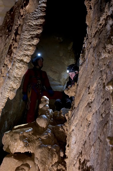 |
| Two cavers in front of a
stalagmite in the "pays des Merveilles" |
|